Panoramic Viewpoint: Hilltop Near Wessobrunn, Upper Bavaria
In Upper Bavaria, you can find an endless number of panoramic viewpoints. Thus the choice might appear a bit arbitrary. There will be certainly more places to be portrayed in the future but recently I discovered a viewpoint I particularly liked because of the extraordinary setting. There is a village nearby, meadows and woods and there is a free sight of the whole chain of mountains in the south.
It is easily accessible because it is close to the famous Wessobrunn monastery, where there is also a parking space, approximately one kilometre from the viewpoint which is basically a small road and a hilltop leading towards Diessen am Ammersee.
I discovered this viewpoint when I did part of the “King Ludwig 2 Trail” between Diessen am Ammersee and Wessobrunn. The viewpoint is certainly the highlight of this section of the trail. It is possible to do this (not recommended if it gets too warm) but there is no restaurant or such thing between Diessen and Wessobrunn. Due to the length of this part, it might be most suitable for a bicycle tour.
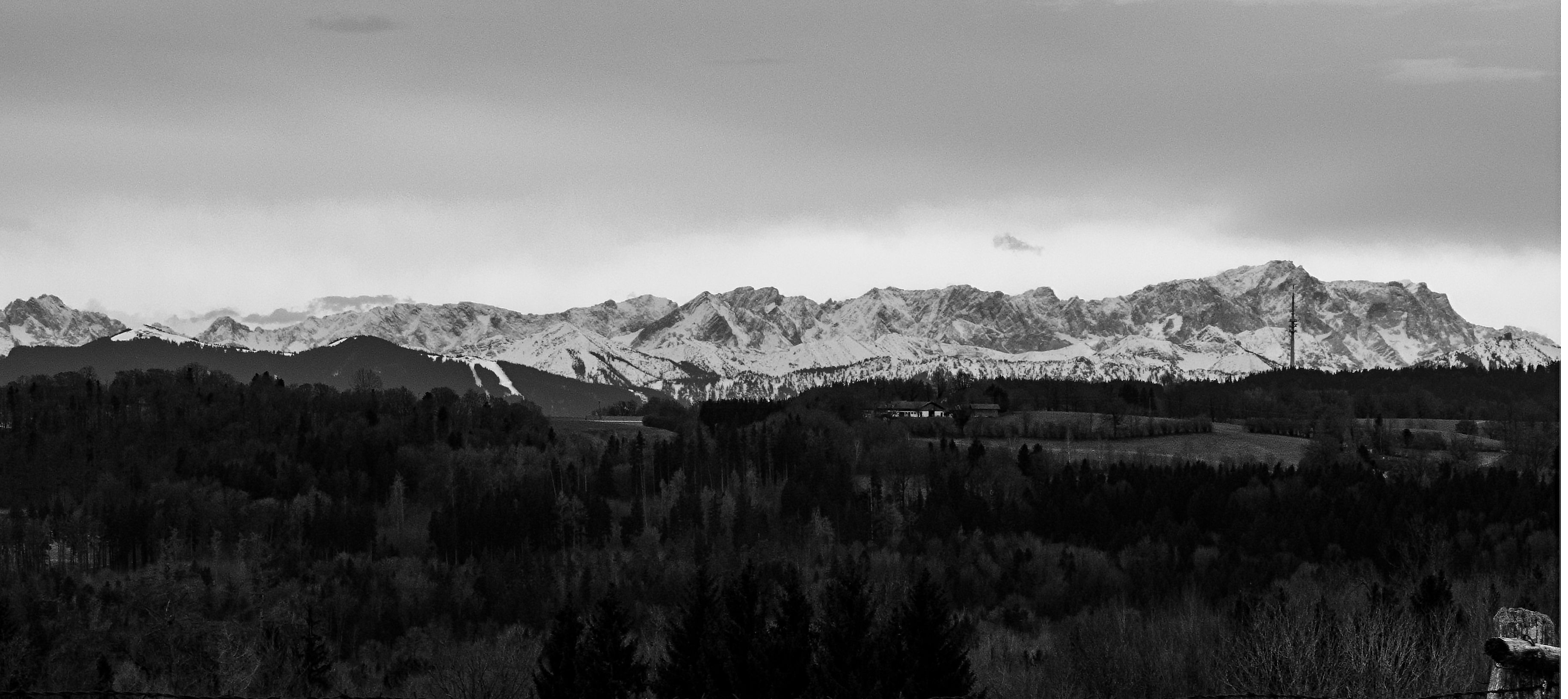
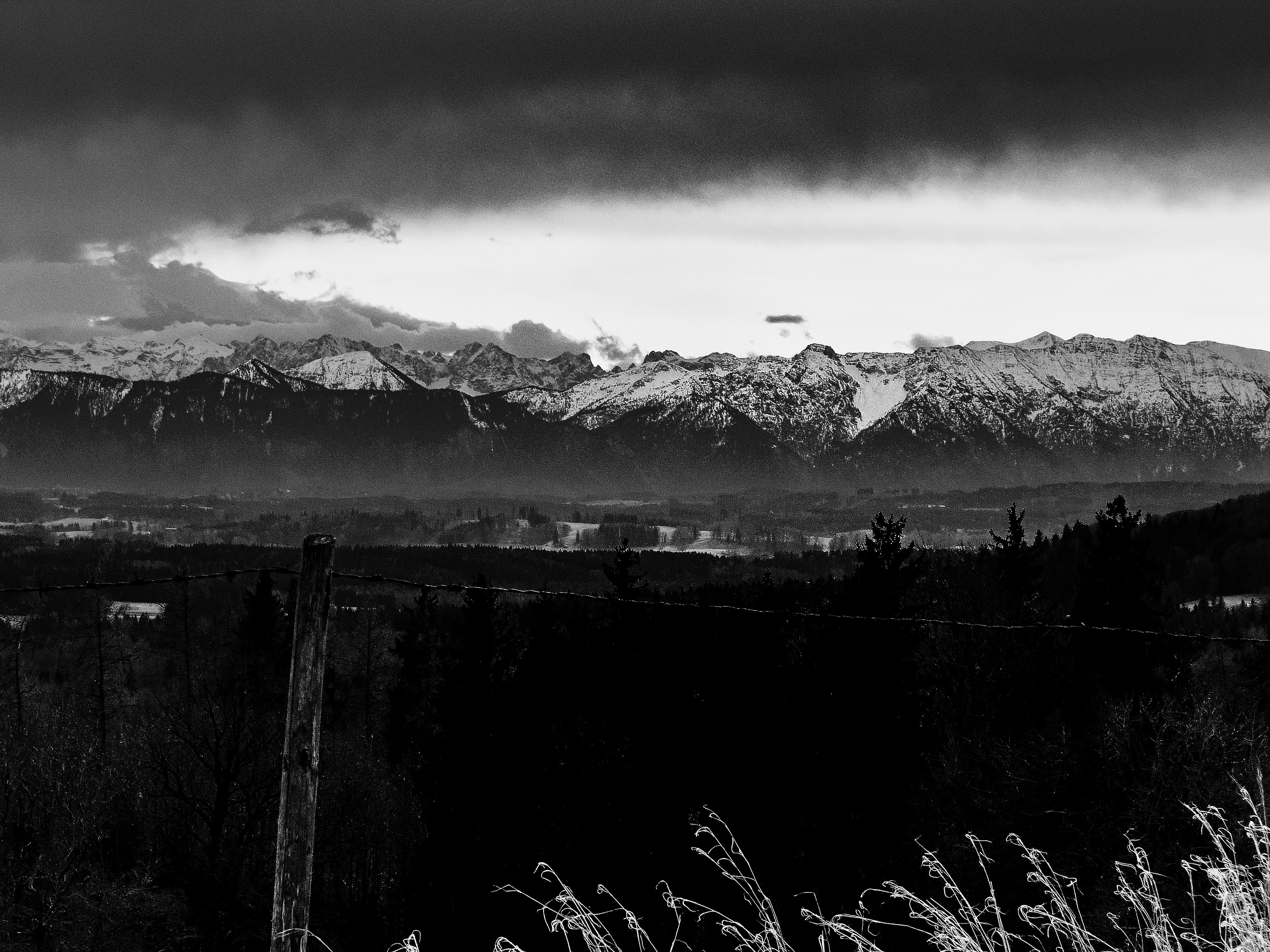
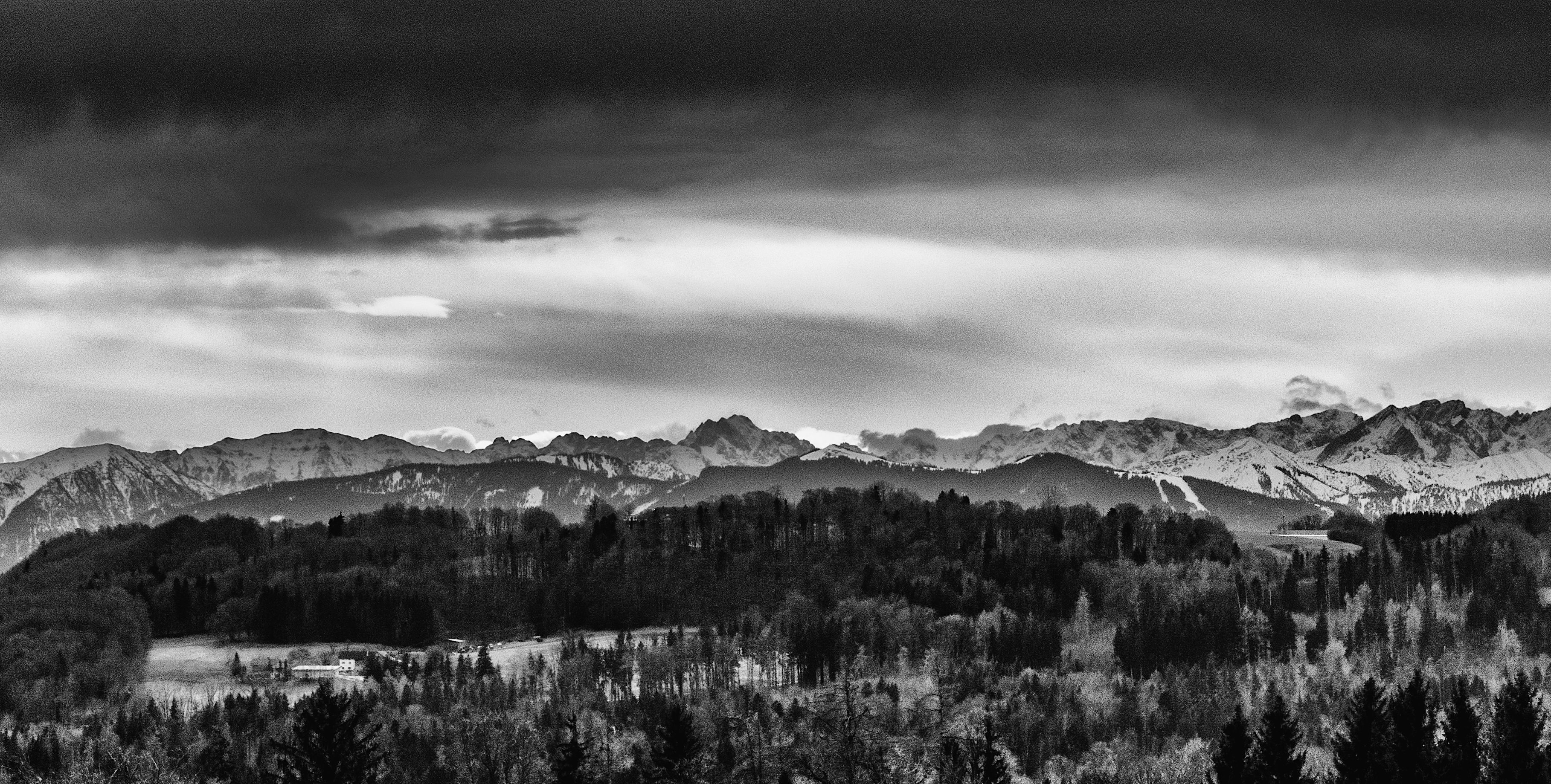
Sunday, March 11, was the first really warm day (17 Celsius) after the period of the arctic cold (“Beast From The East”) in Southern Bavaria. This was mostly due to the Foehn-Effect, which happens often during the wintertime. Foehn leads to an unusual rise in the temperature. The air becomes very clear and there is a clear sight of the mountains with many details. This day, however, there was also a special phenomenon, the so-called “Föhnkante”. This is a distinct border between clouds and the clearer part of the sky. It appears when the Foehn-Effect starts to break down. Subsequently, the following days were much colder and more winter-like.
In March there is little green and if the sun is behind higher-clouds colour in the landscape isn’t much appealing. But this time of the year between winter and spring could be interesting to capture structures in photography. After some time where I played a bit around with the pictures, I decided to present it in black and white. Black and white is often an interesting option and could reveal much of the special atmosphere of a place. The trick is not just to switch to black and white but trying different things with the software. There are also very good black and white filters in the NIK-collection software.
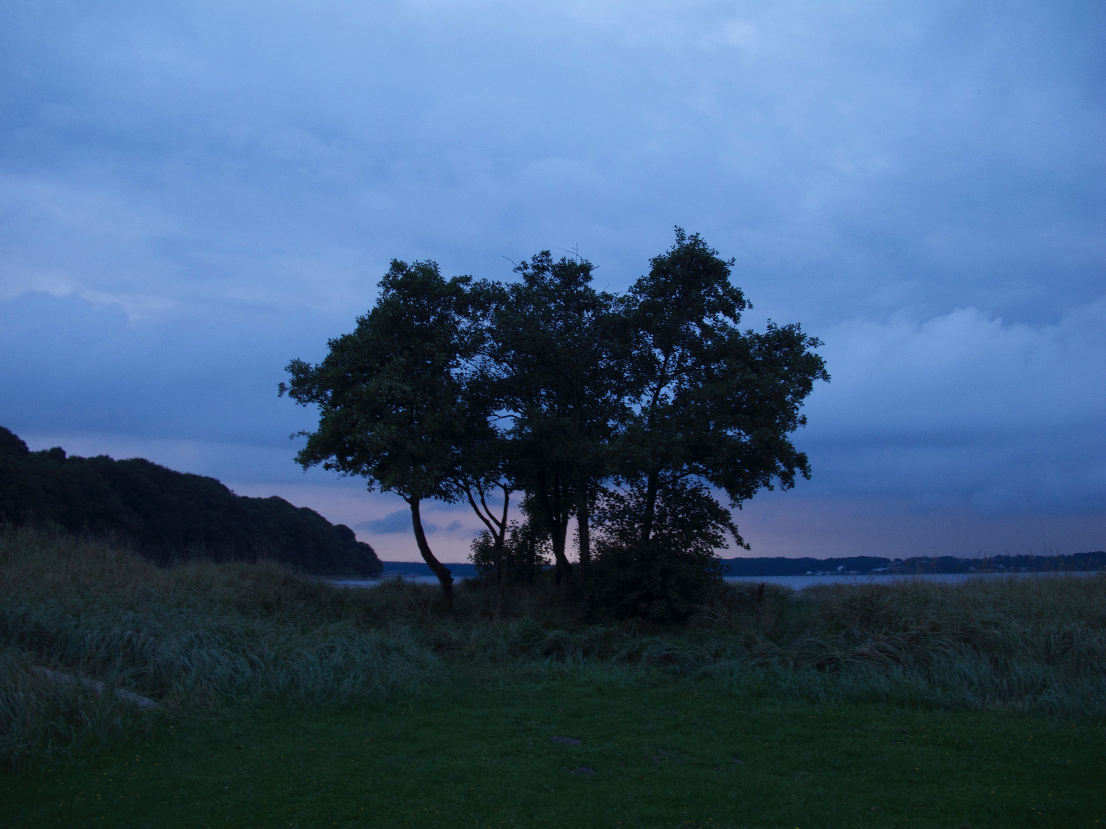
The viewpoint can be reached easily: you can use the parking space at the “Tassiloweg” behind the monastery. From there a steep path leads to the “Schloßbergstr.” The “Schloßbergstraße” leads to a settlement called “Haid” but do not walk towards the settlement but straight. The street becomes a small single road (better not go by car there because it is really very narrow and there is no parking space). It is great for a walk. There is also a seat there near the viewpoint and its fantastic for a rest – and of course to take pictures.
 /a>
/a>
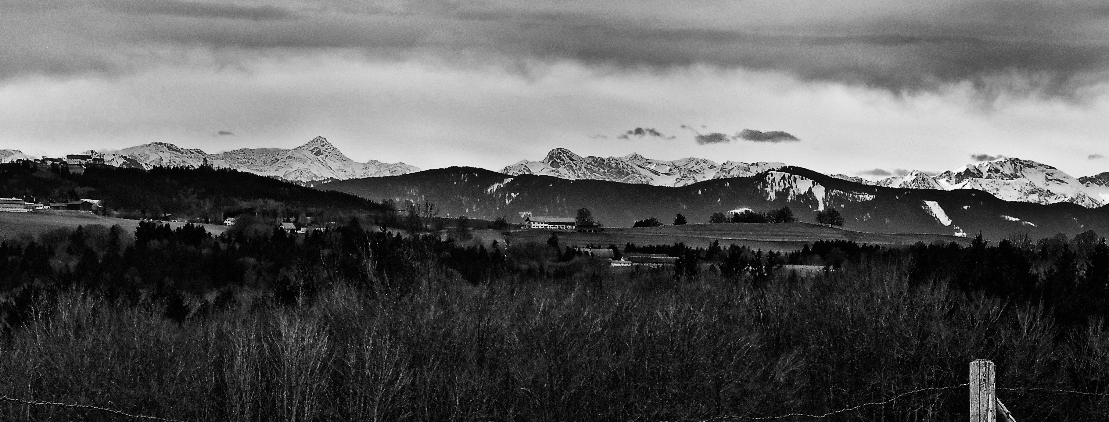
The viewpoint is also not so far from the Hohen Peissenberg. Both places are very suitable for weather-photography. The place near Wessobrunn could be also of particular interest for sunsets or sunrise. It presents a very typical Upper Bavaria landscape setting.
The most dominant mountain in the silhouette in the south is the Zugspitze. Seen from the viewpoint near Wessobrunn you have the Hohen Peissenberg with the big antenna in the foreground before the Zugspitze. It is good to choose a day like this one with the Foehn-Effect or come very early to capture the whole dimension of the view. The lower hills and the bigger mountains in the background add to the depth of the scenery.

The picture above is taken from the viewpoint and shows the whole Hohen Peissenberg. In the middle, there is a church. On the right side, there is a small tower, which is part of the weather station of Deutsche Wetterdienst. On the left side and also in the picture below is the big antenna.