Stormypictures.de is your place to find breathtaking locations with wonders of nature and to discover spectacular phenomena. Find travel tips for photographers, videographers and lovers of nature. Get tips how to photograph phenomena like Aurora Borealis or super-cell storms. Find coverage of dramatic weather-events in Middle Europe. See pictures from severe weather and monuments of nature as gorges, falls, mountains forests or alpine and maritime landscapes and learn how to get there. Learn more about the scientific background of meteorological phenomena in an easy way.
2025 had been a disappointing season for Stormchasers in Southern Germany for some time compared to 2024, or a better and quieter season for farmers and other people.
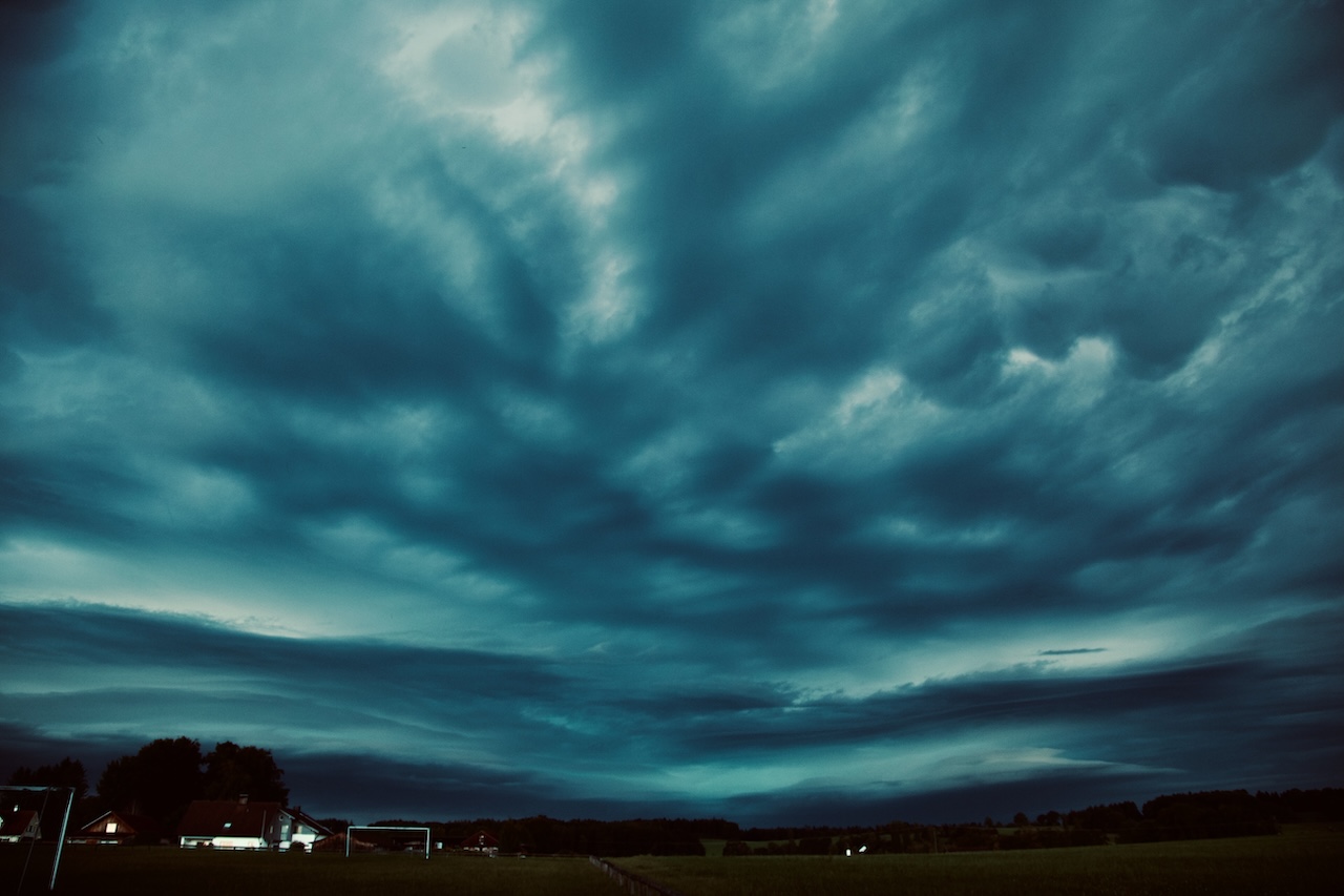
However, near the end of the Thunderstorm Season, there was one spectacular event which reimbursed weather watchers for a long wait. In the early evening hours of September 4, a massive supercell developed in Switzerland, then intensified in the South-West of Bavaria near the Allgaeu mountains and moved towards Lake Ammersee and further to the North-East.
This supercell thunderstorm intensified and brought storm, hail, and lots of rain. Most of all it created a dramatic and memorable scenery due to its highly structured shelf cloud with multiple floors.
That storm system moved slowly, and because it was already getting darker as the sun was close to the horizon, it increased the dramatic effect of the approaching clouds.
Furthermore the approaching shelf-cloud was, even for experienced weather-watchers, a unique experience as it looked like it would directly touch the ground. We were not the only ones filming that day, and there are a number of videos on YouTube documenting this spectacular weather event.
A public festival in Gillamoos had to be evacuated, and this massive storm left some damage across its path. The Firestarters had a lot of work in the Allgeau region. A dam broke.
Another impressive fact was that the weather system, which started in Switzerland, even made it to the North of Germany. The original supercell became a cluster of storms, a so-called MCS (Mesoscale Convective System).
The reason for this extreme weather event was an air mass limit over Germany, separating subtropical warm air from colder air coming from the Atlantic. There was an enormous energy in the air. The models predicted a dangerous situation with severe storms, and a weather warning was issued. The weather forecast was pretty good in this case.
It’s noteworthy that there were often blocking weather patterns over long periods with little change that are responsible for the lower number of thunderstorms in the Southern German area. By the end of the year, there is a clear anomaly with too little rain, even though there wasn’t any severe drought in Southern Germany.
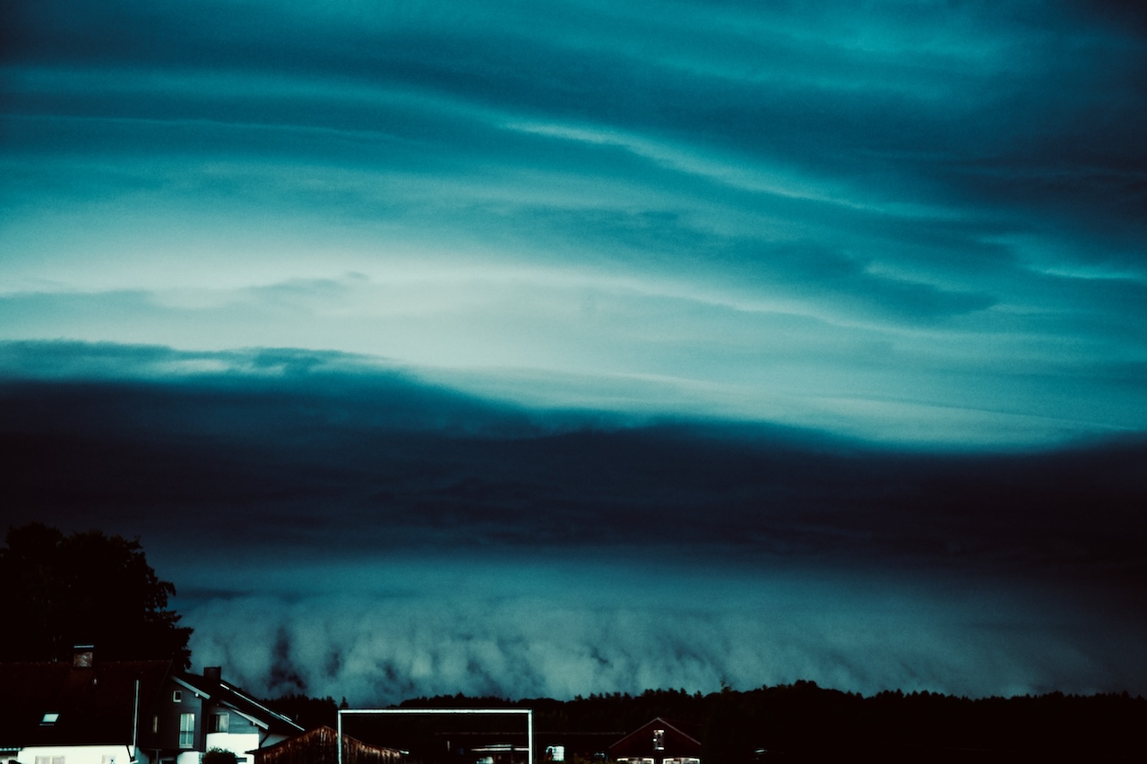
For photographers, this special supercell storm created an eerie, even otherworldly atmosphere which intensified as it got darker and the storm approached:
From the perspective in the picture, the approaching shelf cloud appeared like a giant waterfall touching the ground.
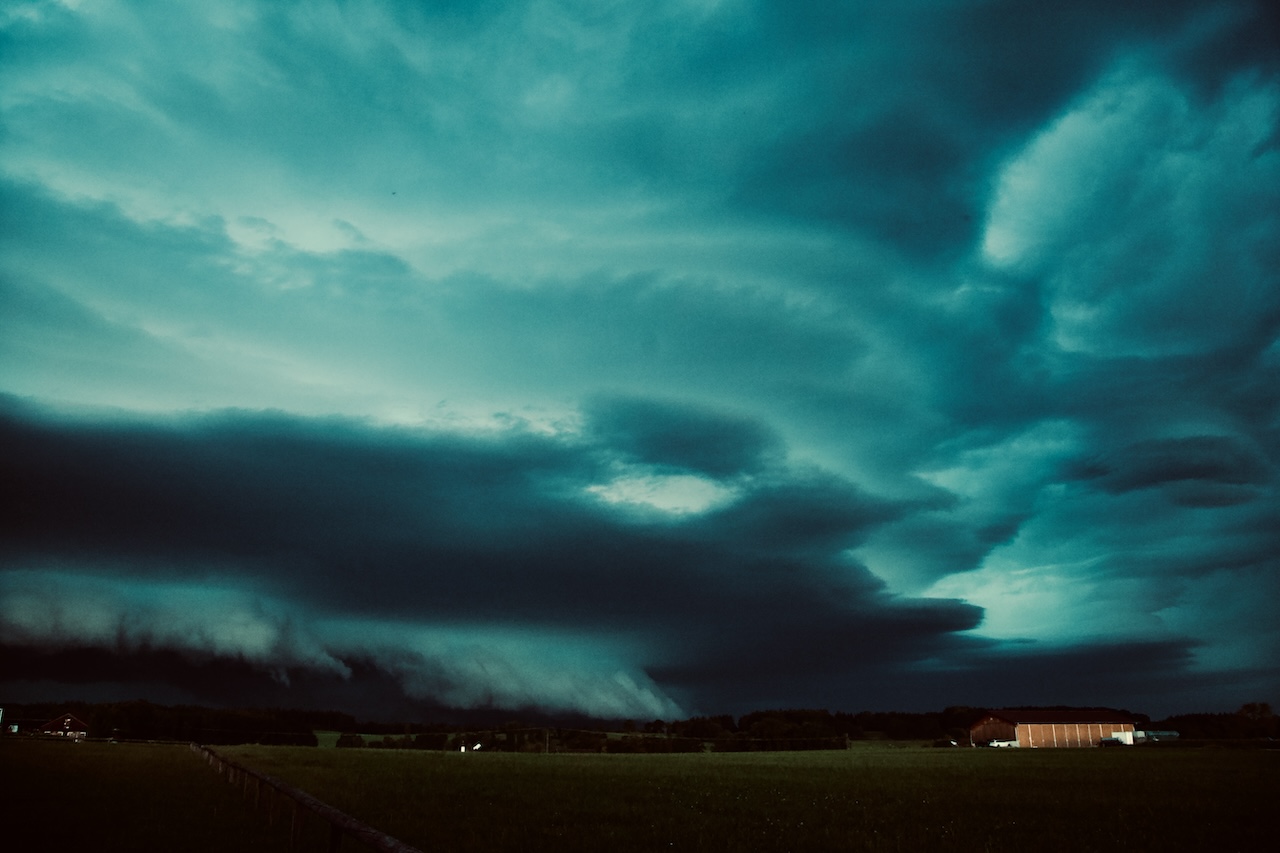
And then unique patterns in the clouds above appeared:
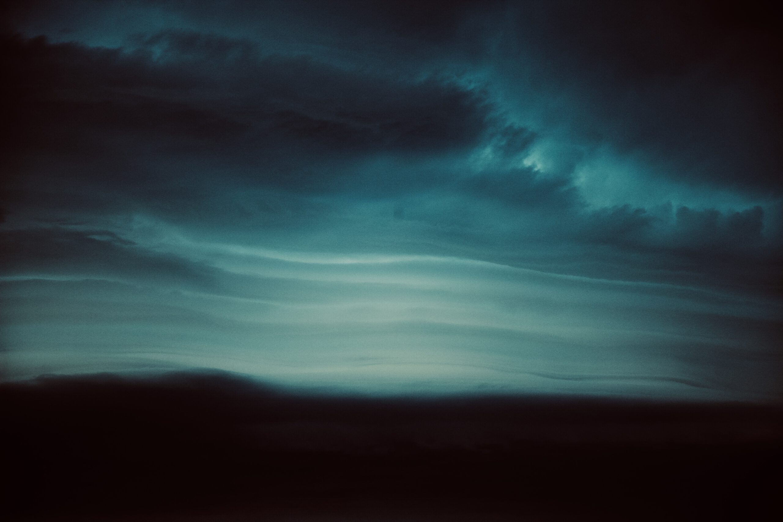
A closer look created images that look more like the picture taken from a probe orbiting Jupiter:
This awe-inspiring thunderstorm was a reminder that we live in a world full of wonder. Even though there is good prediction of these storms, measurement, and scientific synopsis, there is still a mystery here.
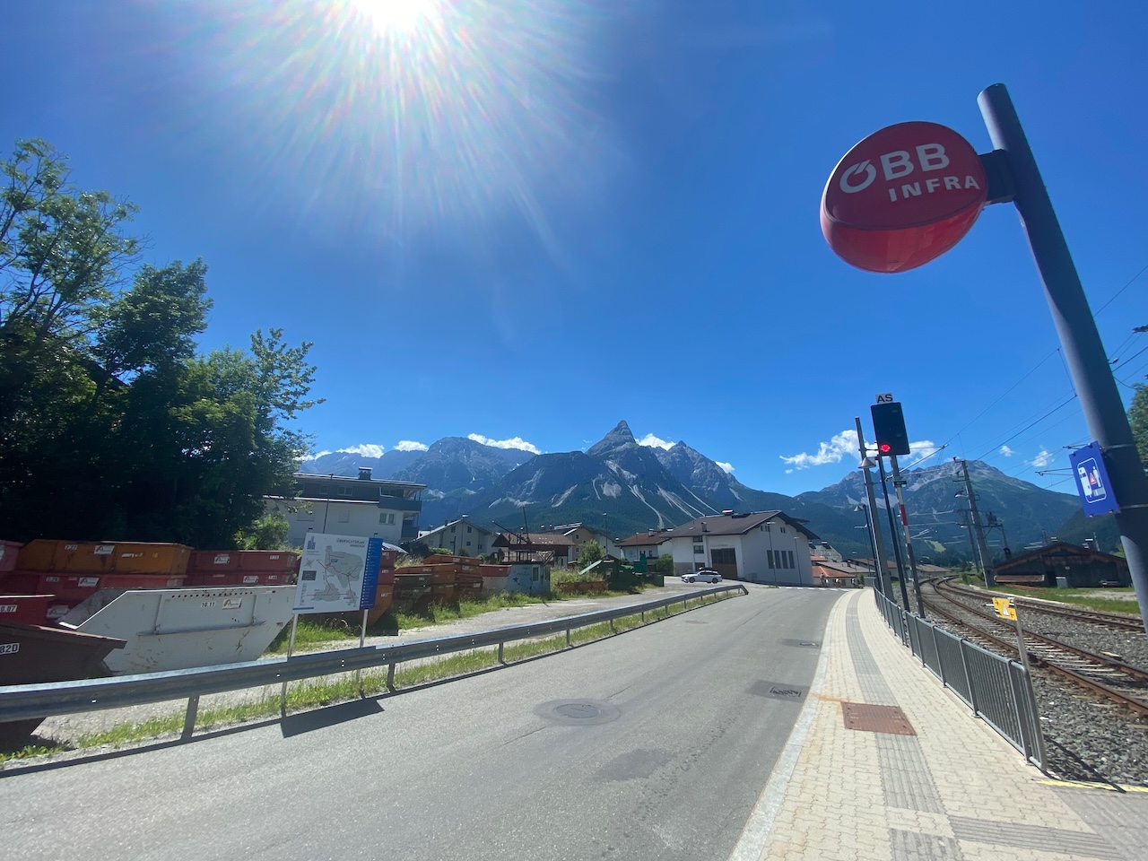
Lake Seebensee near Ehrwald in Tyrol is on the bucket list of many tourists coming to German and Austrian Alps. Especially tourists coming from Garmisch-Partenkirchen can get to Ehrwald quickly by train or via the road to the Fernpass-Straße. You will certainly not alone up there, but the two-hours-trip from the gondola station will be highly rewarded with outstanding vistas and the great motive of the Seebensee. If you have time you could also hike further to the Drachensee.
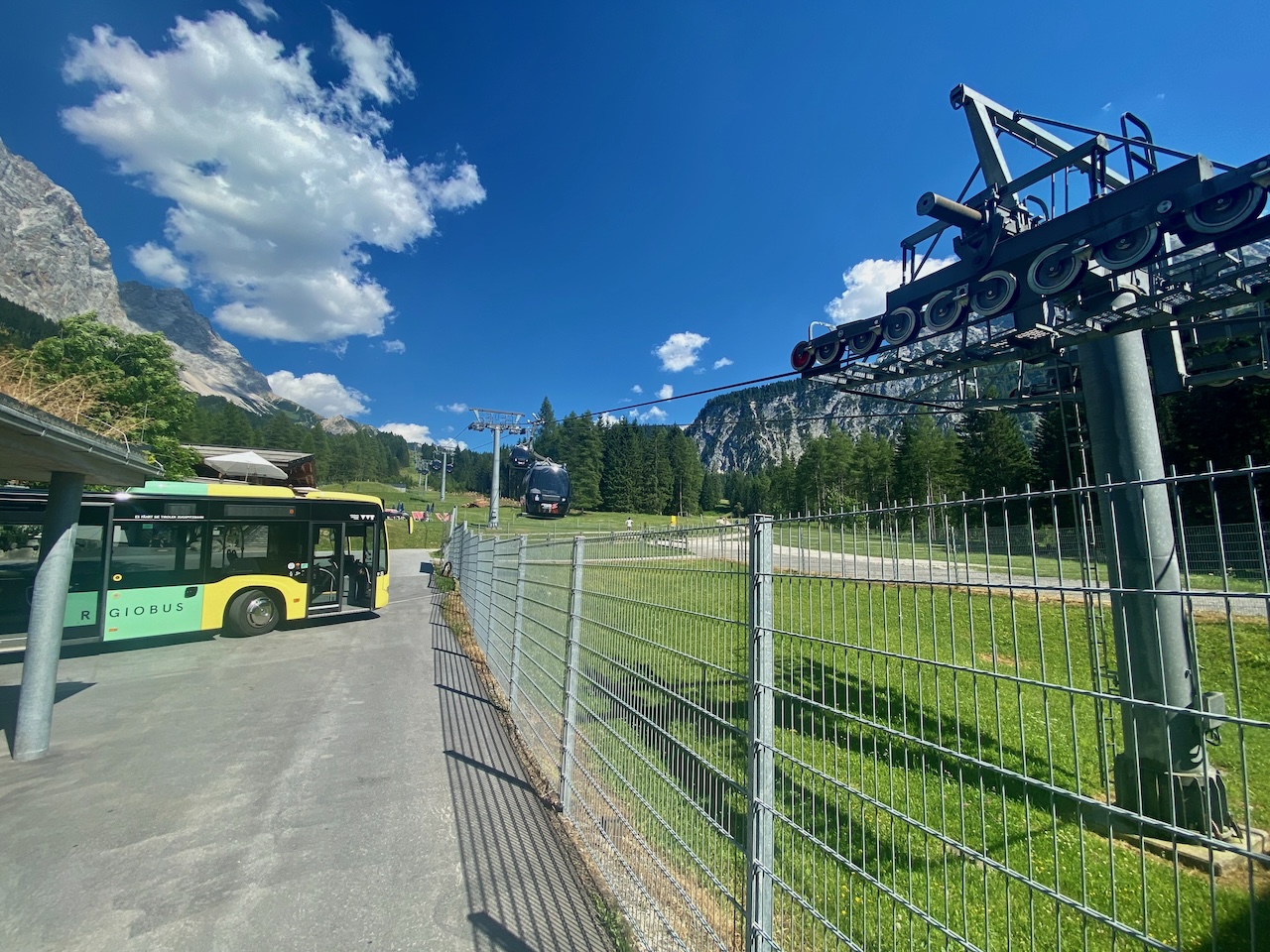
The tour begins at the modern ropeway from Tyrol’s beautiful Ehrwald near Zugspitze to the Ehrwalder Alm. You can get to the ropeway with a bus which commutes between the ropeway station and the train stop, which is also the train stop for visitors using the Tyrolean Zugspitze ropeway.
The area is a highly frequented place for winter sports. During winter, the ropeway brings a lot of people into the skiing area above Ehrwald. But it is a popular destination in summer too. Many hikes begin at the Ehrwalder Alm. The most well-known mountain peak here is the Zugspitze, but there are other spectacular hikes. One leads to the Seebensee and from there to the Drachensee with a mountain cabin, the Coburger Hütte.
The ride in this comfortable cable car is an attraction in itself: We glide over the green alpine meadows and the mountain forest and enjoy a fantastic panoramic view during the short 10-minute journey. From there the hike begins:
Normally, anybody can do this, and this is an easily accessible trail that has a lot to offer. There are many great vistas along the way. BUT please read the advice in the paragraphs below!
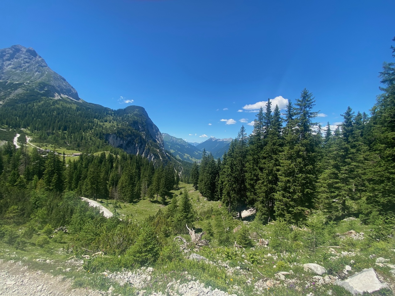
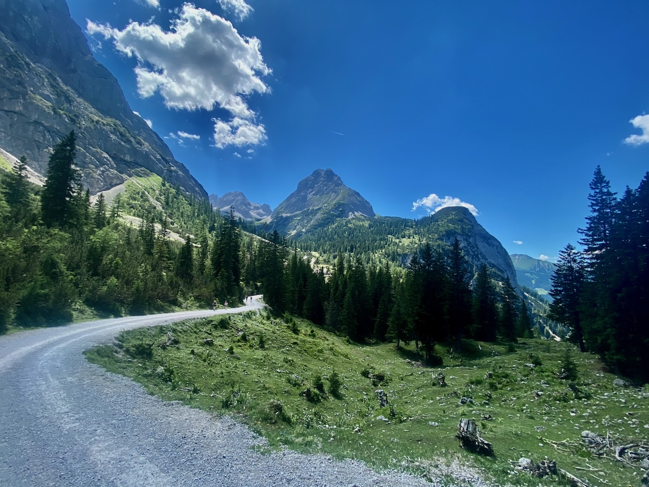
The scenery seen from the trail: Looking south towards the Fernpass.
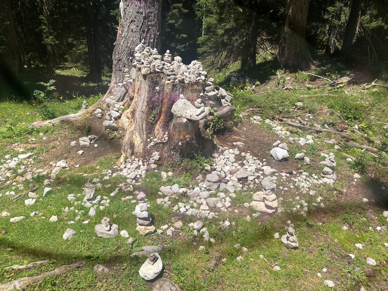
Parts of the trail lead though a wonderful mountain forest. The forest provides some highly welcome shade along the trail. And sometimes an opportunity to build these little stone pyramids:
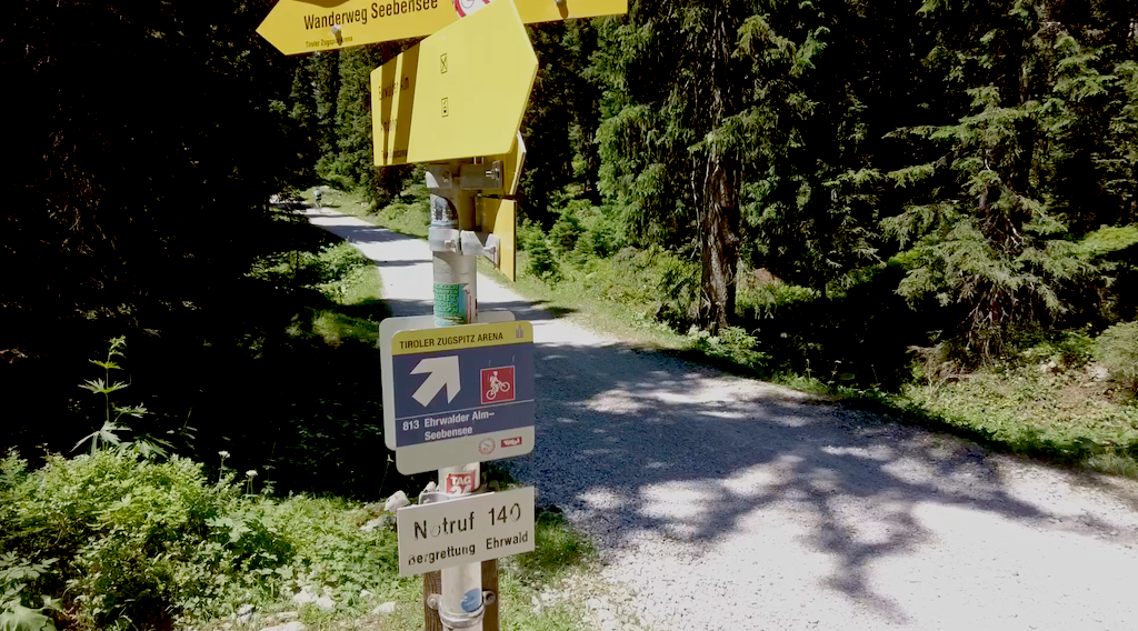
There are a couple of important things: There are two trails, and there is a fork in the path approximately in the middle. The path to the left is shorter, but it is not for bikes, or if you are not comfortable with mountain trails. There is nothing especially difficult here, but there are some ups and downs and it is a mountainous trail with steps and roots and not a street. It could get glitchy after rain. The path on the right is more like a mountain road, and anybody can do it. However it is still also a 2 hours hike bus also with some ups and downs with a difference of 222 metres in height. For further information please check this tour guidance. And always be aware of the weather: It can be hot up there and thunderstorms and dramatic weather-changes with sudden drops of temperature are always possible even in summer.
Stay always on the hiking trails and protect the sensible eco-system of mountain forests, lakes and alpine meadows and you don’t want to get lost. Attention: Don’t follow signs to the Hoher Gang Steig, this is an Alpine VIA FERRATA, not a normal hike and needs climbing experience!
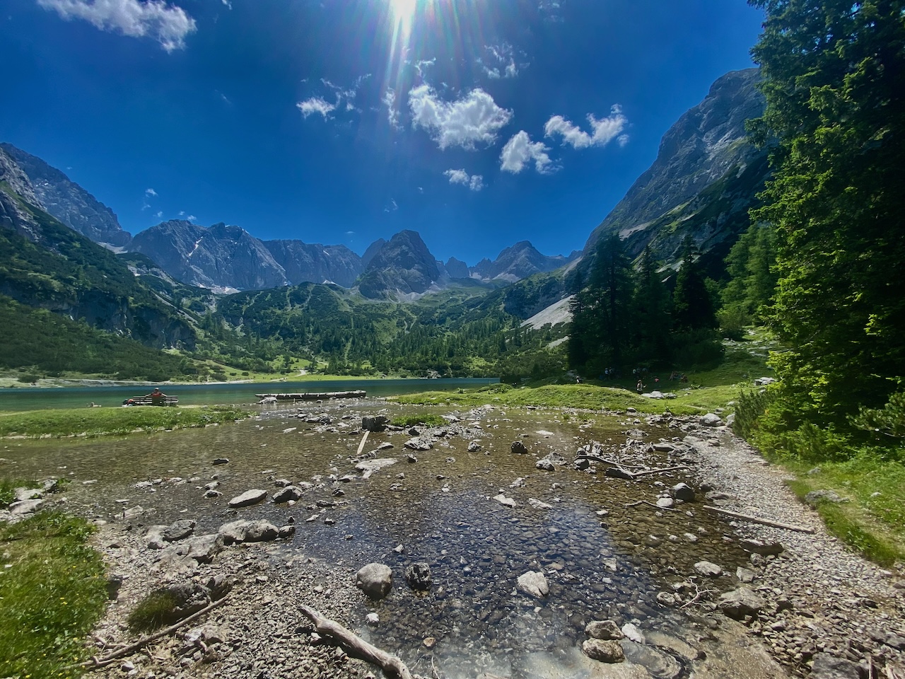
Both trails reach the Seebenalm, where you can get refreshments. After the Seebenalm, an ascent begins with more great panoramic views of the valley with Ehrwald and the surrounding mountains.
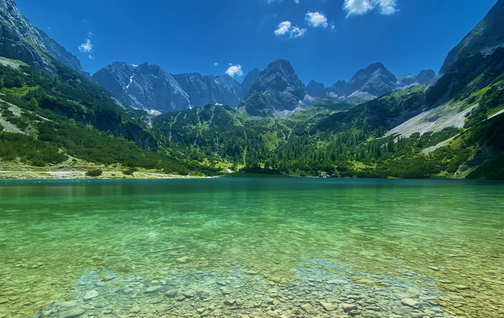
The lake is at a height of 1657 metres. It’s not far from the Seebenalm, but it is exposed to the sun during summer. The sunlight can be pretty intense here.
The famous lake with its unique green and the surrounding mountain tops. On the left side of the shore of the lake the trail leads further to Drachensee. The Drachensee is another great destination however there is an ascend and some condition is required.
The way black to the rope-way offers again many opportunities for pictures and videos. Every corner of the trail offers new perspectives.
It’s a great place to spend time and discover this unforgettable landscape.
One tip: Check when the last gondolas leave the station. It’s a long walk from the mountain station to Ehrwald. Better enjoy this fantastic ride with the ropeway, which offers again some great perspectives of the valley and its surroundings.
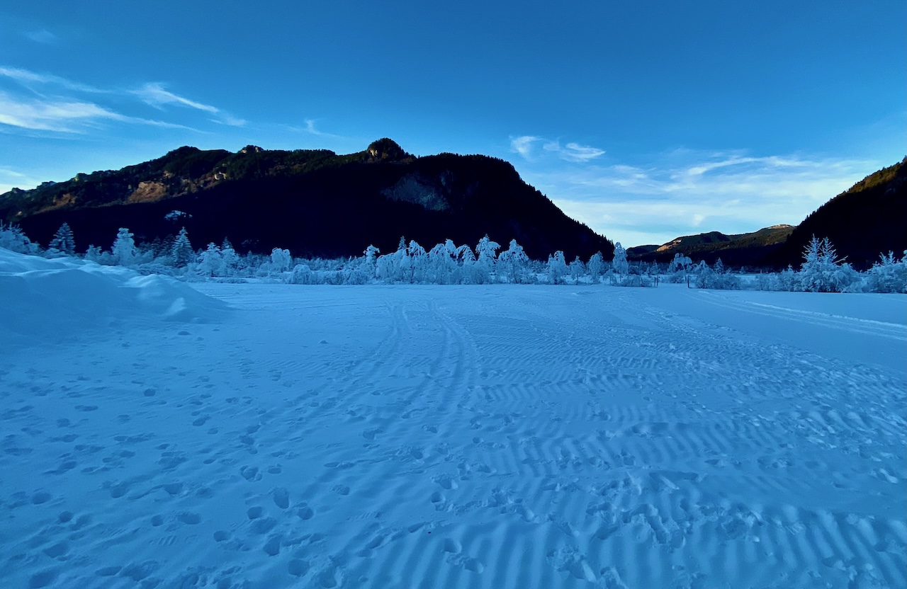
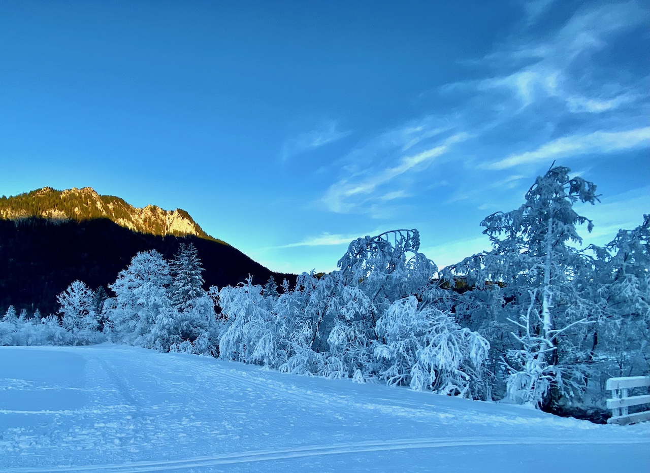
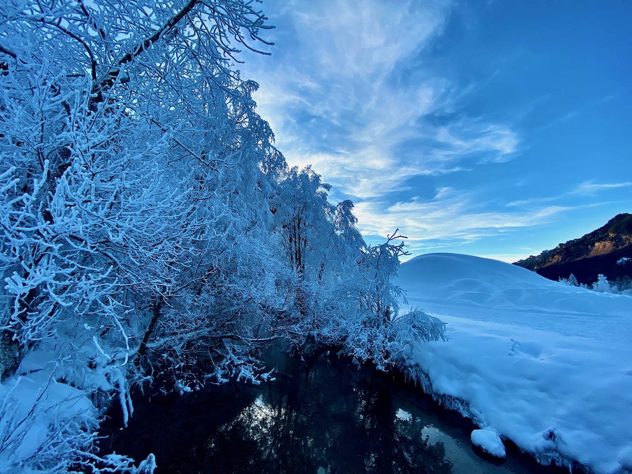
Trees, Bushes, and grass frozen with layers of hoarfrost are great motives. Landscape photographers love these meteorological phenomena because they create fantastic, enchanted landscapes. True magic Winter Wonderland.
On January 1, 2025, such extraordinary scenery could be explored in an Alpine Valley close to the famous Ettal-monastery in Bavaria.
The Graswang Valley is always a spectacular spot for photographers and filmmakers. It begins with a grand rocky mountains-like scenery and a road leads to one of the fairytale-king Ludwig II’s beloved castles, Linderhof.
It’s no wonder the region has a reputation as a romantic fairytale country that also inspired artists. It is in midst of the nature park Ammergauer Alps. Here is the highly recommended website for further informations: https://www.ammergauer-alpen.de/
But some days make it even more fascinating and let us forget our modern rational world even if a lot of traffic due to tourism is never far away.
Weather plays a huge part in this.
Around Christmas and New Year 2025, Middle Europe and Southern Germany were under a long-lasting high-pressure system and a so-called inversion layer. This means that temperatures on top of mountains were higher and temperatures in valleys or lower parts of the country remained low. These inversion layers in Winter lead to a lot of fog.
The fog is very different: It can be more like clouds when there is high fog (low stratus). Mountain highs are often above this fog and from atop the fog it looks like a sea of fog. Or it is a grey cloud cover if you are in a valley. Sometimes there are sheets of ground fog with limited sight or constant changes with a milky sun breaking through the fog over midday.
Wet areas like bog or stream valleys often create their own microclimate with fog. In the Graswang valley, there is not only the Ammer but a number of springs and lots of smaller streams coming from the mountains and wetlands – perfect conditions for fog and hoarfrost.
But why do these layers of ice-crystals around trees and branches so thick?
One possibility:
Fog creates its special sort of hoarfrost which is in German called “Raueis”, ROUGH ICE. It is a bit different than the original hoar frost.
Rough Ice emerges when fog freezes. Fog consists of very small water droplets. If these droplets come in contact with colder surfaces rough ice is created whereas hoar frost is a frozen precipitation of water vapor in ice form.
Rough Ice and rime are hexagonal crystals of frozen water. The bond between hydrogen and oxygen creates this hexagonal shape, which is transparent but appears white due to the diffuse reflection.
This makes hoar frost and rough ice so fascinating for photographers. Combined with some snow and stable cold weather conditions which add more and more ice crystals we can experience these magical landscapes.
If you want to take such pictures it’s good to follow weather reports – and often be there in the morning. The sun usually melts the ice on the trees quickly.
Topography
One of the special circumstances here in the valley is that during winter the sun never reaches the bottom of the valley in some parts. So, if you look for these types of scenery a valley or gorge with a stream where in Winter the shadow of the mountains is there all day is a good option. The valley runs from the West to the East and has openings here to the East which affects airflow too.
Cold temperatures and shadow all day on the Southern side of the valley.
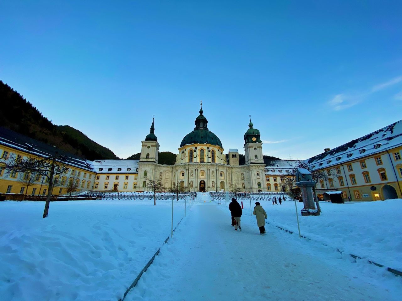
Great motives in the neighbourhood: Ettal Abbey
Always worth a visit. The Ettal Abbey is close to the Graswang valley. The Ettal Abbey was found in 1330. Today 50 monks live in the Benedictine monastery. The impressive building is a baroque rebuilding after the original building was destroyed. On the other side the road through the Graswang valley leads to the famous Linderhof Castle, the German austrian border and the Plansee, a long alpine lake.
DIRECTIONS
The Graswang Valley is accessible from Garmisch Partenkirchen, from Oberammergau and from Reutte, Tyrol.
Trains stop in Garmisch Partenkirchen and Oberammergau. From Oberammergau there is a bus, Line 9622. During summer a special attraction is the “Ringbus” a special bus for tourists and hikers starting in Oberau.