Majestätische Berge und ein Zauberwald – Das Schwarzwassertal in Österreich

von Peter Engelmann, 28 Juli 2022

Das bekannte Kleinwalsertal im österreichischen Bundesland Vorarlberg ist im Winter wie im Sommer ein beliebtes Ausflugsziel. Es gehört zwar zu Österreich, man kommt aber nur von Deutschland aus dorthin. Das Kleinwalsertal ist eine österreichische Enklave. Der Name Walser bezieht sich auf die Geschichte: Die erste Besiedlung erfolgte von Süden, aus der Schweizer Region Wallis. 

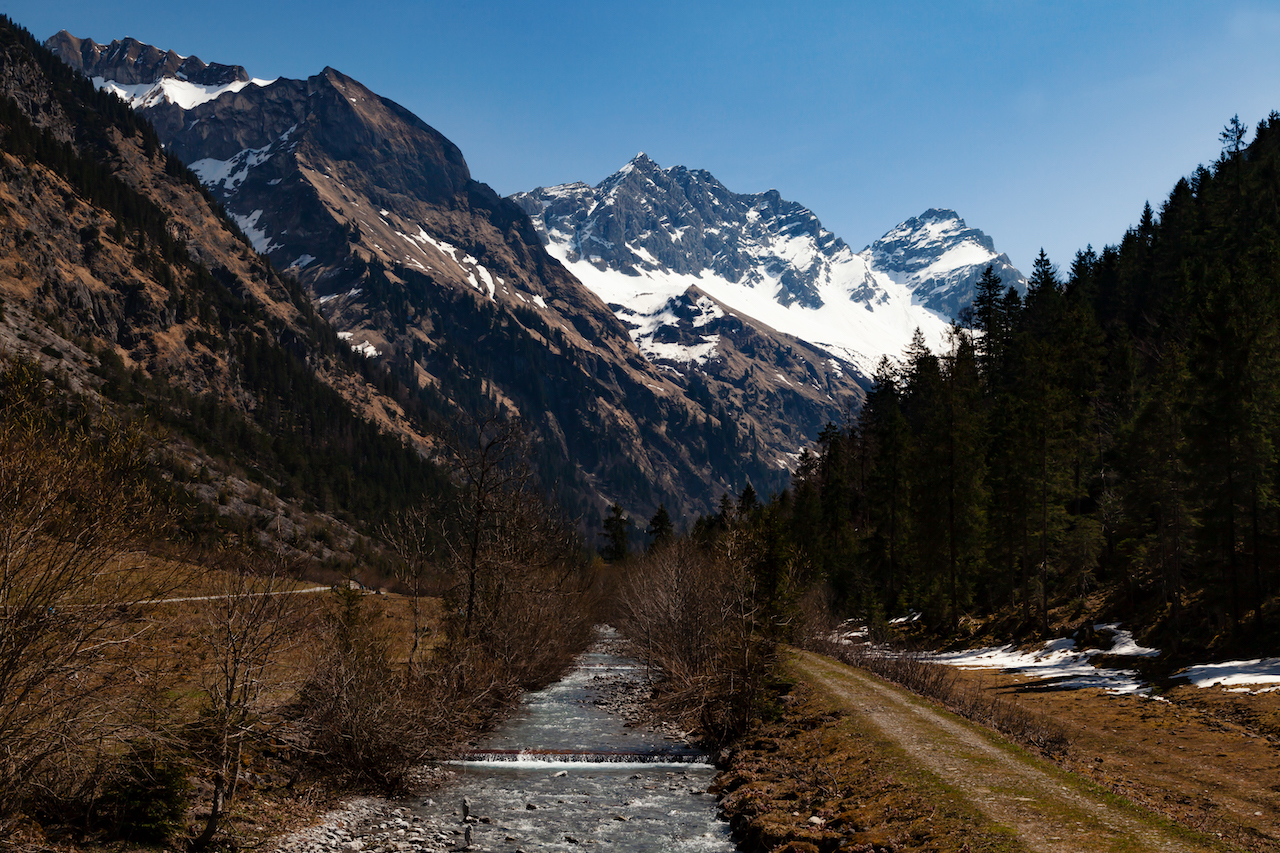
Bei Oberstdorf beginnt das Tal mit seinen vielen Aussichtspunkten. Die Hauptorte im Hochgebirge sind Mittelberg, Hirscheeg und Riezlern. Am Ende des Talschlusses liegt Baad. Vom Kleinwalsertal aus führen viele Wanderwege in wunderschöne und spektakuläre Hochtäler mit Almen. Eines davon ist das Schwarzwassertal. Dieses fantastische Tal bietet viele hervorragende Motive für Foto- und Videografen. Aufgrund seiner herausragenden geologischen Formationen und seiner reichen Flora ist es ein Muss für jeden Naturinteressierten. Auf dem Weg zur Melköde-Alm liegt ein Torfmoor.

Wildnis rund um den Ifen

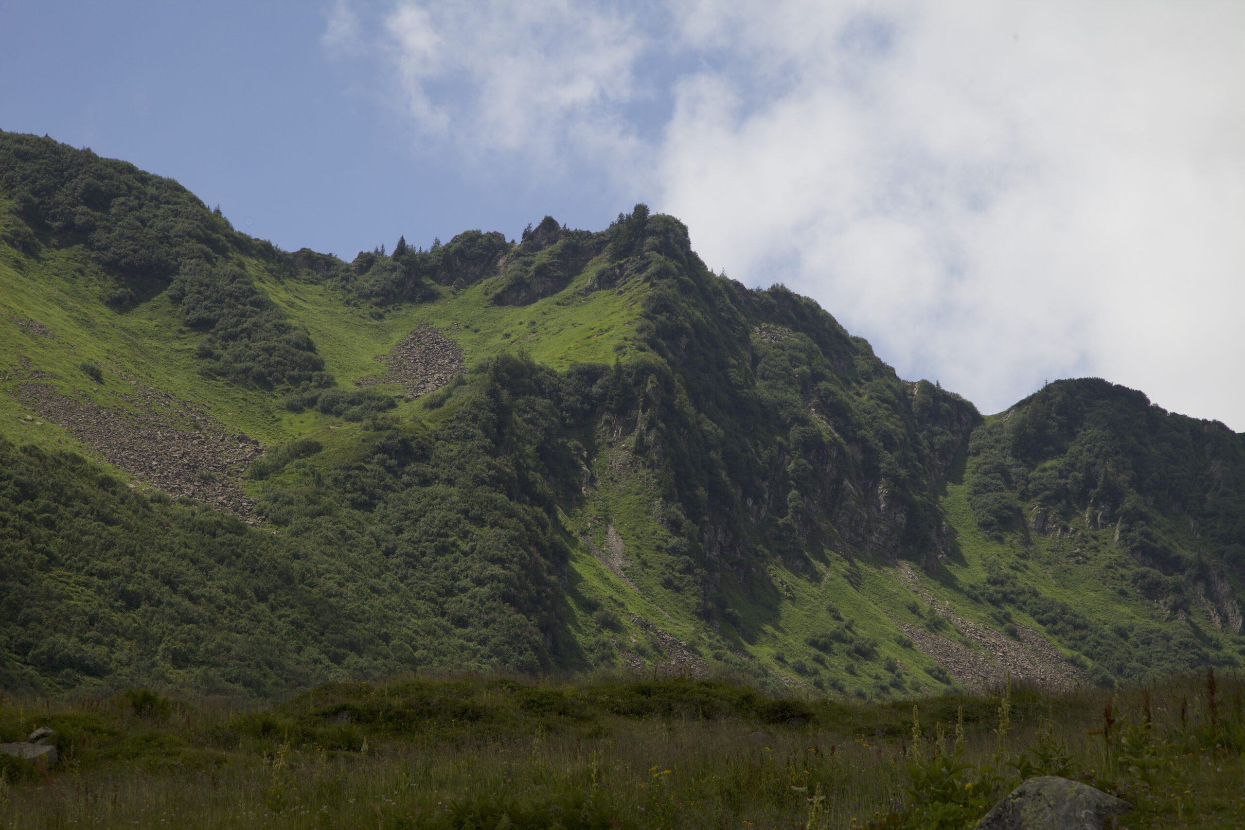
Ein guter Ausgangspunkt für einen Ausflug ins Scharzwassertal ist der Parkplatz bei der Ifenbahn und der Auenhütte. Eine Bergstraße verbindet die Talstation der Ifenbahn, Hirschegg und Riezlern. Das Kleinwalsertal verfügt über ein hervorragendes öffentliches Verkehrsnetz. Busse kommen oft, und es gibt eine Busverbindung nach Oberstdorf in Deutschland; eine gute Alternative, wenn man das Auto nicht nutzen möchte. Der Wanderweg beginnt am Ende des Parkplatzes auf der linken Seite des Bahnhofs und führt zu einem See, der in magischen Grün- und Blautönen schimmert. Dieser Stausee liefert im Winter das Wasser für die Beschneiungsanlagen. Zwischen dem See und der Alm Melköde (wo Sie im Sommer essen und trinken können), liegt auf der linken Seite des Weges ein beeindruckender, unberührter Bergwald. An manchen Stellen wirken massive Felsen wie antike Relikte. Auch wenn es sehr bequem ist, dort zu laufen – und natürlich sind hier oft viele Wanderer –, ist es ein Gefühl, als würde man in die Wildnis eintreten.

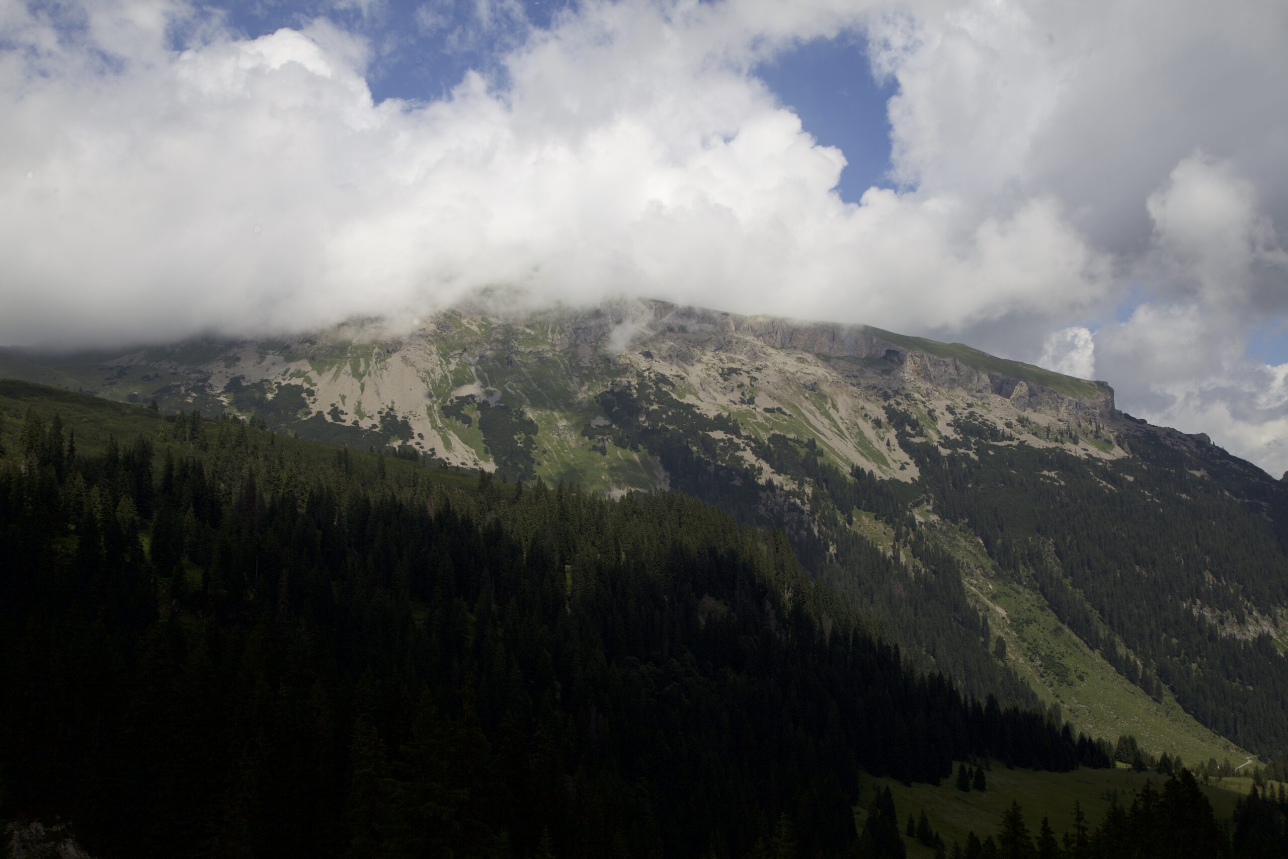
Über dem Tal thront der einschüchternde Hohe Ifen. Dieser Berg ist eine weitere großartige Sehenswürdigkeit und ein sehr interessantes geologisches Phänomen. Der Hohe Ifen ist mehr als 2200 Meter hoch. Seine raue Tafelbergform ist für die Alpen recht ungewöhnlich. Mit seiner wilden und widerspenstigen Felswand bietet er einen spektakulären Anblick. Es ist leicht vorstellbar, dass unsere Vorfahren ihn als heiligen Berg oder rituellen Ort gesehen haben könnten. Besonders interessant und geheimnisvoll wirkt er, wenn es keinen blauen Himmel, aber einige Wolken und Nebel gibt. Wenn Nebelschwaden die Berge hinaufsteigen oder Wolken den Gipfel umspielen, kommt die wilde Natur des Ifen-Gebiets noch stärker zum Vorschein.

Hoher Ifen Plateau

Die Weiden

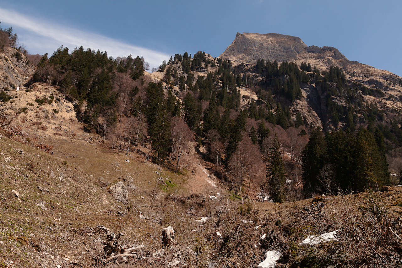
Der Weg steigt langsam an. Wenn Sie den Bergwald fotografieren möchten, gibt es viele Motive entlang des Weges. An einer Stelle führt ein kleiner Pfad nach links zu einem leider schon ziemlich verwitterten und zugewachsenen Bildstock, dessen Heiligenbild kaum noch zu erkennen ist. Es lohnt sich dennoch, sich ein paar Minuten Zeit zu nehmen, um dorthin zu gehen, denn der Bildstock befindet sich auf einem kleinen Hügel im Berg, mit Blick auf eine wilde Gegend mit einigen weiteren großartigen Aussichten.

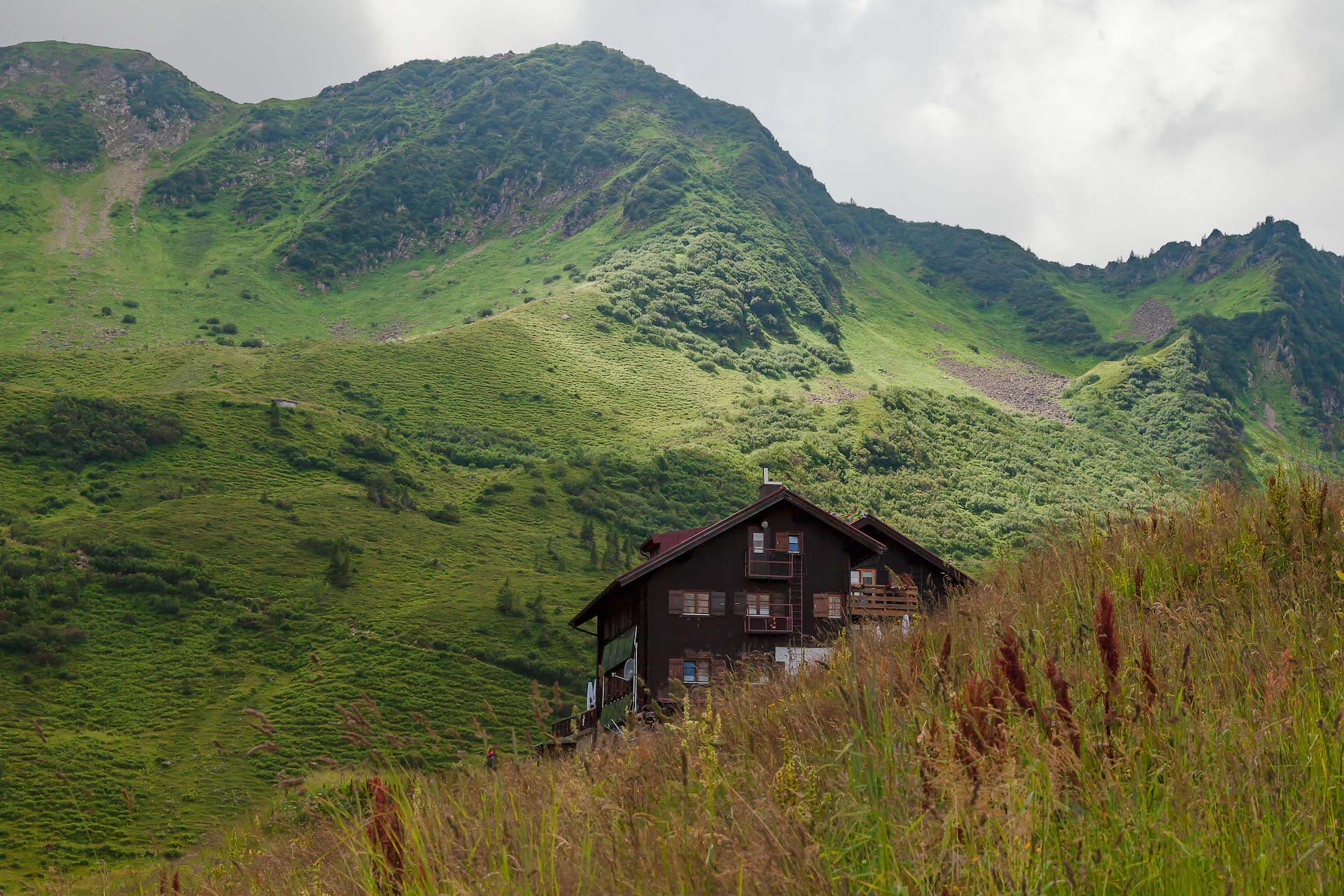
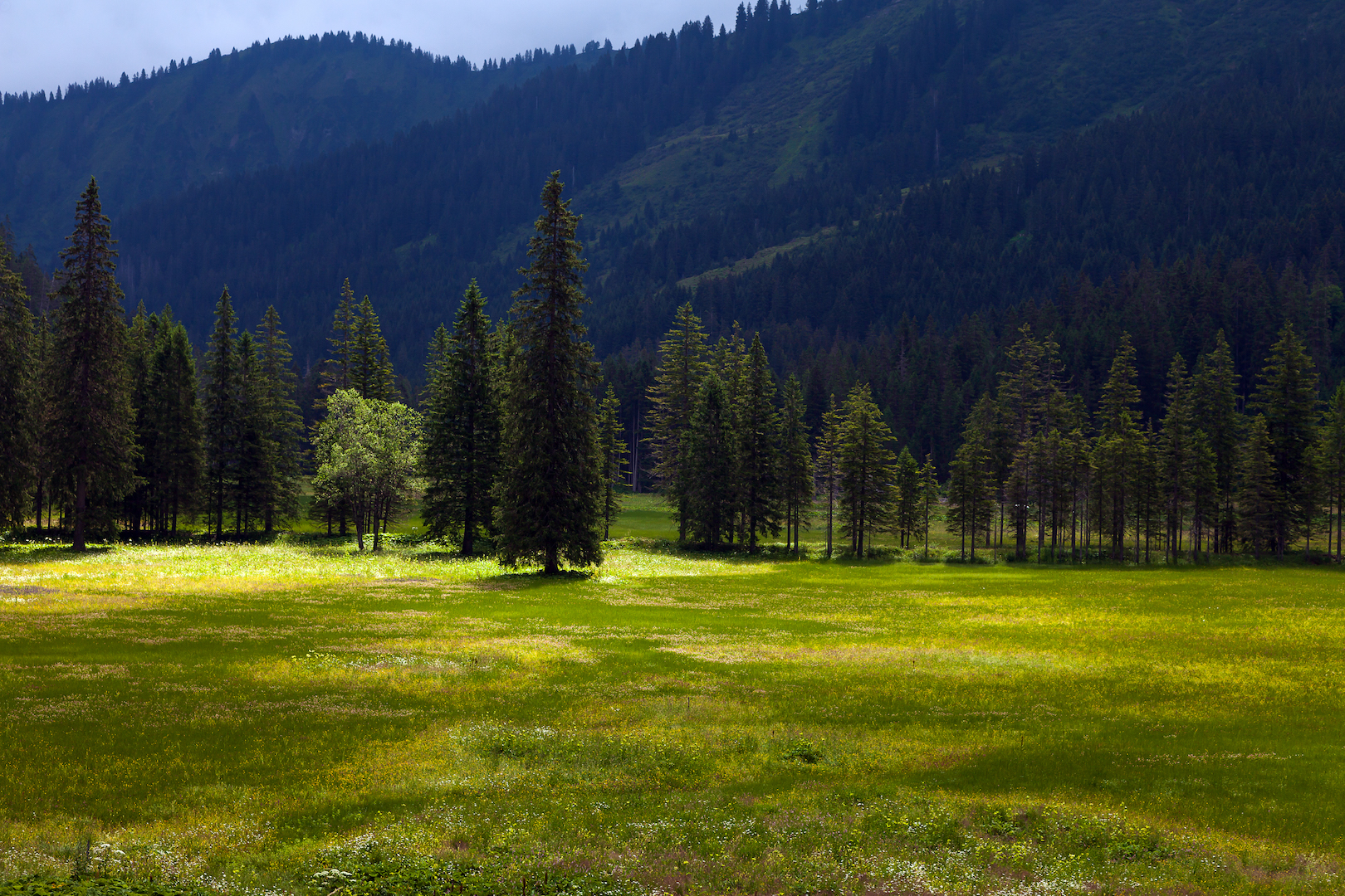
Einige Minuten später, zurück auf der Hauptwanderung, öffnet sich die Landschaft auf Wiesen und Weiden. Kommt man an einem Tag hierher, an dem sich die letzten Regenwolken verziehen und ein Wechselspiel aus Sonnenlicht und Wolken herrscht, ist das wie eine Szene aus „Der Herr der Ringe“. Der Wasserfall hinter dem Weideland verstärkt den Eindruck. Diese Almen sind einzigartig, da sie teilweise zum Torfmoor gehören. Hier wird schon seit sehr langer Zeit Landwirtschaft betrieben. Der Bergbauernhof Melköde geht auf das Jahr 1566 zurück. Zu seiner langen Geschichte gehören auch einige katastrophale Ereignisse: Lawinen zerstörten ein paar Mal Gebäude. Bei einem dieser Ereignisse starben 20 Menschen. Die Wildnis ist hier immer nah, und man darf nie vergessen, die Naturgewalten zu respektieren. Die Almen liegen auf einem Hochplateau im Schwarzwassertal auf 1350 Meter ü. M. Das ermöglicht besondere Lichtverhältnisse und intensive Farben. Die Wiesen sind tolle Motive.

Almwiese neben der Melköde, Schwarzwassertal, Kleinwalsertal

Wanderung zur Schwarzwasserhütte

Nach einer Einkehr beim Bauern- und Gasthaus Melköde führt der Weg in steileres Gelände. Es ist nicht schwierig weiterzugehen, aber der Weg verändert sich nun und erfordert etwas mehr Ausdauer. Dabei ist er in ausgezeichnetem Zustand, und man muss die schwere und ausdauernde Arbeit der Menschen anerkennen, die sich um diesen großartigen Weg in die Berge kümmern. Denken Sie dennoch daran, dass es sich ab hier um alpines Gelände handelt und nicht mehr um einen Ziehweg. Es gibt einige Abschnitte, in denen erhöhte Aufmerksamkeit erforderlich ist. Bei Regen ist dieser Weg rutschig.

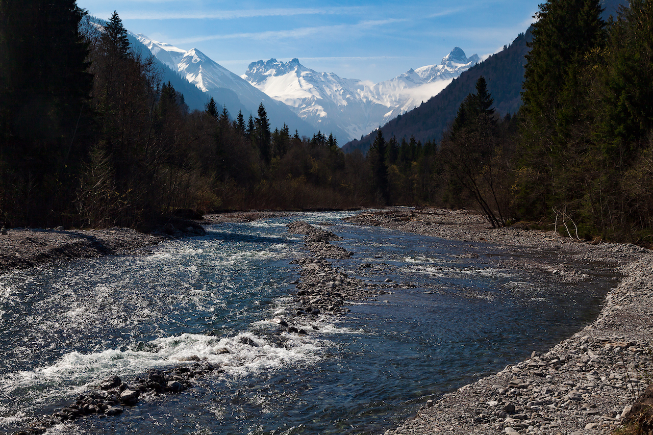
Auch die Klima- und Wetterbedingungen tragen zu der besonderen Qualität des Schwarzwassertales bei. Die Temperatur ist im Sommer gemäßigt, und es regnet viel. Im Winter fällt Schnee. Das sind gute Voraussetzungen für eine einzigartige Vegetation mit einer Vielfalt an Pflanzen, viele von ihnen streng geschützt. Das Schwarzwassertal ist Teil des Pflanzenschutzgebiets rund um den Hohen Ifen.

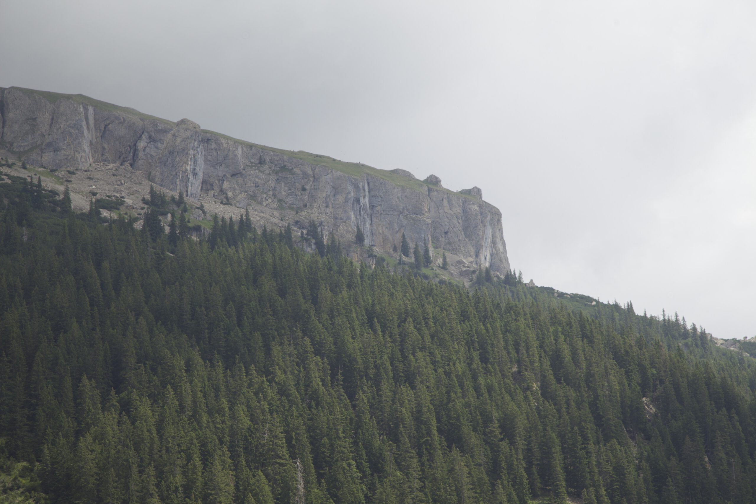
Der Weg öffnet sich wieder und die urige Schwarzwasserhütte kommt in Sicht. Hier ist ein idealer Ort, um weitere Bilder von beeindruckenden Ansichten zu machen: auf der linken Seite imposante Grasberge, gegenüberliegend erneut das Ifenplateau. Auch wenige Meter von der Almhütte entfernt gibt es tolle Möglichkeiten, Fotos oder Videos zu machen.

Die Schwarzwasserhütte geht Jahr 1914 zurück. Betrieben wird diese gemütliche Almhütte vom Deutschen Alpenverein Sektion Schwaben mit einem freundlichen und kompetenten Team. Sie ist auch im Winter geöffnet und bietet Übernachtungsmöglichkeiten, für die Reservierungen erforderlich sind. Die Schwarzwasserhütte ist Ausgangspunkt für mehrere Wanderungen zu den Berggipfeln. Bedenken Sie, dass es sich um hochalpines Gelände handelt und bei Ausflügen zum Hohen Ifen Trittsicherheit ein Muss ist.

Grasberge

Schönheit der Wildnis

Auch wenn es nur ein kurzer Aufenthalt ist, bleibt genug Zeit, um diese himmlische Landschaft zu genießen – eine Landschaft, die raue Wildnis und ergreifende Schönheit miteinander verbindet.

Das Kleinwalsertal hat viel zu bieten. Weitere spektakuläre Ziele sind die Breitenbachklamm auf deutscher Seite und das Gottesackerplateau. Dieses Plateau, eine geologische Formation, liegt auf der anderen Seite des Hohen Ifen.

Hinweis: In einigen Führern gibt es auch eine Wanderung namens „Schwarzwassertal“, die von der Auenhütte nach Mittelberg hinunterführt. Diese führt in eine weitere Schlucht und ist ebenfalls sehr interessant.

Deutsche Bearbeitung: Redaktionsbüro Niemuth


Majestic Mountains And An Enchanted Forest – The Schwarzwasser Valley, Austria

by Peter Engelmann, July 28. 2022

The famous Kleinwalsertal is a popular tourist destination in winter and summer. It belongs to the province of Vorarlberg. The Kleinwalsertal belongs to Austria, but you get only there from Germany. It is an Austrian enclave. The name Walser refers to history: First Settlement came from the South, from Switzerland. The valley with many scenic places begins near Oberstdorf. The main villages in the high mountain area are Mittelberg, Hirscheeg and Riezlern. At the end of the head of the valley is Baad. From the Kleinwalsertal, many trails lead into beautiful and spectacular high valleys with mountain pastures. One of them is the Schwarzwasser Valley. This fantastic valley offers many excellent motives for photographers and videographers. It’s a must-see for anybody interested in nature due to its outstanding geological formations and rich flora. There is a peat bog on the way to the Melköde Alm.

Wilderness Around The Ifen

A good starting point for a trip into the Scharzwasser Valley is the parking spot near the Ifen ropeway and the Auenhütte. A mountain road connects the bottom station of the Ifenbahn, Hirschegg and Riezlern. There is an excellent public transportation system in Kleinwalsertal. Buses come often, and there is a bus connection to Oberstdorf in Germany. A good alternative if you don’t want to use the car. The trail starts at the end of the parking space on the left side of the station. It leads to a lake. That lake is a reservoir for the snow-making facilities in winter. This lake shimmers in magical green and blue colours.

Near the trail between the lake and the mountain pasture Melköde (where you can eat and drink during the summer) lies a mountain forest. It’s an impressive pristine mountain forest on the left side of the trail. In some places, massive rocks look like ancient relics. Even though it is very comfortable to walk there – and of course, there are often many hikers here – it is a feeling of entering the wilderness.

The intimidating Hoher Ifen is towering above the valley. This mountain is another great sight and a very interesting geological phenomenon. The mountain is more than 2200 metres high. The rough table-mountain form is quite unusual for the alps. It is a spectacular sight with its wild and unruly rock face. It is easy to imagine that our ancestors might have seen it as a holy mountain or a ritual place. It is an option to go there, when there is not a blue sky but some clouds and mist. When shrouds of mist climb up the mountains or clouds play around, the wild nature of the Ifen region comes even more to light.

Hoher Ifen Plateau

The Pastures

The trail slowly ascends. If you are interested in taking pictures of the mountain-forest, there are many motives along the trail. At one point, a small path to the left leads to a sort of column with an icon. It’s worth taking a minute and getting there. The column is on a little hill in the mountain overlooking a wild area with some further great sighs.

Some minutes later, back on the main hike the landscape opens up. If you come here on a day when the last rain clouds disappear and there is an interplay of sunlight and clouds this is like a scene from “The Lord Of The Rings”. The waterfall behind the pasture adds to the impression. These mountain pastures are unique since they belong partly to the peat bog. Cultivation and farming goes on on here for a very long time. The Melköde mountain farm goes back to 1566. It has a long history, and there were also catastrophic events. Avalanches destroyed buildings a couple of times. On one occasion, 20 people died. The wilderness is always close, and one must respect nature all the time.

Alpine Meadow Near Melköde, Schwarzwasser Valley, Kleinwalsertal

The pastures are on a plateau within the Schwarzwasser Valley at an altitude of 1350 metres above sea level. That allows special light conditions and intense colours. The meadows are great motives.

Hiking towards the Schwarzwasserhütte

After a stop at the Melköde farming house and inn, the trail enters a more steep terrain. It’s not difficult to go further, but it is now a different type of trail and demands some endurance. The trail is in excellent shape, and one can only praise the fantastic work of the people caring for this great path into the mountains. But keep in mind it’s alpine terrain and not any longer a driveway. There are some sections where attention is necessary. When it is raining, this trail is slippery.

The quality of this valley is also because of the climate and weather conditions. The temperature is moderate in summer. There is a lot of rain in the summer and snow in the winter. These are good conditions for unique vegetation with a variety of plants. It’s still a reservoir of many protected plants.

Schwarzwasserhütte, Alpine Lodge

The trail opens up again, and the rustically Schwarzwasserhütte comes into sight. That is a great place to take more pictures with fantastic views. On the left side, there are impressive grass mountains and on the other side, there is again the Ifen plateau. The Schwarzwasserhütte goes back to 1914. The German Alpenverein Sektion Schwaben runs this cosy alpine lodge. The Schwarzwasserhütte is a starting point for hikes toward the mountain peaks. Bear in mind that this is high alpine terrain and for trips to the Hoher Ifen sure-footedness is a must. But even a few metres from the alpine lodge, there are great opportunities to take pictures or videos. The alpine lodge is open in winter, too. There is accommodation too and a nice and competent team. Reservations are necessary.

But even if it is only a short stay there is enough time to take in that heavenly scenery. This is both a landscape of eternal beauty and the roughness of the wilderness.

Grassy Mountain

The Kleinwalsertal has a lot to offer. More spectacular destinations are the Breitenbachklamm on the German side and the Gottesackerplateau. This plateau, a geological formation is on the other side of the Hoher Ifen. Note: There is also a hike called “Schwarzwassertal” which leads down from the Auenhütte to Mittelberg in some guides. This is interesting too and is another gorge.

An Alpine Wilderness Easy Accessible For Landscape Photography – Oy Valley

by Peter Engelmann, April 30, 2022

The Oy valley or Oytal is a high alpine valley at the Southern tip of Germany. It is one of the most popular destinations among tourists and hikers staying in Oberstdorf. Trips into the Oytal start straight near the valley station of the Nebelhornbahn ropeway. From here a couple of trails lead towards the Oy valley. One trail leads to the pitoresque Trettach valley first (where the Oy valley begins at a fork) and to a first grand scenic view with the tops of the Allgäuer Alpen in the background. Another trail leads high up over the lower part of the valley and offers many vistas. The Oy valley is top destination also for filmmakers and photographers throughout the year.

Trettach Valley near Oberstdorf

What’s special here is that nobody has to leave the road or very comfortable trails to get to places for fantastic motives for video and photo. There is a road (closed for normal traffic) leading to the Oytalhaus, a traditional mountain inn with excellent food and more spectacular views. You reach this lovely mountain inn after 1 1/2 hours walk.

The trails from the Nebelhornbahn ropeway til the Oytalhaus are no problem for normal walkers and easy accessible. There are no steep climbs. It’s more a continuous ascend. The lower trail beginning at the bridge over the Trettach is called Dr. Hohenadl Weg. It leads through an impressing mountain forest.

After a few bends the high and intimidating high peaks of huge mountains show up. Then the trail reaches an alley with trees which is another unique feature in the Oy valley. During the season a lot of tourists use this road.

The valley broadens and on the left side the well-known Seebachwand comes into view. It is a huge intimidating rock-face. Here are some water falls and indeed there is one of the highest waterfalls in Europe here right across the Oytal Haus Mountain inn. If you want to takes pictures of the falls the best time is in spring when a lot of water comes down. The water falls in the lower part of the valley are in some distance. It’s good to have a long focal length. Both in spring and autumn you see wonderful colors in this unique mountain wilderness.

Impressive water falls, Seebachwand

The trail between the Oytalhaus mountain inn and some alpine farms leads to more and more impressive sights of the peaks and their unique shapes. Spring is again a good time as long as the mountain tops are white with snow from the last winter. To the left and to the right there are alpine meadows with rare alpine plants. Please be careful, because this a nature reserve and help to protect animals and these rare plants. There is really plenty to shoot for video and photography straight from the trail.

Oytal Valley

If you want to take pictures and need a quiet atmosphere during the week, for or after the main holiday seasons or on a day with cloudy weather conditions is a good time. During afternoon in summer tourists can rent special scooters for a fast journey back. And there can be a lot of people out there on weekends. There are also plenty of mountain bikers often. Nevertheless there is enough room for anybody to enjoy the fantastic nature.

The trail from the Trettach valley bridge and the Oytal Haus is only part of a much bigger network of trails which lead high up into the mountains. It is for some time still very comfortable (til the next alpine farm) but its lengthy and in the higher part there is a steep ascent. There are more alpine farms up there which offer food and drinks during the summer time. Another huge waterfall is further down the trail (Stuibenfall), which is closer to the trail then the first ones and it looks fantastic, but this is another one and a half hour walk from the Oytalhaus.

In some areas there is still snow in April

A typical thing for these regions are grassy mountains. They should never be underestimated by climbers because they can be very challenging. The region is due to its different type of mountains and the materials they are made of highly interesting for people who are into geology. You see outstanding forms of rock, mountains and different earth ages.

High grass mountain

Good preparation is key as always in alpine terrain. The Oy valley is easy accessible but its good to know about distances (walking times) and what are further options. During summer there is also an exhausting round trip possible with a descend into another mountain valley. However, these might be more for people with a good condition. Weather conditions could change quickly, too.

Sometimes, in spring, water runs in small creeks over the trail in the upper parts of the valley. There might be also snow even in late spring some years in shadowy parts of the valley (proper shoes for hiking strongly recommended). In summer the upper parts are exposed to the sun.

For the high part with mountain peaks and more attractions like the Eissee high above the valley please keep in mind that there are completely different conditions as in the bottom of the valley with comfortable roads and trails. It’s difficult rocky and alpine terrain. It requires experience with hiking in the mountains and it’s a fascinating but also potentially dangerous wilderness region. Tourist offices in Oberstdorf and other towns and villages in the Allgäu-Region can certainly help with good advice. They can tell you also if trails are open or closed or if moutain huts are open. The Oytal trails are accessible by train and by car. There is a huge parking slot near the Nebelhornbahn ropeway station. But it’s great to use the train and the buses, which run frequently.