SAHARAN DUST IN EUROPE, MARCH 2022

From Peter Engelmann, March 19, 2022

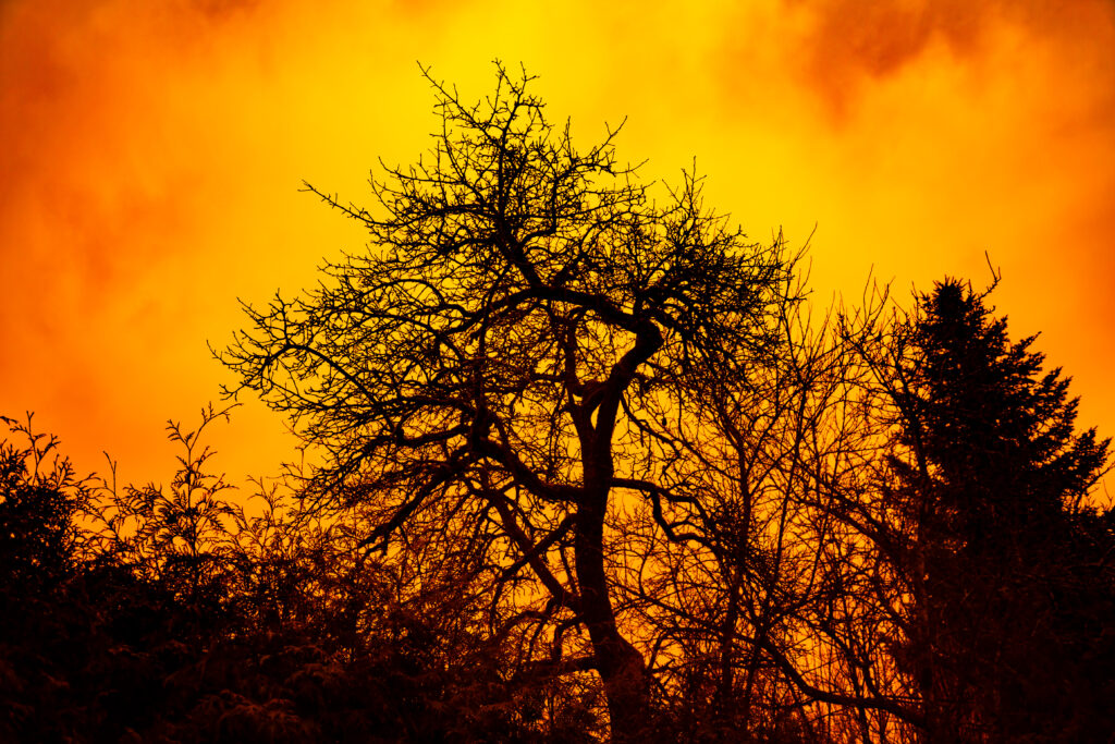
Saharan Dust in Europe appeared in the second week of March 2022. This is not an unusual weather pattern in spring. This year, however, there was a very high concentration of Saharan Dust in the atmosphere. It was even labelled a “dust bomb”. It led to an unparalleled otherworldly if not apocalyptic scenery in many places around Europe. The phenomenon was accompanied by rain in some places. This rain is called blood rain, due to the reddish colour. The blood rain was a bad omen in former times. The blood rain was a harbinger of the Black Death in Middle Ages or war and other apocalyptic events. The term blood rain is associated also with other phenomenas in nature due to bacteria or other where rain is red coloured.

The Saharan Dust in March was not only impressing because of the yellow-orange tinted skies but because of the vast dimension. The dust came from Marokko, entered Spain, reached Germany and was seen in UK too.

A map provided by French Meteorologist Guillaume Suchet shows the fast range of the saharan dust plume which reached even Norway and Sweden:

Saharian Dust Over The Alps

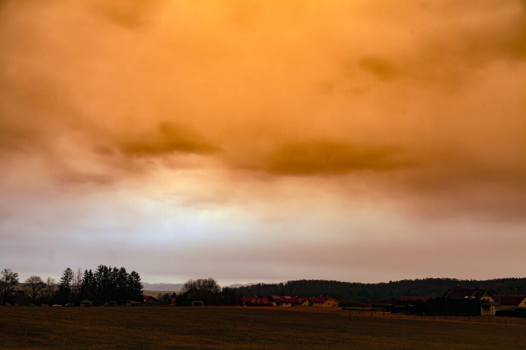
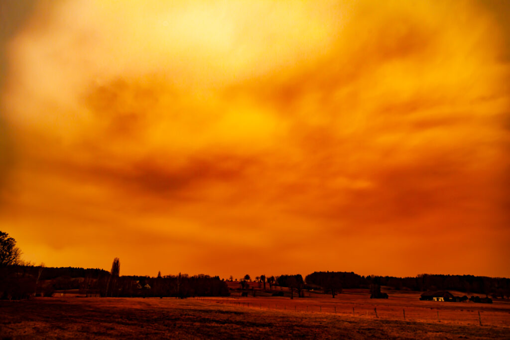
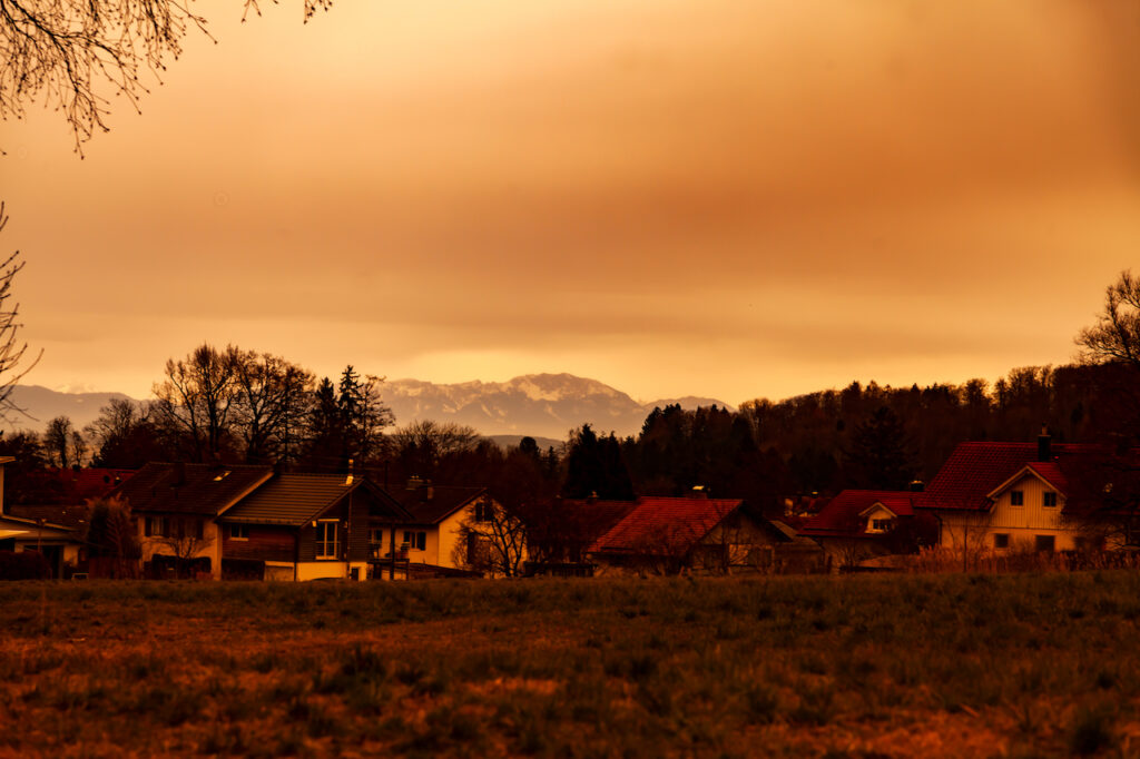
This is not very often. In Bavaria the phenomenon was extraordinarily intense in the afternoon of March 15. It created “Martian Skies” for hours. Around noon the sky was cloudy but colors were still normal. It was a milky grey sky. Later the day, in the early afternoon hours, the sky became intensely orange and red. The webcams on certain mountains showed that the orange sky was nearly everywhere. The sight remained good. There was no mist. But the clouds became thicker and thicker. Between 3.00pm and 5.00.pm it became really dark. It was necessary to turn on the lights inside. Such a darkness had never occurred before. It contributed much to the “apocalyptic mood” of the day. Later the sky returned slowly to “normal mood” again. There was some rain. Cars, roofs, everything was covered by a thick layer of reddish dust.

The camera looks to the south-east. At the horizon there is still less concentration of dust particles. The thick yellowish clouds were coming from the west.

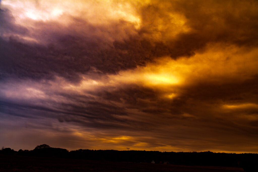
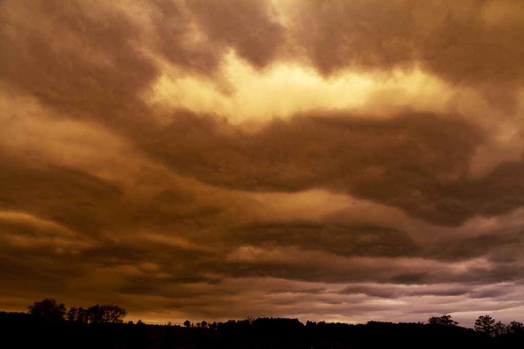
The pictures reveal even more unusual things which happened during this weather pattern. Colors weren’t changed here. The sky had indeed these reddish colors. Dust removal effect in photoshop however shows some unusual patterns inside this clouds. There is a detailed structure in the clouds which wasn’t so clear to the pure eye. There is nothing added or manipulated here. It seems like an unusual coincidence between saharan dust and a certain cloud weather pattern.

Rayleigh scattering phenomenon

There is another interesting phenomenon here. The saharan dust creates the so-called Rayleigh scattering phenomenon. Met Office meteorologist Dan Stroud explained the phenomenon: “The dust in the atmosphere causes the light to be more refracted, so you get the dominance of the red and orange tinges of the spectrum”. Rayleigh scattering is “the dispersion of electromagnetic radiation by particles that have a radius less than approximately 1/10 the wavelength of the radiation” The dust in the air originated from the storm Celia and swept as a plume over Europe.

Rayleigh scattering during saharan dust in the sky is very interesting from a photographic standpoint. It creates different lighting conditions as on a normal sunny or cloudy idea. It is more like a studio light, a diffuse light not so much a directed light. You see no shadows. In film and photography this soft light coming from different directions is often a desired effect. It’s also a effect used in the artificial sky atmosphere of the Unreal Engine software where the Rayleigh scattering can be “regulated”.

The Rayleigh scattering effect might be a reason why some people are having an uneasy feeling during such weather events. It has an apocalyptic feel because in natural conditions. It feels somehow “wrong”.

Rayleigh scattering is also present on normal weather conditions and is responsible for the blue sky on a normal day. However the effect is much different as during a saharan dust event. During the appearance of the saharan dust cloud there are many additional particles in the atmosphere.

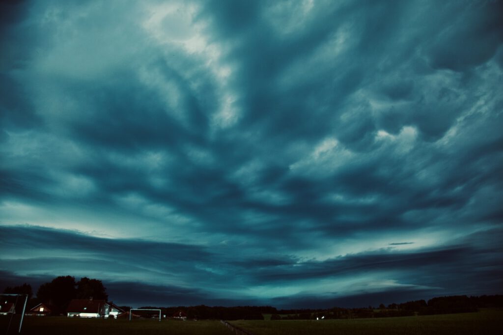
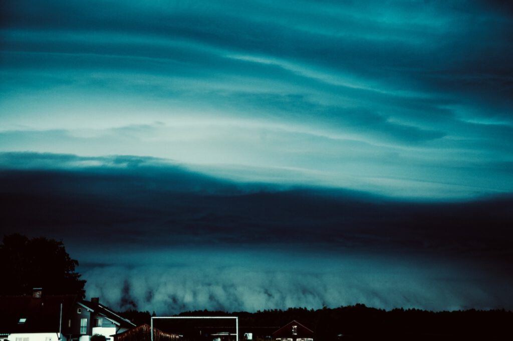
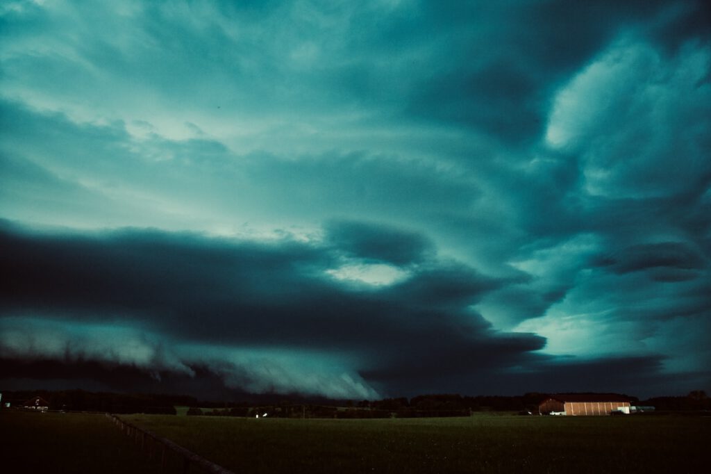
When the darker clouds arrived there were unparalleled cloud structures.

The air was not either cold nor war. Of course, the quality of the air was bad and that bad quality lasted long. After the saharan dust an unusual high pressure system begun to form over Northern Europe. That’s bad news since the continent urgently need more rain.

The moment when the thickest clouds were hanging in the sky. In the afternoon around 3.00.
An atmosphere like in a doomsday movie. Late afternoon March 15,2022.T
Intense orange color late afternoon of March 15, 2022. The Rayleigh scattering phenomena creating a diffuse unnatural light.

The lower part of the atmosphere was very clear all the time. Camera looks to the south west towards the Allgäuer Alpen in Southern Bavaria

Sunset And Foehn Effect


October 31, 2018 was a day with an unforgettable sunset in many places. On the eve of the Halloween night the sky was burning. Bright yellow and red colored clouds illuminated the sky. The extraordinary evening glow is a typical phenomenon in autumn.

In Upper Bavaria the foehn effect delivered the perfect conditions for the fire in the sky. The Northern side of the alps was very lucky since there were normal weather conditions during that evening in a year full of extremes. These extremes still continue. The foehn effect was generated by the torrential rainfall on the Southern side of the mountains. Subsequently, wet air was rising on one side and descending on the other side.

Shortly before sunset: The Sun illuminates the cloud layer


Before that Halloween evening there were also severe weather on the Northern side of the alps in Bavaria. There was an extreme windstorm which inter-cut railway connections in Upper Bavaria. Foehn windstorms can be dangerous particular on the mountain tops and some valleys.

Typical Foehn sky: a very clear view of the mountains


During the day the weather had calmed down and there were these impressing cloud patterns in the sky. The good thing was that the clouds got stopped and had not moved too much to the south. Therefore the sun appeared shortly before sunset.

These conditions happen often in autumn and also around New Year in Bavaria. This is always a good time to take pictures.

Intense orange and yellow colors in the west


The hilltops in Upper Bavaria are a good place to watch the foehn effect. The sky is very clear and there are a lot of details visible of the alpine silhuette in the South. However, days are already short and it gets pretty fast very dark.

Unlike some so-called-weather-rules the evening glow doesn’t necessarily indicate a change of weather. The next days were calm on the Northern side of the Alps.

nature as an artist: shortly after sunset


Severe weather continues in many parts of Europe. Particularly in Italy a disastrous situation due to thunderstorms and torrential rain developed. In some higher areas there was a lot of snowfall. Tourists were trapped for some time.

October 2018 was another month in Germany where the weather-anomaly continued. It is still too dry and too warm. Sunshine was above average. A new term was coined in Germany: October-Summer.

Get pictures from stormypicture.de at Adobe Stock: https://petengelmann.myportfolio.com/

The dramatic “Halloween Sky”

April Weather

April weather has a certain reputation. It is often non-predictable. The German term “Aprilwetter” means usually a rapid change between sunshine and rain. It means a day with a lot of showers and sunshine. But April weather is also about extremes: It happens a lot that winter returns with snow and frost as last year (2017). In some years there is also a first heat wave. I remember years when people in Berlin went swimming in the lakes in April.

Such a little heat wave has happened currently in Middle Europe. However, it seems that this year “April Weather” is a candidate for new extremes: We just heard about many new temperature records in Germany (Jena 29,7 Celsius on Thursday, April 19).

But why is April weather so special? There are a couple of factors involved: In April it gets warmer but there is a difference between the landmass and the sea. The sea is still very cold. Furthermore, the Northern regions are still very cold. At the same time, it is already very warm in the South (Southern Europe, North-Africa).

Typical “April weather” happens when cold air from the Northern Atlantic and the Northern Sea reaches middle Europe and has become more an more humid. Now – over land – the air is getting warm and rises. The condensed water vaporizes and is turned into shower clouds. The whole mass of air is not stable. Since it is still very cold in the upper levels of the atmosphere there is sleet, hail, snow, and rain.

The effect is completed when cold air descends and creates larger areas of clear air between the shower clouds. This way the typical “April Weather” effect is created: a mix of showers and moments of sunshine.

“April Weather” is a normal weather phenomenon, which is a powerful demonstration of the struggle between winter and summer. Some people suffer not only because you could easily get a cold but this weather pattern also triggers headaches.

It can be also a challenge for farmers: for example, the late return of winter in 2017 led to crop failures due to frost. Fruit trees are particularly vulnerable and late frost can seriously damage them.


For photographers this weather pattern is a great opportunity: it is maybe the best time of the year to capture rainbows. Furthermore, the dark shower clouds create impressing and dramatic sceneries in the sky especially in the late afternoon, early evening or in the morning.

The pictures are taken around lake Ammersee in Upper Bavaria on April 1, 2018. During a boat trip, the weather changed between intense sunshine and a lot of rain.

Weather forecasters announced an end of the significant heatwave after the weekend, April 21-22. Then we will most probably see thunderstorms and possibly severe weather. Due to the increased risk of forest fires rain is welcomed.

A better way to learn Photoshop, Lightroom, and Photography.

Panoramic Viewpoint: Hilltop Near Wessobrunn, Upper Bavaria

In Upper Bavaria, you can find an endless number of panoramic viewpoints. Thus the choice might appear a bit arbitrary. There will be certainly more places to be portrayed in the future but recently I discovered a viewpoint I particularly liked because of the extraordinary setting. There is a village nearby, meadows and woods and there is a free sight of the whole chain of mountains in the south.

It is easily accessible because it is close to the famous Wessobrunn monastery, where there is also a parking space, approximately one kilometre from the viewpoint which is basically a small road and a hilltop leading towards Diessen am Ammersee.

I discovered this viewpoint when I did part of the “King Ludwig 2 Trail” between Diessen am Ammersee and Wessobrunn. The viewpoint is certainly the highlight of this section of the trail. It is possible to do this (not recommended if it gets too warm) but there is no restaurant or such thing between Diessen and Wessobrunn. Due to the length of this part, it might be most suitable for a bicycle tour.

Sunday, March 11, was the first really warm day (17 Celsius) after the period of the arctic cold (“Beast From The East”) in Southern Bavaria. This was mostly due to the Foehn-Effect, which happens often during the wintertime. Foehn leads to an unusual rise in the temperature. The air becomes very clear and there is a clear sight of the mountains with many details. This day, however, there was also a special phenomenon, the so-called “Föhnkante”. This is a distinct border between clouds and the clearer part of the sky. It appears when the Foehn-Effect starts to break down. Subsequently, the following days were much colder and more winter-like.

In March there is little green and if the sun is behind higher-clouds colour in the landscape isn’t much appealing. But this time of the year between winter and spring could be interesting to capture structures in photography. After some time where I played a bit around with the pictures, I decided to present it in black and white. Black and white is often an interesting option and could reveal much of the special atmosphere of a place. The trick is not just to switch to black and white but trying different things with the software. There are also very good black and white filters in the NIK-collection software.

The viewpoint can be reached easily: you can use the parking space at the “Tassiloweg” behind the monastery. From there a steep path leads to the “Schloßbergstr.” The “Schloßbergstraße” leads to a settlement called “Haid” but do not walk towards the settlement but straight. The street becomes a small single road (better not go by car there because it is really very narrow and there is no parking space). It is great for a walk. There is also a seat there near the viewpoint and its fantastic for a rest – and of course to take pictures.

/a>


The viewpoint is also not so far from the Hohen Peissenberg. Both places are very suitable for weather-photography. The place near Wessobrunn could be also of particular interest for sunsets or sunrise. It presents a very typical Upper Bavaria landscape setting.

KelbyOne. Learn Photography from the World's Best Instructors.
The most dominant mountain in the silhouette in the south is the Zugspitze. Seen from the viewpoint near Wessobrunn you have the Hohen Peissenberg with the big antenna in the foreground before the Zugspitze. It is good to choose a day like this one with the Foehn-Effect or come very early to capture the whole dimension of the view. The lower hills and the bigger mountains in the background add to the depth of the scenery.

The picture above is taken from the viewpoint and shows the whole Hohen Peissenberg. In the middle, there is a church. On the right side, there is a small tower, which is part of the weather station of Deutsche Wetterdienst. On the left side and also in the picture below is the big antenna.