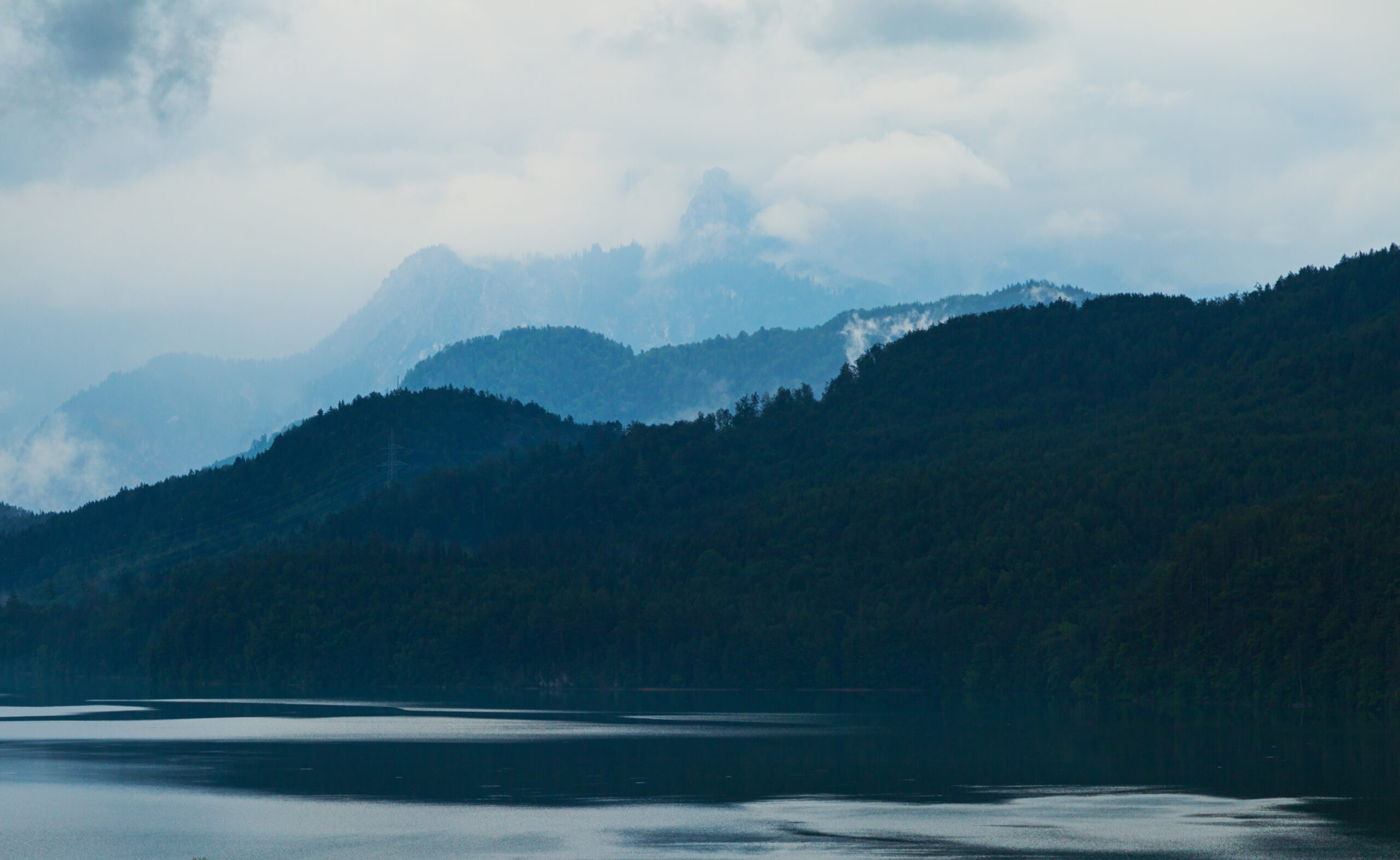
In Upper Bavaria weather changed Sunday, June 28. Along the Allgäu Mountains, intense rainfall began in the afternoon. Thunderstorms with hail occurred in the south-east of Bavaria. The hailstorm pilots near Chiemsee started four times theses days. Clouds and rain created a magical atmosphere around Weissensee not far from the famous Neuschwanstein castle.
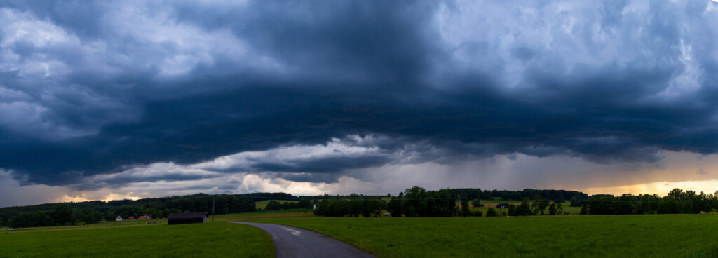
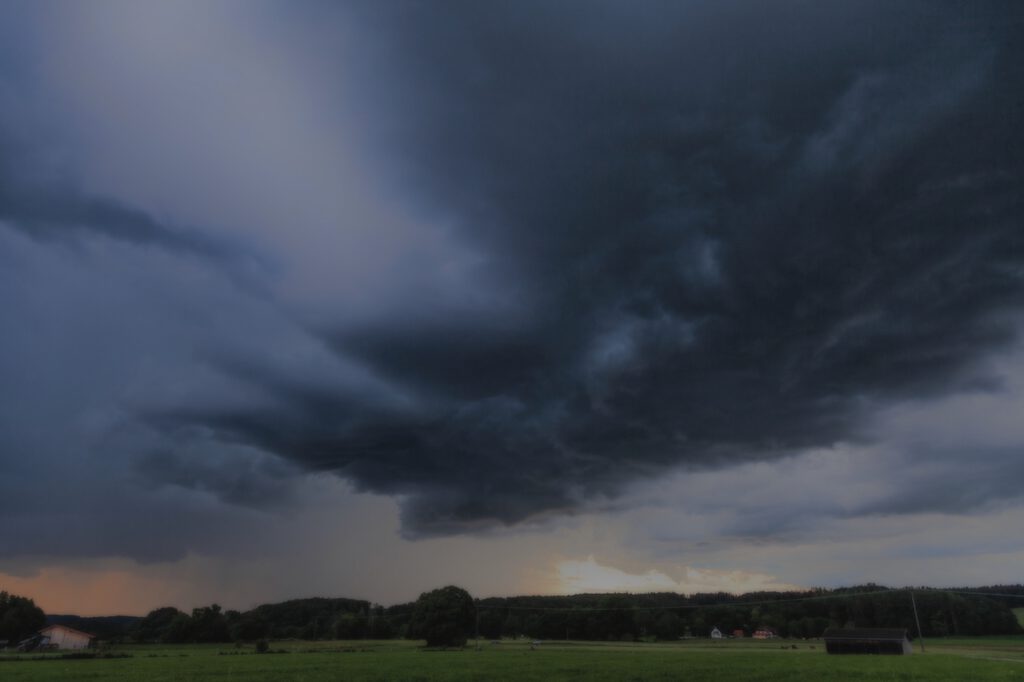
Three days later an impressing thunderstorm happened in the early evening hours in South-Bavaria. It was before sunset. Thus there were interesting effects with a colored sky. There were some intense local rainshowers and the weather lasted for more days.
On July 2 a supercell-storm devastated an area around Murnau, which is not far from Garmisch Partenkirchen. Witnesses reported that there was both hail and a flashflood rain at the same time. They could not remember a similar phenomenon happened before. Within 15 minutes streets were flooded and cows had to be rescued from a farm.
Later the week the weather calmed down. This kind of weather is very typical for the season in Bavaria. There is always a change between warm summer days and rain except the last years when a drought happened. Most of the severe storms in Germany happen in July. In 1984 an unparalleled hailstorm led to incredible destruction in Bavaria’s capital Munich.
Intense supercell-storms, hail and flash floods can, however, occur any time between May and September. In June 2019 a hailstorm led to a lot of destruction in the Northern-Ammersee region. In some years there were storms with flooding in May. Storms happen also in August, usually in September heavy thunderstorms are not so often because the days are getting shorter. There is less energy from the sunlight to generate these type of storms however there are weather patterns which could also lead to strong storms in October. In September 2017 lightning hit the Munich Octoberfest.
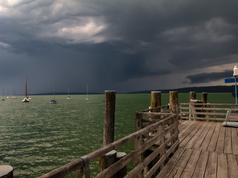
Thunderstorms with devastating hail happen more often in the south-east of Upper Bavaria rather than in the Allgäu. Usually, the storms develop over the hills and mountains in the West and move to the East. A squadron of Hailstorm pilots, “Hagelflieger” from Vogtareuth protects the area around lake Chiemsee efficiently and gather important scientific information.
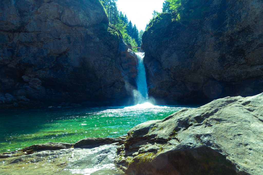
In the South-West of Bavaria is one of the most spectacular places of the Northern Alps located: The Buchenegger Wasserfälle with two huge turquoise pools of water and a strong waterfall of crystal clear water. It is really an impressing sight and an unforgettable experience.
The Buchenegger Waterfall is a wonderful motive for any photographer. Of course, on weekends during summer there are a lot of people around. This is because it’s not only something to watch but there is a five-meters deep pool where people can swim. Most of them, however, leave quickly since even in July and August the water is pretty cold. Furthermore, there are courageous young people who do a 30metre high jump from above the waterfall. It is a bit like Acapulco.
The Buchenegger Wasserfälle is part of an impressing canyon of the river Weissach. The Weissach river is coming from the Hochgrat-Mountain and cascades between two villages Buchenegg and Steibis. Further down the river reaches Oberstaufen, which is a famous and excellent tourist location. There are many hotels and attractions there. The landscape isn’t usually as dramatic as in other parts of the Bavarian Alps. Therefore the canyon of the Weissach and the Buchenegger Wasserfälle is an extreme contrast adding to an unforgettable experience.
Oberstaufen can be reached by train or by car. The trains commute frequently. Oberstaufen is located in the West of the Allgäu not far from Kempten and the Bodensee. It is also close to the Austrian border.
There are two paths leading to the Buchenegger Wasserfälle. One path begins near the parking-space in Buchenegg (a very narrow mountain road is leading there and it is crowded on some days – thus it is not recommended particularly for drivers who are not experienced to drive in mountain areas. Better use the parking spots in Steibis on the other side). There is another reason for this particularly for people who are not experienced hikers. The path is in very good shape but it is very steep. If you are afraid of heights or don’t feel safe walking in such rocky areas use the path coming from Steibis. This is much shorter and is most of the time an easy walk.
You can also use the bus from Oberstaufen to Steibis. The path begins near the stop “Berggaststätte Hirsch”. Before the path enters the canyon, there are two lovely farmed alps. One of them is the Alm Neugreuth, the other is the Alpe Neugschwend. These are very good places to rest and grab some tasty food before hiking down the canyon.
> Entering the canyon is deeply impressing from the first moment. It is not only the white waters, the cliffs and the waterfall: There is a primaeval forest growing inside the canyon with a huge variety of trees and plants. This adds to the scenery and offers much more attractive motives.
The best time for catching the fantastic atmosphere is during summer even there are a lot of people around. The morning hours are a convenient time to do pictures because it isn’t so much crowded early in the day.
There are a few things to keep in mind when you want to do pictures of the waterfall and the pool: Your camera will often pointing southwards. Thus, in the middle of the day there is backlighting and strong contrast. Furthermore if you get closer to the waterfall or the wind gets stronger there is a misty spray of the waterfall. It happens easily that there are tiny droplets on the lens. Therefore it is good to always check the camera and clean the lens. Of course be careful because the terrain can be slippery.
May 2019 was the first month in Middle Europe for a long time which wasn’t too hot. There were some rainy days. It seemed that weather might turn in a more “normal” mode compared to 2018. This was before June. In the larger Munich area people experienced a freak hail storm on Whit Monday. There was also severe weather in other parts of Germany in the first half of June. Later the month, large parts of Europe suffered from one of the most extreme heatwaves ever recorded.
Aftermath of severe Hailstorm in Munich region
Thunderstorms and severe weather didn’t came unexpected on pentecost. Weather models showed a highly likelyhood for thunderstorms in the Alps and the Upper Bavaria region. However the events on June 10 proved again how tricky severe weather developments can be and how difficult it is to set precicely the right weather alert in motion.
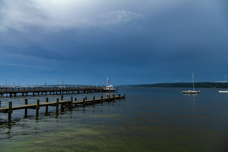
Sunday, June 9, was more or less a qiet day. It was getting warmer in Upper Bavaria and other regions. There were already weather warnings issued. On Monday, June 10, the alert system of the huge lake Ammersee south-west of Munich was activated in the morning hours, but then it was quiet for most of the day. A lot of tourists enjoyed the holiday in Germany. People were swimming and sailing. Weather forecasters and and the lifeguard service were still expecting something to happen.
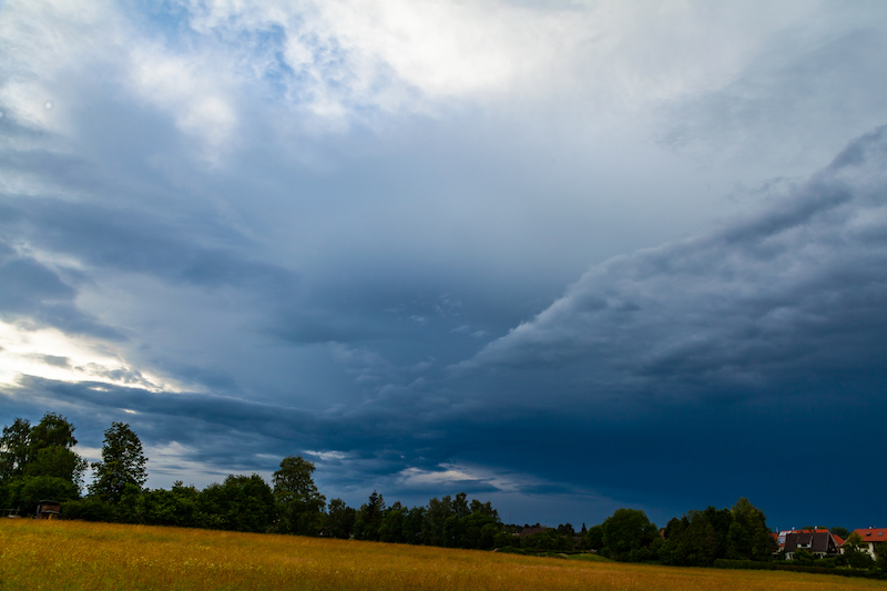
The weather radar showed signals getting stronger in the Allgäu and the Upland before the Alps around Kempten after noon. Here an incredibly strong cell was building up. When I checked the radar a couple of times in the early afternoon however, I couldn’t figure out which path that storm would take. I also didn’t figured out how fast this monsterstorm would move eastwards, so I was also surprised when it suddenly became really dark on this summer afternoon.
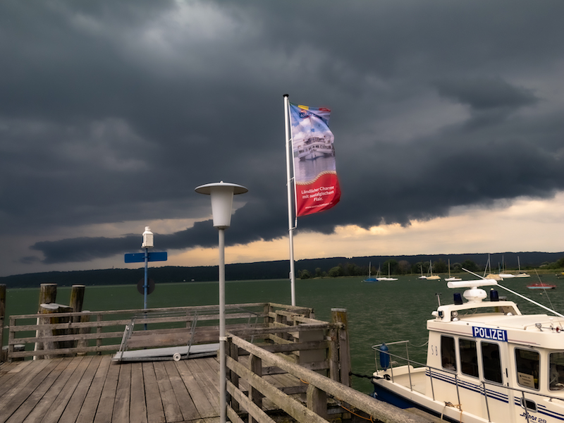
It was around 16.23pm when the orange alarm lights at the Bavarian lakes were activated again. There were still a lot of sailors out there. At one lake the lifeguard service warned people who were still swimming in the “Wörthsee” and closed the shore. 50 minutes later all hell brake loose on lake Ammersee. The Starnberger Merkur Newspaper later published a very interesting coverage.
Alex Beck, a sailor, told later the Merkur-reporters that the storm-cell was “racing”. Very soon the lifeguard service had to solve hands full over the next hours.
The same applied to firestarters and police: The thunderstorm left a path of destruction beginning in the Allgäu, hit several communities around the North side of the lake Ammersee region and also hit the west and the north of the Munich area.
Hailstorms in Upper Bavaria are not unusual. There is particularly a history for severe weather in May and around Pentecoste. What’s so unusual was the path, which was hard to predict. Big hail is often more seen in the South-East were there is even a special cloudseeding flyer unit for this problem. I didn’t find any report from a professional weather researcher, but I am sure this was a strong super-cell. Super-cells are more likely to take unusual paths.
The intensity was the other unusual fact. I experienced also strong wind gusts and smaller hail but 10 km to the north it was raining hailstones with the size of tennis balls.
Within minutes roofs very destroyed, nameless cars damaged, a motorway tunnel was set under water, greenhouses were completely destroyed and also a grocery store. It ended up in estimated damage cost of 30 Mio. Euros.
The same time people on the lake Ammersee were struggling for their lives. A couple hung on their capsized sailing boat, others were stranded and another sailor couple were only safed by their “persenning”, a cover, from the hail bombardement. They had reached a buoy but couldn’t leave their ship. Then they had to wait out the storm. At this time they experienced waves like never before according the their account in the “Starnberger Merkur” newspaper.
The following weeks people began to recover from the hailstorm, settling insurance matters and repairing windows, cars and houses. There were more thunderstorms but nothing like the cell on June 10. However another extreme weather situation was already throwing a shadow.
Weather models predicted an enormorous heatwave for the second half of June. Weather services were astonished by themselves about the numbers. And the models were mostly right. Germany saw new temperature records but not the 40 degrees Celsius. Nevertheless, there were set many new records. It didn’t took long and the bushfires, which were a problem in May started, again.
France saw the worst with some over 40 degree Celsius records. The authorities had to issue a state of emergency in some areas. Particularly Southern France was affected.
The situation calmed by the end of month. On July 1, 2019, a cold front with thunderstorms reached Southern Germany. There are still wildfires raging. The heatwave is only part of a problem which has the potential to become the real big threat for the near future: In wide parts of Germany there is still a drought. The government published recently a study about the effects of a drought lasting several years.