MAGIC ATMOSPHERE ABOVE THE CLOUDS: HIGH-FOG IN THE ALPS
Ideas for landscape photography in the colder season
Autumn is just around the corner. This means the days are getting shorter. The colours change. In some regions like the Alps there is more often high fog, a weather pattern where hills and peaks sometimes are above the clouds.
Fog is interesting for photographers in many ways. It adds mood and atmosphere to the pictures. Fog is useful in landscape pictures to add structure. Of course if the fog is very strong and there is nothing but a white wall it is an obstacle.
Misty days occur mostly in autumn, spring and winter. The change of temperature and moisture creates fog. There are a lot of interesting phenomena connected with fog. Sometimes it is a thin veil above a meadow. On other occasions there are thick layers of fog and the fog lasts the whole days. Sometime the fog is moving, sometimes not. In time-lapse videos the movement of fog is somehow similar to water. The shrouds of mists “float” along mountain peaks.
Since misty air is colder the fog can “fall” like a water-fall for example when fog floats over a ridge into a valley. Fog begins to form often before sunset and lasts in the morning hours. When the sun shines the mist often disappears during the day. However in river valleys like the Danube valley the mist can last much longer. It is often significantly colder in these day.
Fog is more often in regions with wetter soil like bog or wet meadows. It happens in summer too. Shrouds of mist appear after hail showers or after thunderstorms too. In July the first mornings with fog are early harbingers of the changing season. As the days become shorter and the nights getting colder misty mornings happen more often.
Its often hard to say if the fog lifts or disappears during the day. There are many different weather conditions. Fog can be also dangerous when it suddenly forms and the visibility turns to near zero. Drivers are surprised and can’t see a thing. Since conditions on a foggy day can always change quickly it is good for drivers to slow down particularly on motorways and highways when a layer of fog appears.
If the weather is cold fog can lead to hoar frost. Ice crystals form and surround twigs and trees. This a particularly interesting phenomenon.
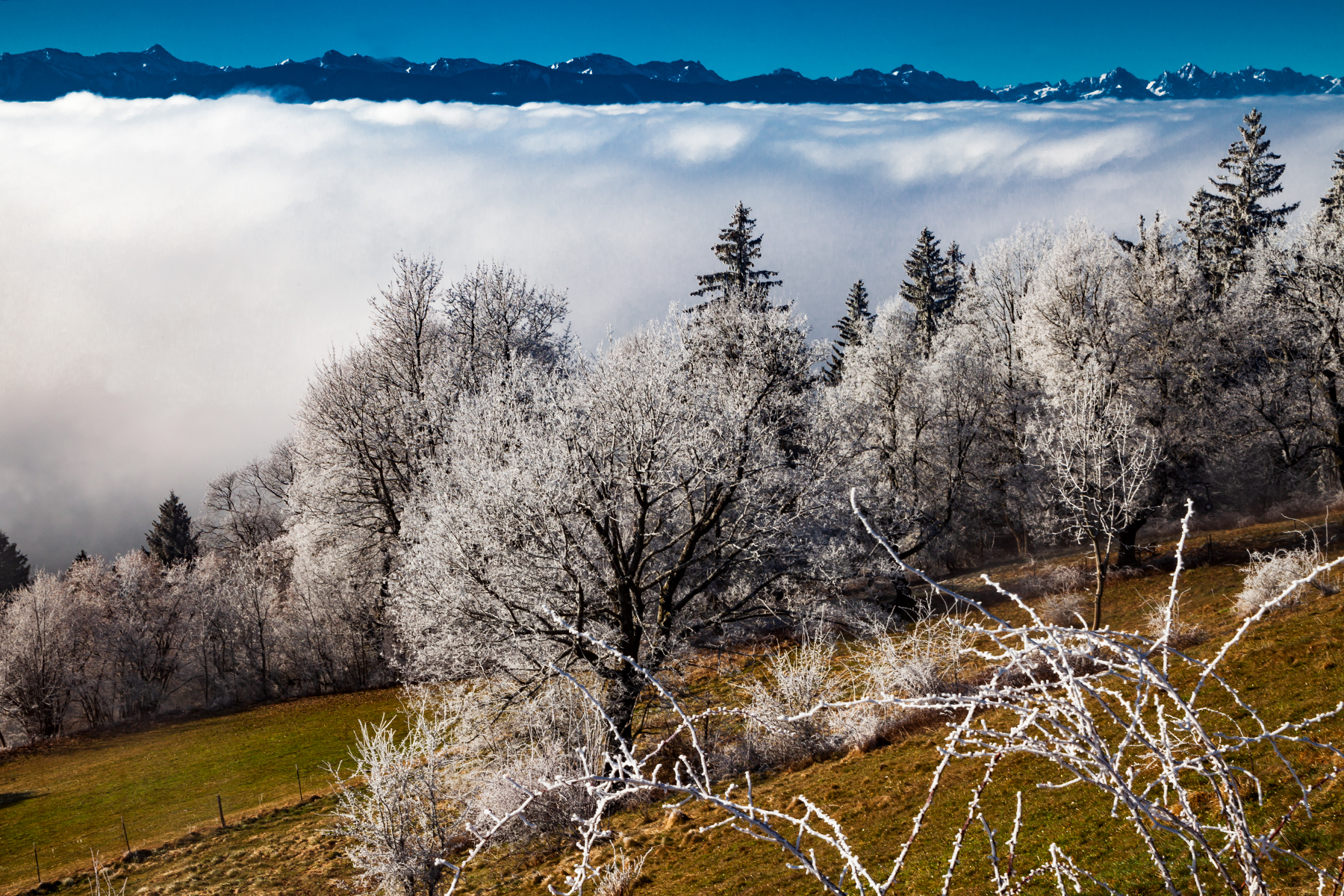
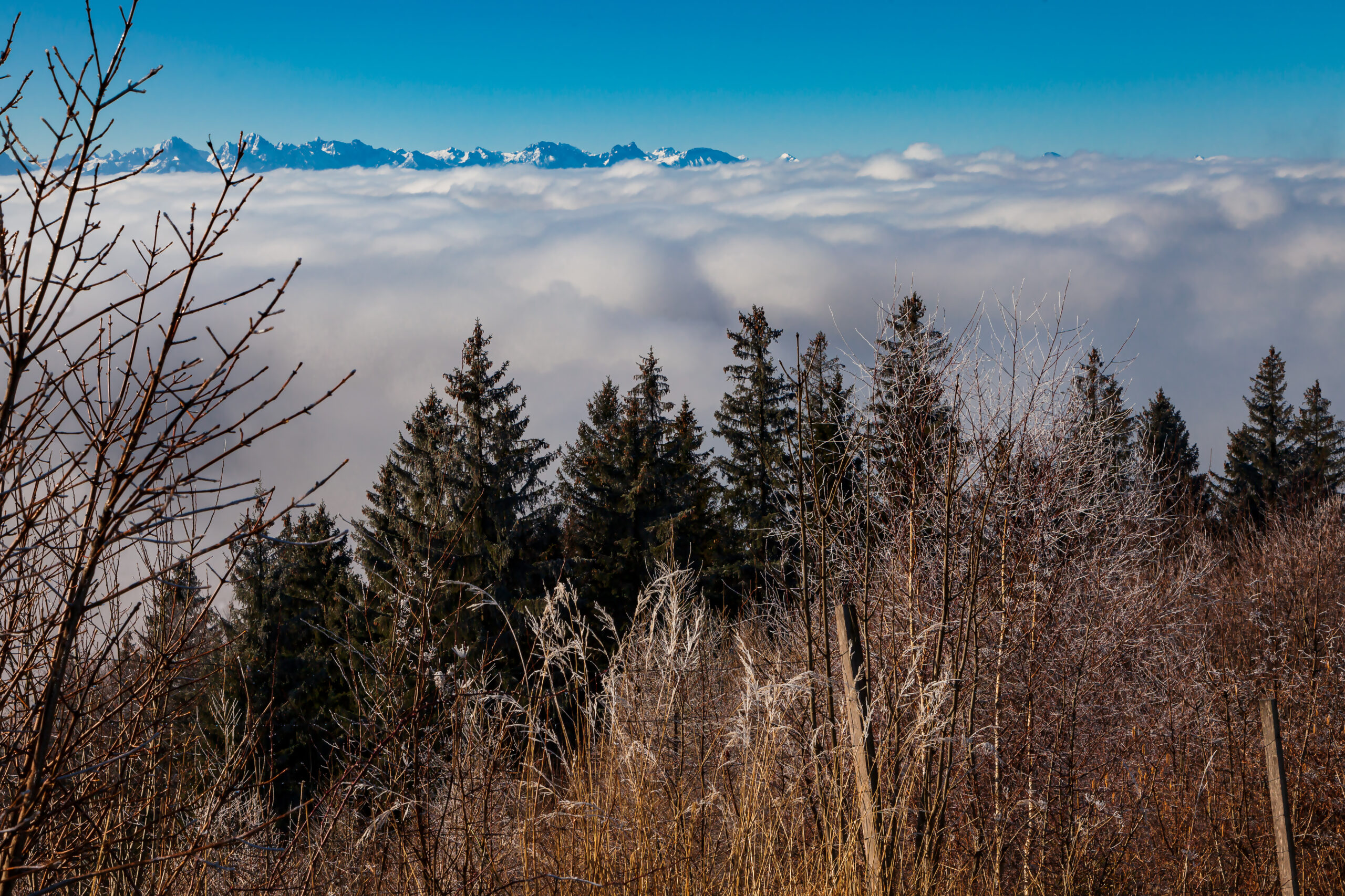
There is one form of fog which is great for photographers if they are in a regions with hills or mountains. Mostly in autumn there are days with high fog. This happens when a thermal inversion occurs. This means you have low ground temperatures and a layer of higher temperatures above that prevent the convection currents. These convection currents usually mix in the atmosphere. You can think of a thermal inversion like a saucepan lid. It keeps the colder moist air layer with fog from rising. This happens a lot in basins and during periods of high pressure weather when there is not much wind.
The video below was taken in the morning of February 28, 2021 with a Canon 5d Mark2. The time-lapse shows the movement of the shrouds of mist above the hillside between the Hohen Peissenberg and the peaks of the Bavarian mountains. There is a quick change in visibility and a change in lighting condition. For video it is good to go into manual mode and fix aperture before shooting.
At the border between the layer of cold air and the warm air on top the cold air layer there are very interesting effects which are useful for pictures and videos. The challenge is to predict where that border is: Where does the blue sky break through the thick layer of mist? And when does it happen? Actually this is a lot of try and error.
Knowing some good places is “money in the bank”. You might want to get to a hill or mountain which is easily accessible and high enough that you can get above the cold air layer with mist. In Germany, Bavaria the Hohen Peissenberg with its famous old weather observatory is a good spot. Mostly because there is a road to the top of this mountain. The top of the Hohen Peissenberg has an elevation of 987 metres. However on some days the layer of mist will be above your heads and you need to find a higher mountain.
The pictures were taken on a spring day in 2021. That day there was a typical thermal inversion. In the morning the Hohen Peissenberg mountain was in the middle of a thick layer of high fog. But in the following hours the sun broke through and there was a very interesting scenery with fast changing moods and impressions.
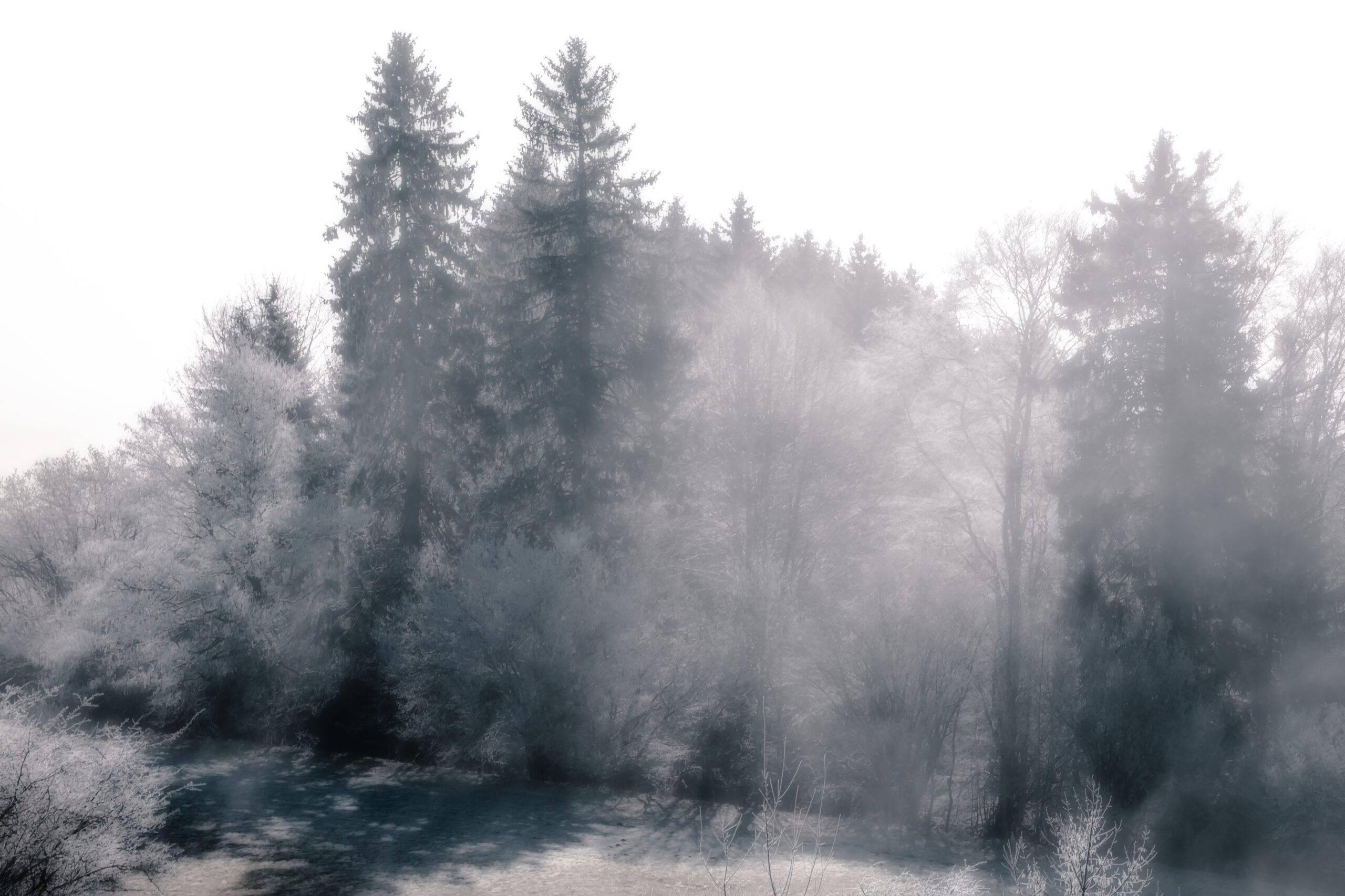
The wilderness near the top of the Hohenpeissenberg Mountain. The fog creates an otherworldly atmosphere.

")
")
")


")
