THE JAPANESE GARDEN IN AUGSBURG, BAVARIA
The Japanese Garden is a dream in every time of the year. In autumn, the colors are an unparalleled firework of yellow and red. You don’t need to go to Japan to enjoy the fascination of a Japanese garden and the many motives it has to offer.
In Augsburg, Bavaria, not far from the city center is one of the most impressive and representative Japanese Gardens in Europe. Japanese landscape architect Yoshikuni Araki designed the Garden of Friendship. He created an outstanding experience with a unique setting where trees, plants, boulders, and water are in a special combination.
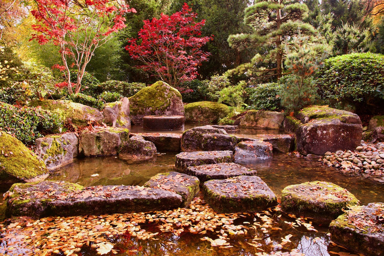
Water is a central element of the Japanese garden. The garden architects made use of Augsburg’s special landscape where water plays a pivotal role. There are two rivers, Lech and Wertach, and a huge number of channels in and around Augsburg, which previously helped the city to become an important industrial center. The channels, the water management system, and the industrial installations are UNESCO WORLD HERITAGE.
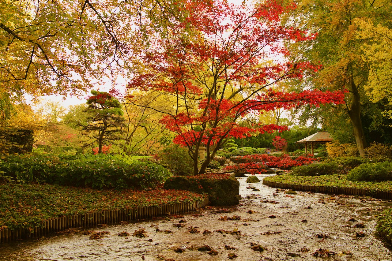
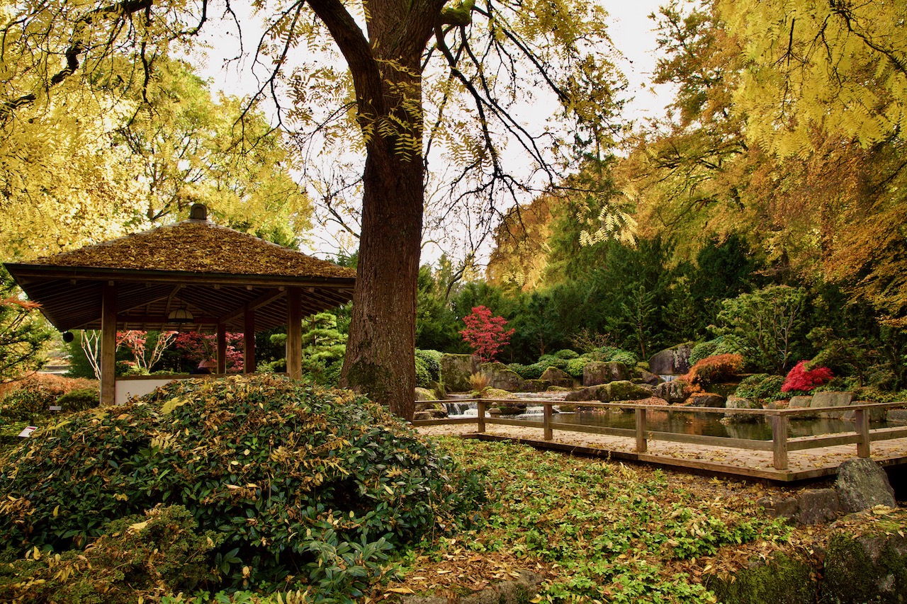
One of the many streams runs through the Botanical Garden and the embedded Japanese Garden in Augsburg. On one side, the water cascades over boulders and disappears under a bridge on the northern side of the Japanese garden.
The Japanese garden was built as a present for the 2000th anniversary of Augsburg in 1985. It presents also the friendship with partner cities Amagasaki and Nagahama. The friendship was initiated by Magokichi Yamaoka, president of Yanmar. There is also a Japanese memorial in the Wittelsbacher Park in Augsburg. Yamaoka intended to honor German Rudolf Diesel.
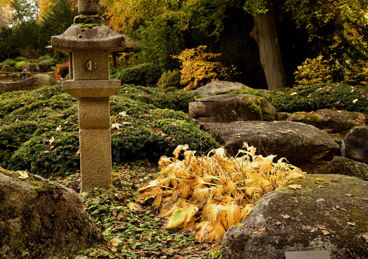
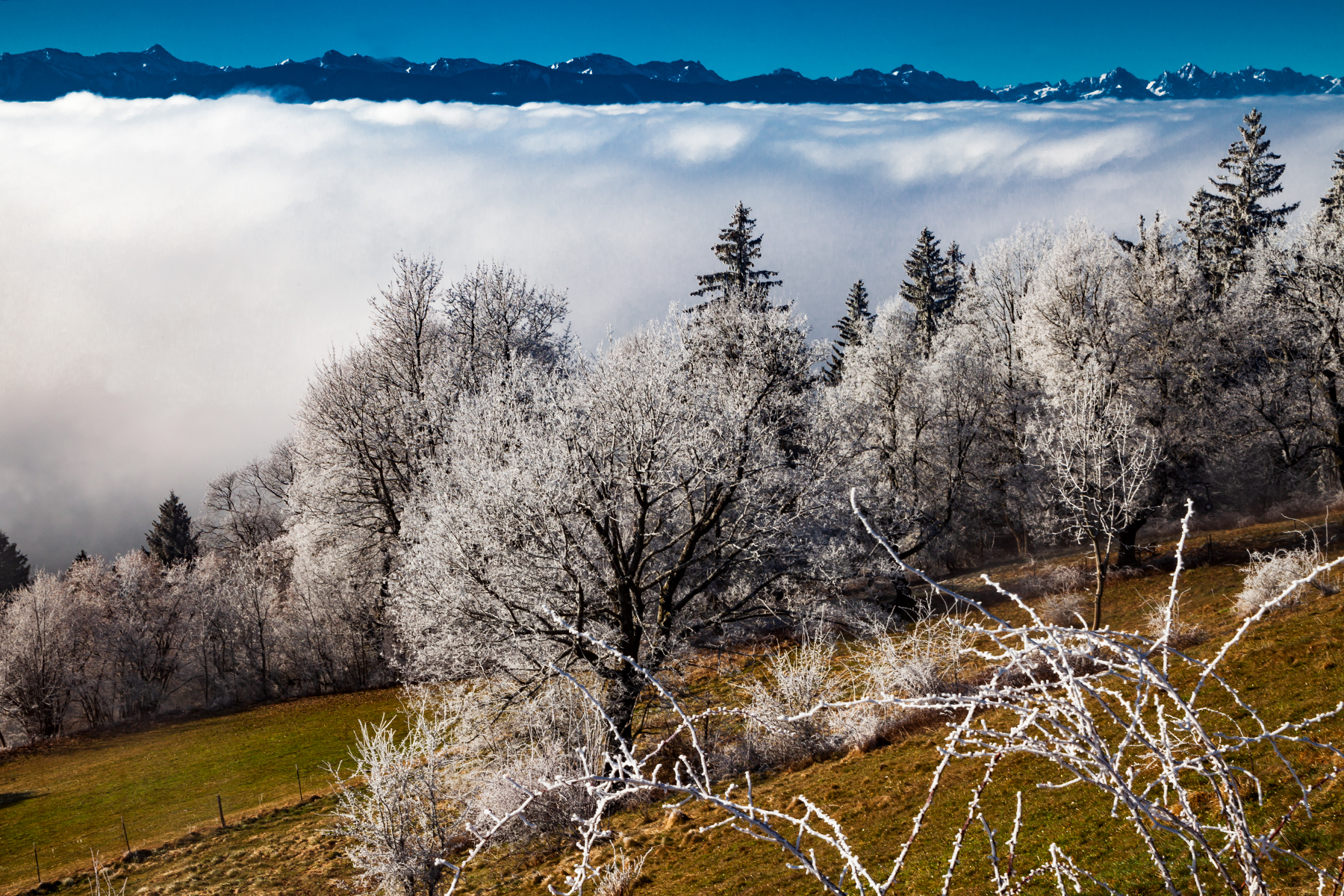
Augsburg’s Japanese Garden presents the Japanese Art Of Gardening at its best. These gardens are works of art. They present a landscape and have a spiritual quality. There are two entries to the garden and you can explore new angles that show different perspectives for hours. Uneven curved paths are a typical element and they lead you to the most interesting points. The center of the Japanese Garden is a lake (Euchi). It symbolizes the sea. Typical stone lanterns (Ishidoro) are placed at significant points. An open building (Pavillion) resembles a temple and is a great place to rest there. Tons of boulders were transported from the Fichtelgebirge, a mountain range in Northern Bavaria, to Augsburg. Inspiration for the garden came from Kyoto.
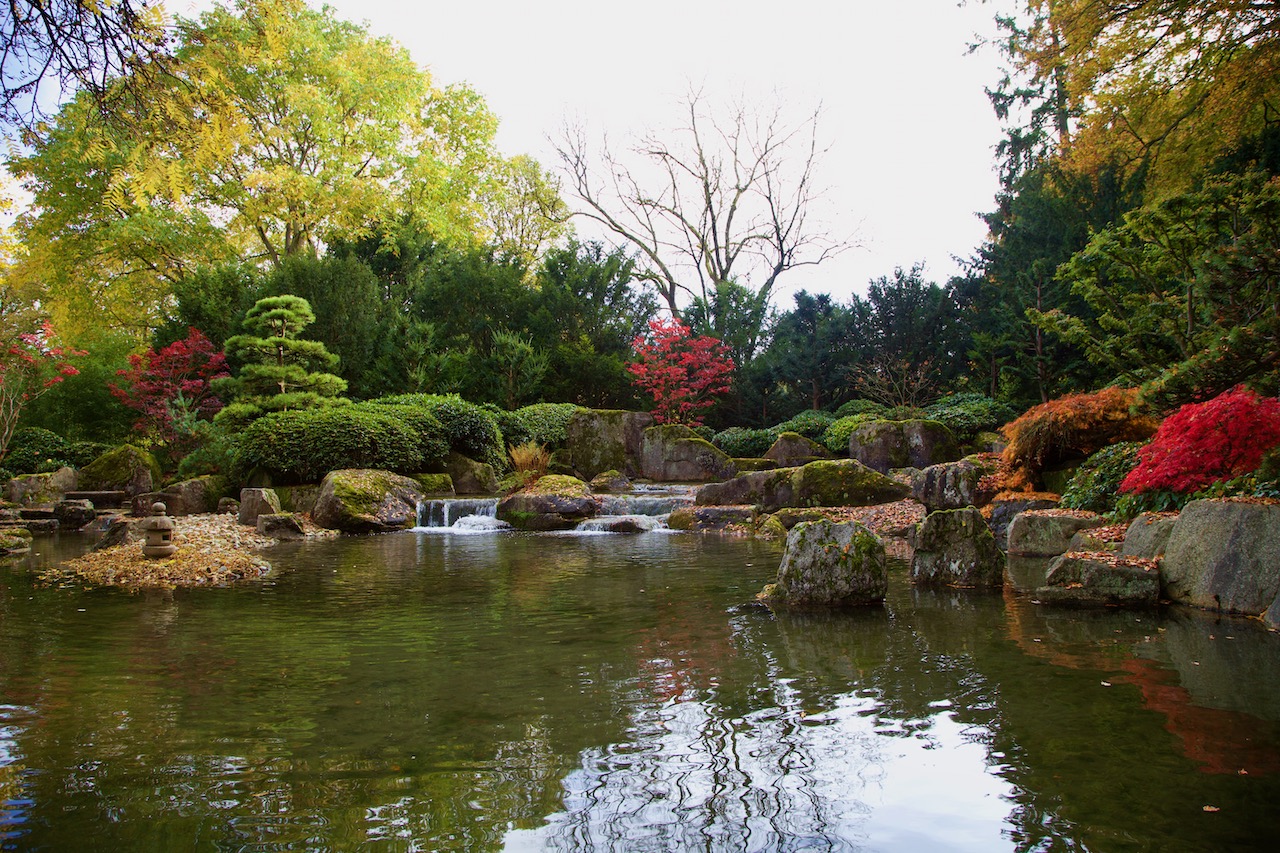
The waterfall and the boulders create the impression of a mountain landscape:
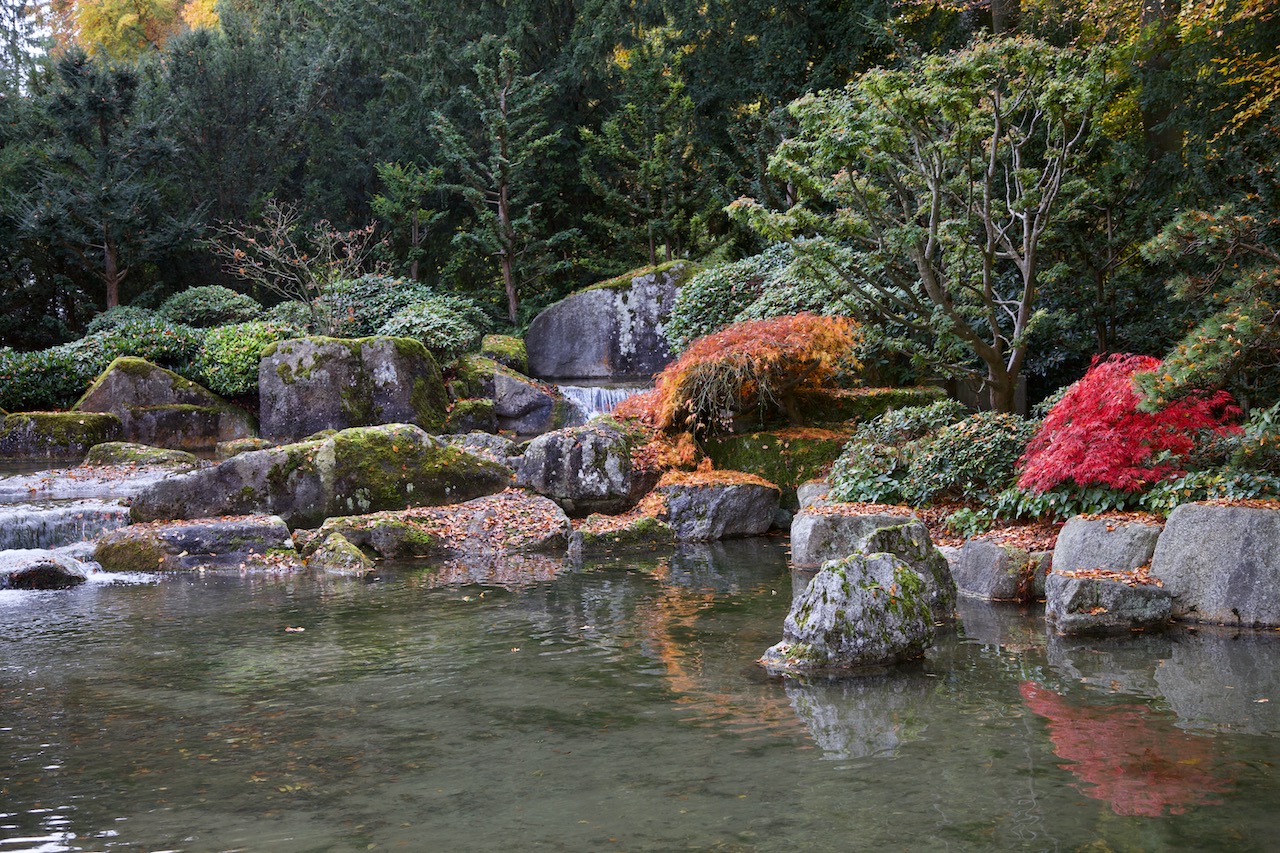
A magical place: Boulders with lichen and moss, a thick canopy, and water cascading over stones.
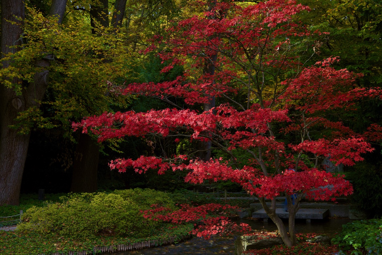
Trees and perennials play an important role in the Japanese garden. The typical cherry trees there and many other sorts of plants are typical for Japan. Due to the different climates, there are some compromises.
The Japanese Garden is an attractive place throughout the year. Highlights are festivities in spring and of course the interesting colors in autumn. Green, Yellow, and intense red are dominant colors. There are many opportunities for photographers here. On weekends there are many visitors in the garden. A good time is certainly shortly after the botanical garden opens.
More info is available at www.augsburg.de/botanischergarten
The Japanese garden inside the Botanischer Garten is easily accessible for a little entry fee. There is a huge parking space around and, you can get there by Bus 32 from Augsburg Hauptbahnhof. The Botanical Garden is surrounded on one side by the Siebentisch-Wald, which is a huge landscape park and forest.


 /a>
/a>


