Majestic Mountains And An Enchanted Forest – The Schwarzwasser Valley, Austria

by Peter Engelmann, July 28. 2022

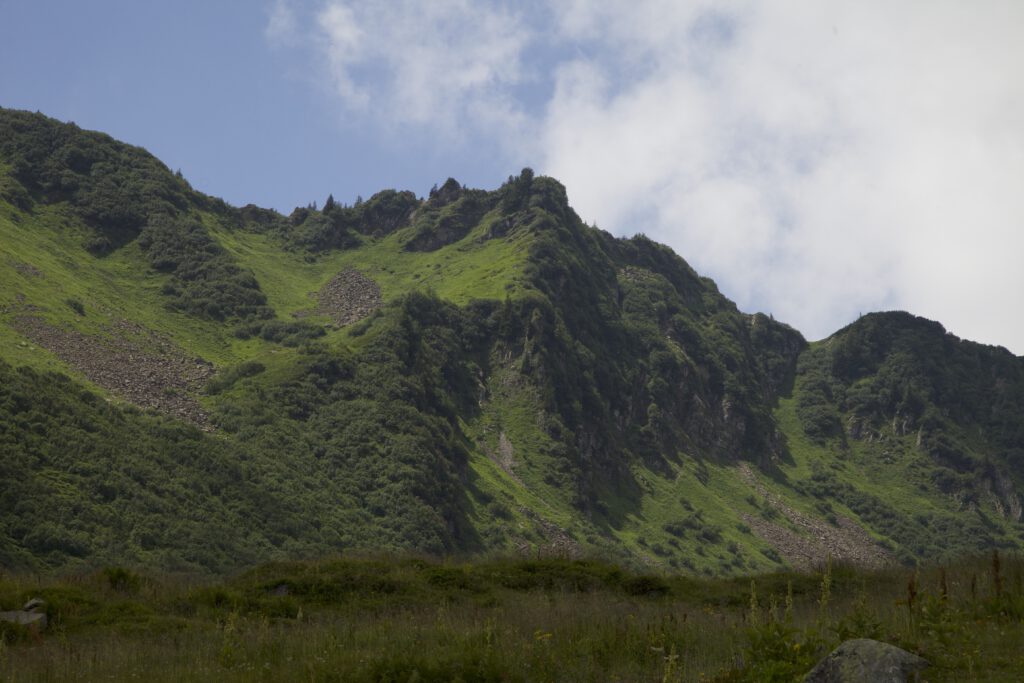
The famous Kleinwalsertal is a popular tourist destination in winter and summer. It belongs to the province of Vorarlberg. The Kleinwalsertal belongs to Austria, but you get only there from Germany. It is an Austrian enclave. The name Walser refers to history: First Settlement came from the South, from Switzerland. The valley with many scenic places begins near Oberstdorf. The main villages in the high mountain area are Mittelberg, Hirscheeg and Riezlern. At the end of the head of the valley is Baad. From the Kleinwalsertal, many trails lead into beautiful and spectacular high valleys with mountain pastures. One of them is the Schwarzwasser Valley. This fantastic valley offers many excellent motives for photographers and videographers. It’s a must-see for anybody interested in nature due to its outstanding geological formations and rich flora. There is a peat bog on the way to the Melköde Alm.

Wilderness Around The Ifen

A good starting point for a trip into the Scharzwasser Valley is the parking spot near the Ifen ropeway and the Auenhütte. A mountain road connects the bottom station of the Ifenbahn, Hirschegg and Riezlern. There is an excellent public transportation system in Kleinwalsertal. Buses come often, and there is a bus connection to Oberstdorf in Germany. A good alternative if you don’t want to use the car. The trail starts at the end of the parking space on the left side of the station. It leads to a lake. That lake is a reservoir for the snow-making facilities in winter. This lake shimmers in magical green and blue colours.

Near the trail between the lake and the mountain pasture Melköde (where you can eat and drink during the summer) lies a mountain forest. It’s an impressive pristine mountain forest on the left side of the trail. In some places, massive rocks look like ancient relics. Even though it is very comfortable to walk there – and of course, there are often many hikers here – it is a feeling of entering the wilderness.

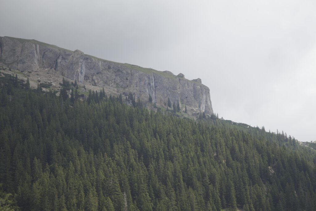
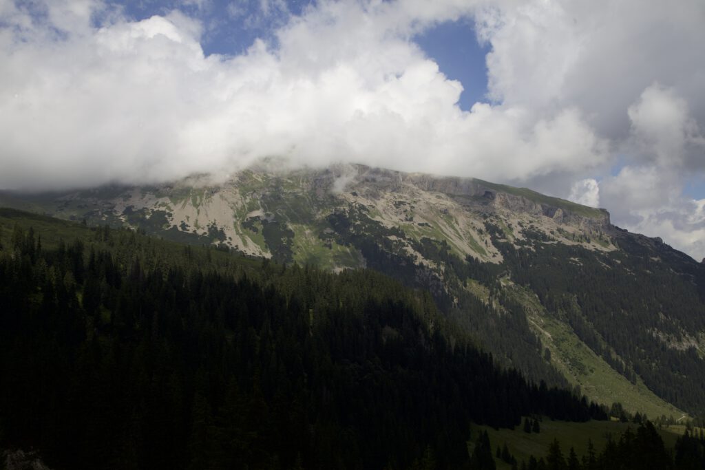
The intimidating Hoher Ifen is towering above the valley. This mountain is another great sight and a very interesting geological phenomenon. The mountain is more than 2200 metres high. The rough table-mountain form is quite unusual for the alps. It is a spectacular sight with its wild and unruly rock face. It is easy to imagine that our ancestors might have seen it as a holy mountain or a ritual place. It is an option to go there, when there is not a blue sky but some clouds and mist. When shrouds of mist climb up the mountains or clouds play around, the wild nature of the Ifen region comes even more to light.

Hoher Ifen Plateau

The Pastures

The trail slowly ascends. If you are interested in taking pictures of the mountain-forest, there are many motives along the trail. At one point, a small path to the left leads to a sort of column with an icon. It’s worth taking a minute and getting there. The column is on a little hill in the mountain overlooking a wild area with some further great sighs.

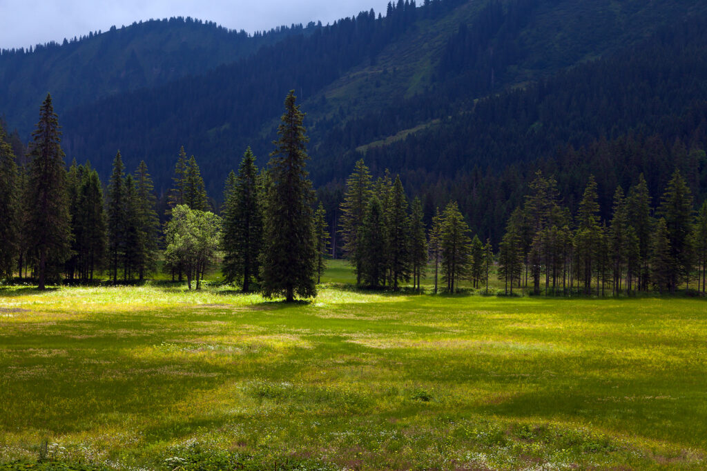
Some minutes later, back on the main hike the landscape opens up. If you come here on a day when the last rain clouds disappear and there is an interplay of sunlight and clouds this is like a scene from “The Lord Of The Rings”. The waterfall behind the pasture adds to the impression. These mountain pastures are unique since they belong partly to the peat bog. Cultivation and farming goes on on here for a very long time. The Melköde mountain farm goes back to 1566. It has a long history, and there were also catastrophic events. Avalanches destroyed buildings a couple of times. On one occasion, 20 people died. The wilderness is always close, and one must respect nature all the time.

Alpine Meadow Near Melköde, Schwarzwasser Valley, Kleinwalsertal

The pastures are on a plateau within the Schwarzwasser Valley at an altitude of 1350 metres above sea level. That allows special light conditions and intense colours. The meadows are great motives.

Hiking towards the Schwarzwasserhütte

After a stop at the Melköde farming house and inn, the trail enters a more steep terrain. It’s not difficult to go further, but it is now a different type of trail and demands some endurance. The trail is in excellent shape, and one can only praise the fantastic work of the people caring for this great path into the mountains. But keep in mind it’s alpine terrain and not any longer a driveway. There are some sections where attention is necessary. When it is raining, this trail is slippery.

The quality of this valley is also because of the climate and weather conditions. The temperature is moderate in summer. There is a lot of rain in the summer and snow in the winter. These are good conditions for unique vegetation with a variety of plants. It’s still a reservoir of many protected plants.

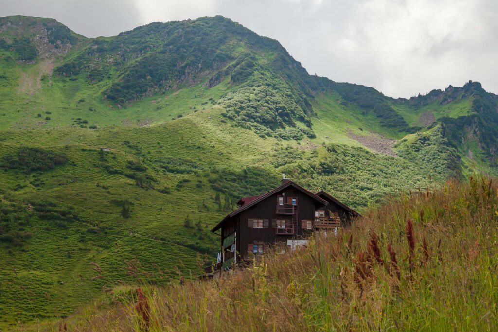
Schwarzwasserhütte, Alpine Lodge

The trail opens up again, and the rustically Schwarzwasserhütte comes into sight. That is a great place to take more pictures with fantastic views. On the left side, there are impressive grass mountains and on the other side, there is again the Ifen plateau. The Schwarzwasserhütte goes back to 1914. The German Alpenverein Sektion Schwaben runs this cosy alpine lodge. The Schwarzwasserhütte is a starting point for hikes toward the mountain peaks. Bear in mind that this is high alpine terrain and for trips to the Hoher Ifen sure-footedness is a must. But even a few metres from the alpine lodge, there are great opportunities to take pictures or videos. The alpine lodge is open in winter, too. There is accommodation too and a nice and competent team. Reservations are necessary.

But even if it is only a short stay there is enough time to take in that heavenly scenery. This is both a landscape of eternal beauty and the roughness of the wilderness.

Grassy Mountain

The Kleinwalsertal has a lot to offer. More spectacular destinations are the Breitenbachklamm on the German side and the Gottesackerplateau. This plateau, a geological formation is on the other side of the Hoher Ifen. Note: There is also a hike called “Schwarzwassertal” which leads down from the Auenhütte to Mittelberg in some guides. This is interesting too and is another gorge.

An Alpine Wilderness Easy Accessible For Landscape Photography – Oy Valley

by Peter Engelmann, April 30, 2022

The Oy valley or Oytal is a high alpine valley at the Southern tip of Germany. It is one of the most popular destinations among tourists and hikers staying in Oberstdorf. Trips into the Oytal start straight near the valley station of the Nebelhornbahn ropeway. From here a couple of trails lead towards the Oy valley. One trail leads to the pitoresque Trettach valley first (where the Oy valley begins at a fork) and to a first grand scenic view with the tops of the Allgäuer Alpen in the background. Another trail leads high up over the lower part of the valley and offers many vistas. The Oy valley is top destination also for filmmakers and photographers throughout the year.

Trettach Valley near Oberstdorf

What’s special here is that nobody has to leave the road or very comfortable trails to get to places for fantastic motives for video and photo. There is a road (closed for normal traffic) leading to the Oytalhaus, a traditional mountain inn with excellent food and more spectacular views. You reach this lovely mountain inn after 1 1/2 hours walk.

The trails from the Nebelhornbahn ropeway til the Oytalhaus are no problem for normal walkers and easy accessible. There are no steep climbs. It’s more a continuous ascend. The lower trail beginning at the bridge over the Trettach is called Dr. Hohenadl Weg. It leads through an impressing mountain forest.

After a few bends the high and intimidating high peaks of huge mountains show up. Then the trail reaches an alley with trees which is another unique feature in the Oy valley. During the season a lot of tourists use this road.

The valley broadens and on the left side the well-known Seebachwand comes into view. It is a huge intimidating rock-face. Here are some water falls and indeed there is one of the highest waterfalls in Europe here right across the Oytal Haus Mountain inn. If you want to takes pictures of the falls the best time is in spring when a lot of water comes down. The water falls in the lower part of the valley are in some distance. It’s good to have a long focal length. Both in spring and autumn you see wonderful colors in this unique mountain wilderness.

Impressive water falls, Seebachwand

The trail between the Oytalhaus mountain inn and some alpine farms leads to more and more impressive sights of the peaks and their unique shapes. Spring is again a good time as long as the mountain tops are white with snow from the last winter. To the left and to the right there are alpine meadows with rare alpine plants. Please be careful, because this a nature reserve and help to protect animals and these rare plants. There is really plenty to shoot for video and photography straight from the trail.

Oytal Valley

If you want to take pictures and need a quiet atmosphere during the week, for or after the main holiday seasons or on a day with cloudy weather conditions is a good time. During afternoon in summer tourists can rent special scooters for a fast journey back. And there can be a lot of people out there on weekends. There are also plenty of mountain bikers often. Nevertheless there is enough room for anybody to enjoy the fantastic nature.

The trail from the Trettach valley bridge and the Oytal Haus is only part of a much bigger network of trails which lead high up into the mountains. It is for some time still very comfortable (til the next alpine farm) but its lengthy and in the higher part there is a steep ascent. There are more alpine farms up there which offer food and drinks during the summer time. Another huge waterfall is further down the trail (Stuibenfall), which is closer to the trail then the first ones and it looks fantastic, but this is another one and a half hour walk from the Oytalhaus.

In some areas there is still snow in April

A typical thing for these regions are grassy mountains. They should never be underestimated by climbers because they can be very challenging. The region is due to its different type of mountains and the materials they are made of highly interesting for people who are into geology. You see outstanding forms of rock, mountains and different earth ages.

High grass mountain

Good preparation is key as always in alpine terrain. The Oy valley is easy accessible but its good to know about distances (walking times) and what are further options. During summer there is also an exhausting round trip possible with a descend into another mountain valley. However, these might be more for people with a good condition. Weather conditions could change quickly, too.

Sometimes, in spring, water runs in small creeks over the trail in the upper parts of the valley. There might be also snow even in late spring some years in shadowy parts of the valley (proper shoes for hiking strongly recommended). In summer the upper parts are exposed to the sun.

For the high part with mountain peaks and more attractions like the Eissee high above the valley please keep in mind that there are completely different conditions as in the bottom of the valley with comfortable roads and trails. It’s difficult rocky and alpine terrain. It requires experience with hiking in the mountains and it’s a fascinating but also potentially dangerous wilderness region. Tourist offices in Oberstdorf and other towns and villages in the Allgäu-Region can certainly help with good advice. They can tell you also if trails are open or closed or if moutain huts are open. The Oytal trails are accessible by train and by car. There is a huge parking slot near the Nebelhornbahn ropeway station. But it’s great to use the train and the buses, which run frequently.

SAHARAN DUST IN EUROPE, MARCH 2022

From Peter Engelmann, March 19, 2022

Saharan Dust in Europe appeared in the second week of March 2022. This is not an unusual weather pattern in spring. This year, however, there was a very high concentration of Saharan Dust in the atmosphere. It was even labelled a “dust bomb”. It led to an unparalleled otherworldly if not apocalyptic scenery in many places around Europe. The phenomenon was accompanied by rain in some places. This rain is called blood rain, due to the reddish colour. The blood rain was a bad omen in former times. The blood rain was a harbinger of the Black Death in Middle Ages or war and other apocalyptic events. The term blood rain is associated also with other phenomenas in nature due to bacteria or other where rain is red coloured.

The Saharan Dust in March was not only impressing because of the yellow-orange tinted skies but because of the vast dimension. The dust came from Marokko, entered Spain, reached Germany and was seen in UK too.

A map provided by French Meteorologist Guillaume Suchet shows the fast range of the saharan dust plume which reached even Norway and Sweden:

Saharian Dust Over The Alps

This is not very often. In Bavaria the phenomenon was extraordinarily intense in the afternoon of March 15. It created “Martian Skies” for hours. Around noon the sky was cloudy but colors were still normal. It was a milky grey sky. Later the day, in the early afternoon hours, the sky became intensely orange and red. The webcams on certain mountains showed that the orange sky was nearly everywhere. The sight remained good. There was no mist. But the clouds became thicker and thicker. Between 3.00pm and 5.00.pm it became really dark. It was necessary to turn on the lights inside. Such a darkness had never occurred before. It contributed much to the “apocalyptic mood” of the day. Later the sky returned slowly to “normal mood” again. There was some rain. Cars, roofs, everything was covered by a thick layer of reddish dust.

The camera looks to the south-east. At the horizon there is still less concentration of dust particles. The thick yellowish clouds were coming from the west.

The pictures reveal even more unusual things which happened during this weather pattern. Colors weren’t changed here. The sky had indeed these reddish colors. Dust removal effect in photoshop however shows some unusual patterns inside this clouds. There is a detailed structure in the clouds which wasn’t so clear to the pure eye. There is nothing added or manipulated here. It seems like an unusual coincidence between saharan dust and a certain cloud weather pattern.

Rayleigh scattering phenomenon

There is another interesting phenomenon here. The saharan dust creates the so-called Rayleigh scattering phenomenon. Met Office meteorologist Dan Stroud explained the phenomenon: “The dust in the atmosphere causes the light to be more refracted, so you get the dominance of the red and orange tinges of the spectrum”. Rayleigh scattering is “the dispersion of electromagnetic radiation by particles that have a radius less than approximately 1/10 the wavelength of the radiation” The dust in the air originated from the storm Celia and swept as a plume over Europe.

Rayleigh scattering during saharan dust in the sky is very interesting from a photographic standpoint. It creates different lighting conditions as on a normal sunny or cloudy idea. It is more like a studio light, a diffuse light not so much a directed light. You see no shadows. In film and photography this soft light coming from different directions is often a desired effect. It’s also a effect used in the artificial sky atmosphere of the Unreal Engine software where the Rayleigh scattering can be “regulated”.

The Rayleigh scattering effect might be a reason why some people are having an uneasy feeling during such weather events. It has an apocalyptic feel because in natural conditions. It feels somehow “wrong”.

Rayleigh scattering is also present on normal weather conditions and is responsible for the blue sky on a normal day. However the effect is much different as during a saharan dust event. During the appearance of the saharan dust cloud there are many additional particles in the atmosphere.

When the darker clouds arrived there were unparalleled cloud structures.

The air was not either cold nor war. Of course, the quality of the air was bad and that bad quality lasted long. After the saharan dust an unusual high pressure system begun to form over Northern Europe. That’s bad news since the continent urgently need more rain.

The moment when the thickest clouds were hanging in the sky. In the afternoon around 3.00.
An atmosphere like in a doomsday movie. Late afternoon March 15,2022.T
Intense orange color late afternoon of March 15, 2022. The Rayleigh scattering phenomena creating a diffuse unnatural light.

The lower part of the atmosphere was very clear all the time. Camera looks to the south west towards the Allgäuer Alpen in Southern Bavaria

A miracle of Nature: Pink Sandstone in the Northern Vosges

Bizarrely shaped sandstone cliffs illuminated by the sun in pink and orange: This is something which you usually expect in the US in national parks in Arizona or Colorado. However, in the middle of Europe located on the Franco-German border, there is a unique landscape with low mountain range forests, rivers, 100 castles and impressive sandstone cliffs. A landscape which was formed by wind and weather and 200 million years old: The UNESCO Biosphere Reserve Palatinate Forest (Pfälzerwald) and Northern Vosges.

weathered sandstone, chateau du Falkenstein

The Northern Vosges area is located west of the Rhine in northeastern France. It is not the same as the Vosges mountains or the Haute Vosges. It is the foothills just north of them in Alsace. The regional nature park of the Northern Vosges exists since 1976. It is an extraordinary region with an incredible variety of wildlife. 65% of the area is covered by forest.

A big attraction is the castles which are often located on view-points. These are hills where you have an impressing look and here you often find this intense red-brown coloured sandstone in the French Vosges. It is a mid-grained and pebble bound sandstone which was also important for many buildings as chateaus and cathedrals. The material was formed by wind and weather. The interesting thing is that it looks always different depending on the sun and the conditions of light. It makes a great motive for any photographer. It is also of great interest for anybody interested in geology and history of the Earth. The park was winner 2009 of the Eden competition.

Chateau du Falkenstein: Medieval heritage and a great viewpoint

The chateau du Falkenstein is a great location: It is a ruined castle on top of a hill in the commune of Philippsborg in the Mosélle department. After a walk of 20 minutes from the parking spot, there is great view, the ruins of a once huge medieval castle and very impressing sandstone formations.

The sandstone was indeed part of the castle: The builders carved some caves and rooms in the sandstone rock. The castle was built in 1127 and destroyed in the Thirty Year’s War. However, there is still a lot to see there.

A room carved in the sandstone riff


In the Northern Vosges, there is also a place they call “Little Colorado”: This is the Altschloßfelsen in Poppeviller in the Pays de Bitche, a long sandstone Riff. The German pendant of the Northern Vosges is the “Dahner Felsenland” in the Rhineland Palatinate. Tourists visiting France and this region can get information in the “Maison du Parc” in Little Pierre, a cosy village with an impressing chateau. Tourism is important here: Both the communities and other institutions like the Club Vosgien did a lot of work to inform and guide interested visitors:

Train stops are in Sarrebourg and Saverne (TGV Paris-Strasbourg). Important centres are Bitche and Sarreguemines. The Northern Vosges area is also not far from Saarbrücken. The area is great for hiking and offers long-distance trails. It is also a popular region for cycling.

The climate is semi-continental with dry and hot summers and cold winters with a lot of snow. Like many other areas, the region suffered from the heatwaves and drought 2018 and 2019.