Orografische Wolken und ein atemberaubender Aussichtspunkt oberhalb von Garmisch-Partenkirchen in Oberbayern

Peter Engelmann, Dezember 2024

Der weltbekannte Olympiaort Garmisch-Partenkirchen ist berühmt für Deutschlands höchsten Berg, die Zugspitze, für atemberaubende Schluchten und für die spektakuläre Landschaft, in die er eingebettet ist: das Werdenfelser Land.

Aber auch einzigartige Wetterphänomene prägen die Region. Ähnlich wie das Matterhorn ist die Zugspitze ein Ort, an dem bestimmte stationäre orografische Wolken wie Bannerwolken und Linsenwolken (Stratocumulus lenticularis oder Altocumulus lenticularis) zu sehen sind. Diese sogenannten orografischen Wolken sind für Fotografen von besonderem Interesse, da sie der Landschaftsfotografie eine einzigartige und magische Atmosphäre verleihen. Der Begriff „orografisch“ bedeutet, dass sie mit dem Relief der Landschaft in Verbindung stehen.

Stratocumulus Lenticularis

Stratocumulus lenticularis (linsenförmige Stratocumulus) sehen manchmal wie Ufos aus und wurden tatsächlich mit ihnen verwechselt, aber es sind orografische Wolken, die oft mit dem Föhnphänomen in Verbindung gebracht werden (wenngleich Föhnwinde für ihre Entstehung nicht notwendig sind).
 
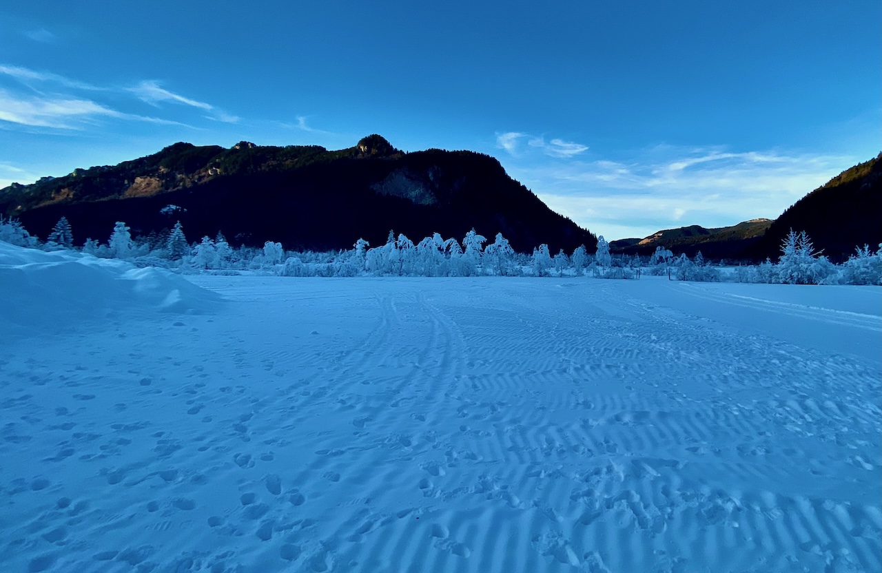
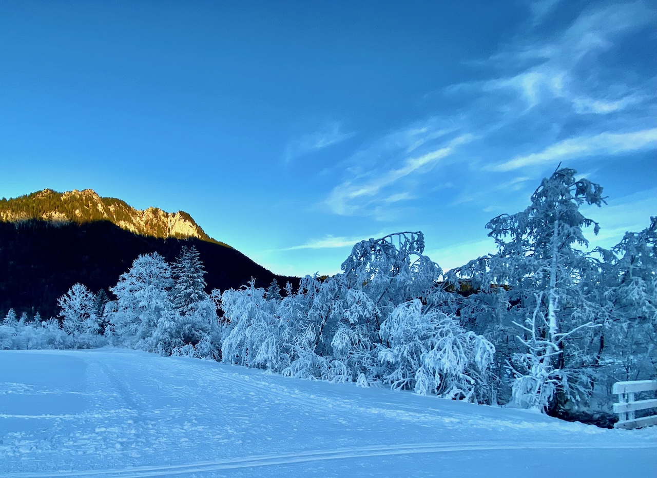
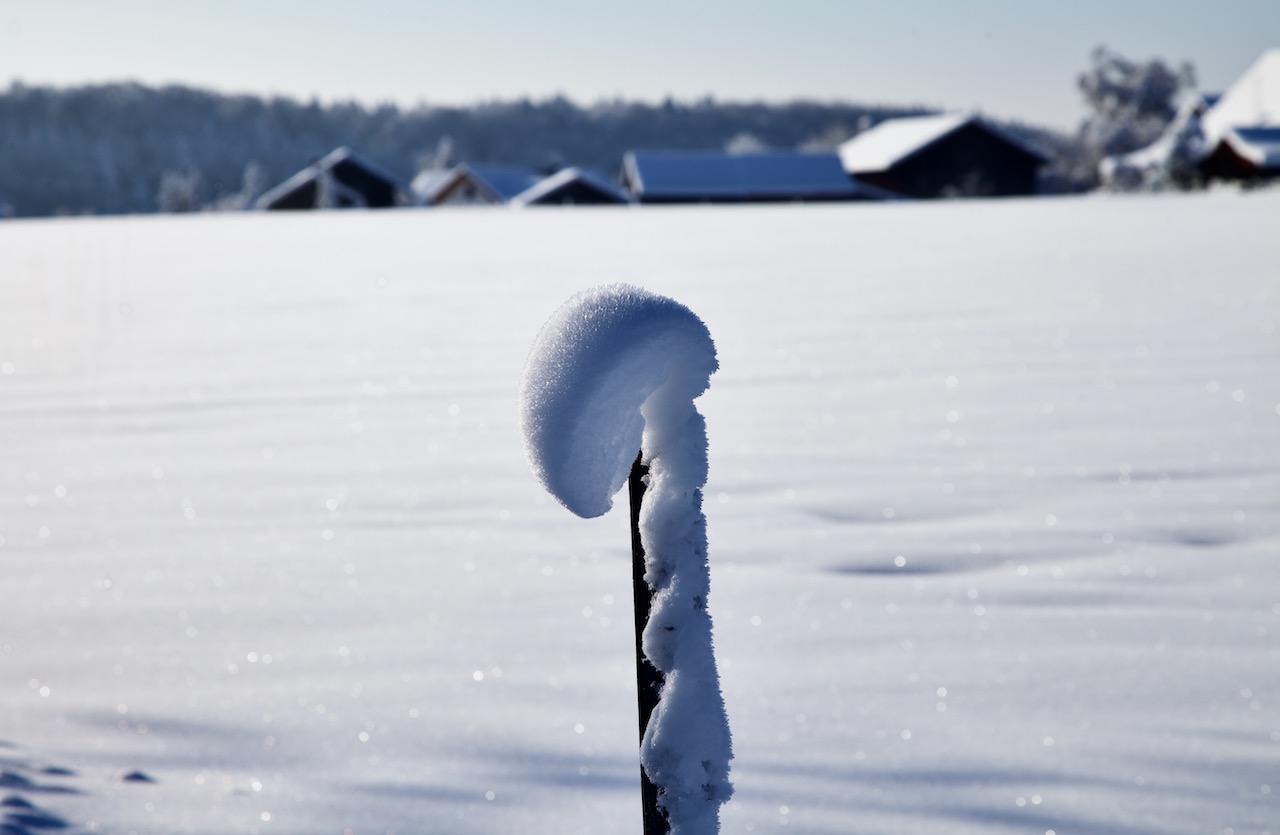
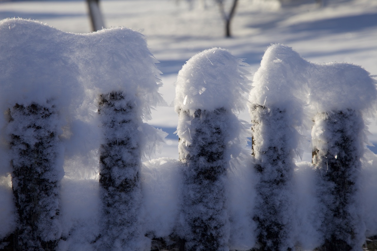
Im Dezember 2024, an einem fantastischen Wintertag, konnte man in der Nähe der Zugspitze diese Wolke beobachten, die wie ein Pfannkuchenstapel aussieht.

Aber was sind diese mysteriösen Wolken und wie entstehen sie?

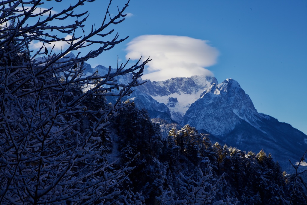
21. Dezember 2024: Eine Kappe auf der Zugspitze

Laut dem National Weather Service sind Altocumulus Lenticularis „mit Wellen in der Atmosphäre verbunden, die entstehen, wenn relativ stabile, sich schnell bewegende Luft nach oben und über eine topografische Barriere gepresst wird, die mehr oder weniger senkrecht zu der Richtung ausgerichtet ist, aus der der Wind der oberen Ebene weht. Durch diese Ablenkung entsteht eine Schwerkraftwelle in Windrichtung der topografischen Barriere, die einer Welle ähnelt, die man durch das Werfen eines Kieselsteins in einen Teich erzeugen kann. Wenn oberhalb der Bergkuppe genügend Feuchtigkeit vorhanden ist, bilden sich ACSL-Wolken innerhalb des Kammes dieser Bergwellen, wo die Luft aufsteigt. ACSL-Wolken entstehen und verflüchtigen sich ständig in der Nähe des Wellenkamms bzw. unmittelbar hinter dem Wellenkamm. Deshalb scheinen sie stationär zu bleiben (daher der Name), obwohl sich die Winde schnell (manchmal sehr schnell) durch die gesamte Wolke bewegen.

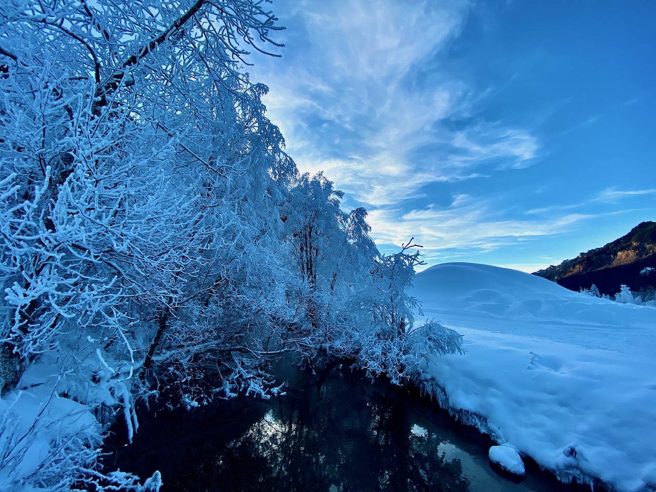
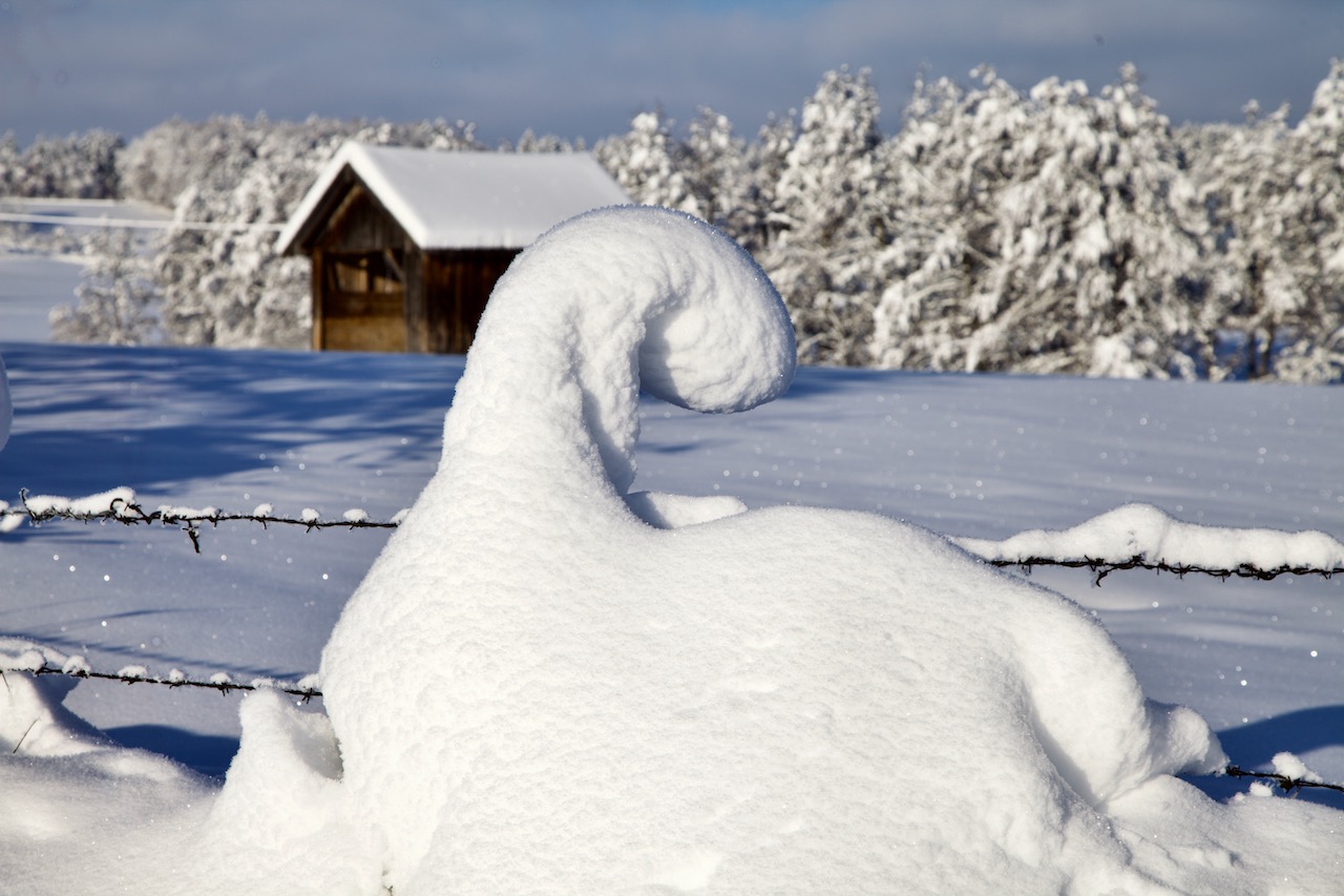
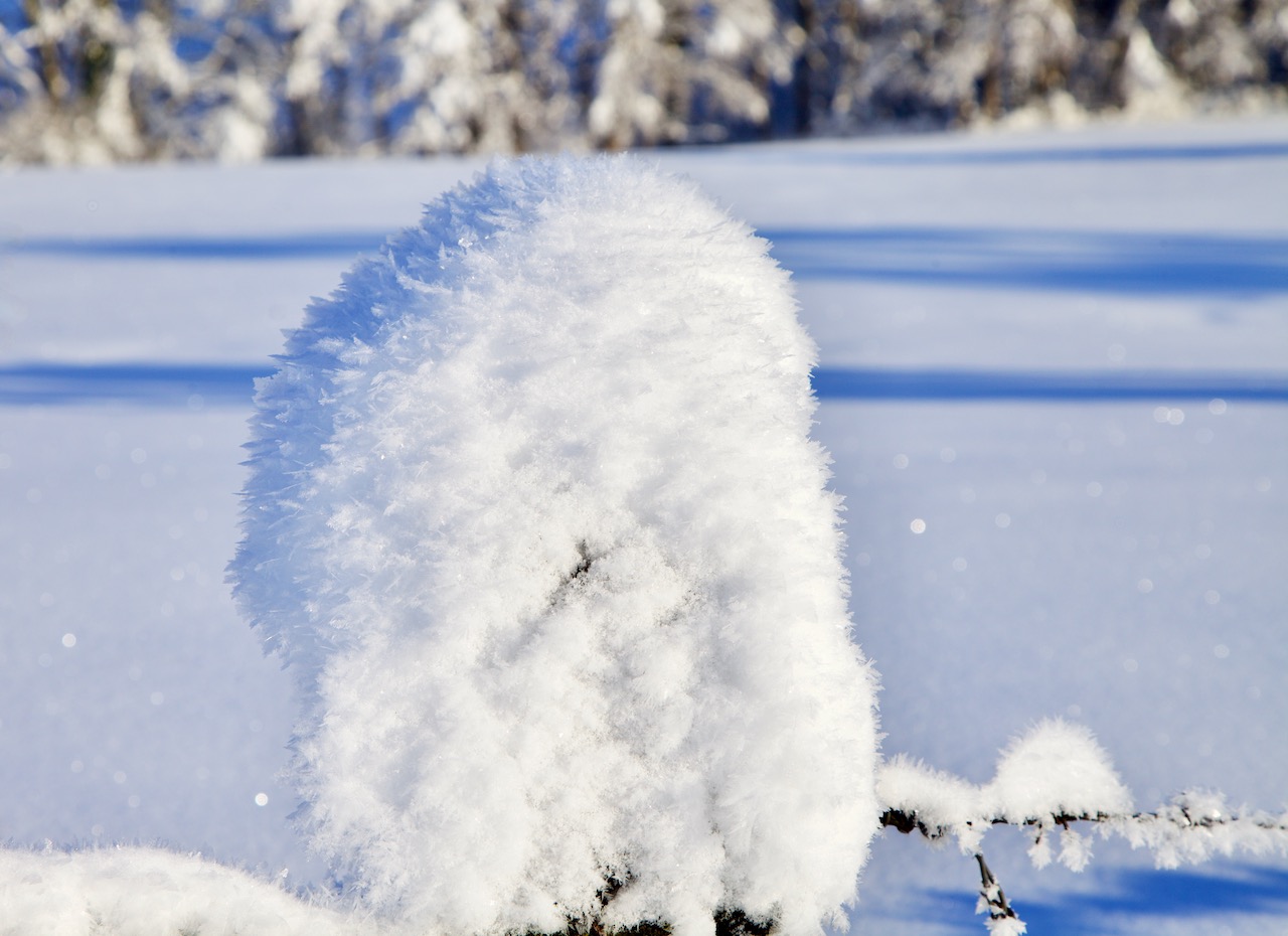
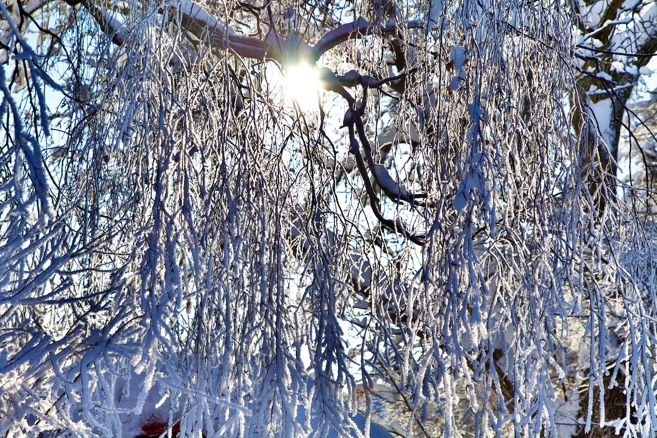
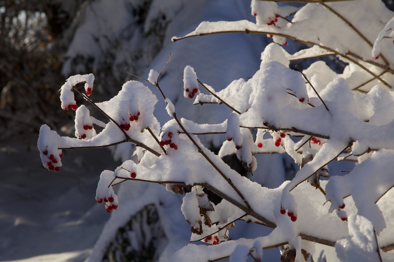
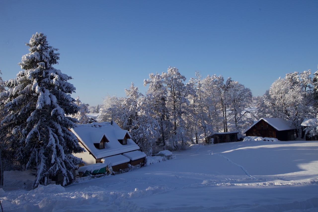
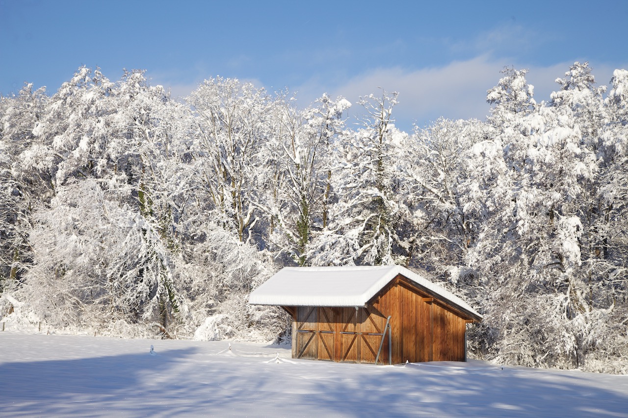
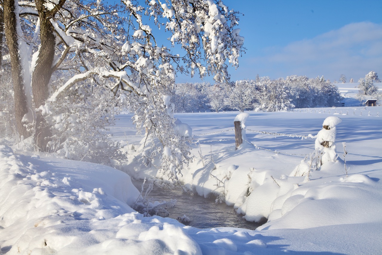
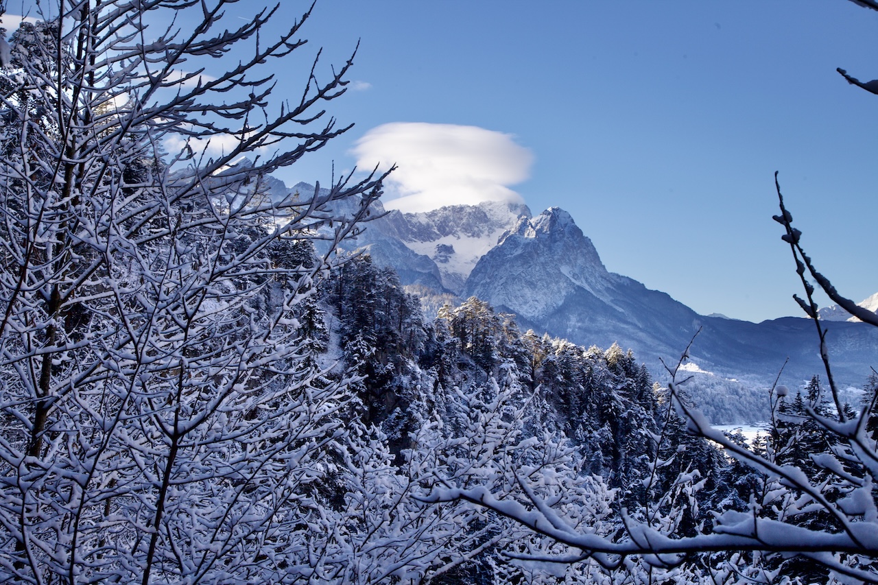
Das Phänomen tritt häufig im Winter auf, und hier sind einige Eindrücke von diesem Dezembermorgen.
 
Die orografische Wolke verschwand später und am Nachmittag beendete ein Wetterumschwung die magische Episode am Morgen des 21. Dezember 2024.

Wo kann man nun solch interessante Phänomene beobachten?

Die Zugspitze ist zwar nah, aber die gegenüberliegende Talseite ist für solche Beobachtungen besser geeignet: Hier befinden sich die Berge Wank und Kramer. Am Kramer entlang führt ein bekannter Wanderweg, der Kramer-Plateauweg.

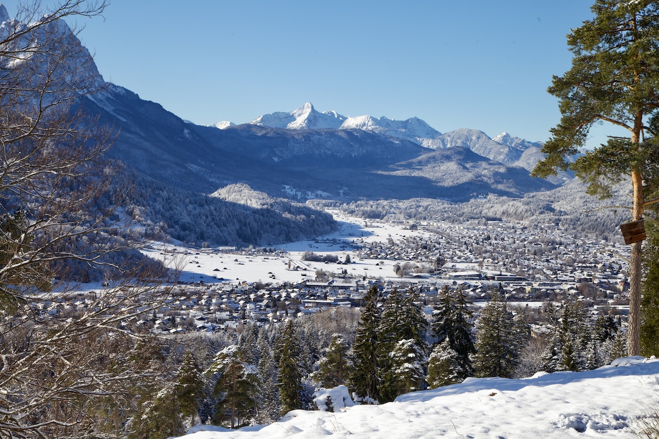
An der Flanke des Wank befindet sich eine beeindruckende moderne Hütte mit einem ausgezeichneten Restaurant, der Tannenhütte. Von hier aus hat man einen atemberaubenden Blick auf das gesamte Zugspitzmassiv. Die pyramidenförmige Alpspitze ist gut zu sehen.

Von der Altstadt von Partenkirchen aus führen mehrere Wege zur Tannenhütte. Die Wanderung dauert etwa eine Stunde.

Bannerwolken

Es gibt aber auch noch andere orografische Wolken, die hier zu sehen sind. Sogenannte „Bannerwolken“ treten auch in der Nähe der Zugspitze oder des Matterhorns auf. Wie die Linsenwolke ist auch die Bannerwolke eine orografische Wolke.

Bannerwolken scheinen mit dem Berg verbunden zu sein und sehen aus wie eine Flagge oder ein Banner. Die Wolken erscheinen auf der Lee-Seite, d. h. der windabgewandten Seite des Berges. Ihre Dynamik ist Gegenstand laufender Forschungen. Diese Art von Wolken ist auch in Bergen wie dem Matterhorn oder der Zugspitze zu sehen.

Wie erreicht man den Aussichtspunkt?

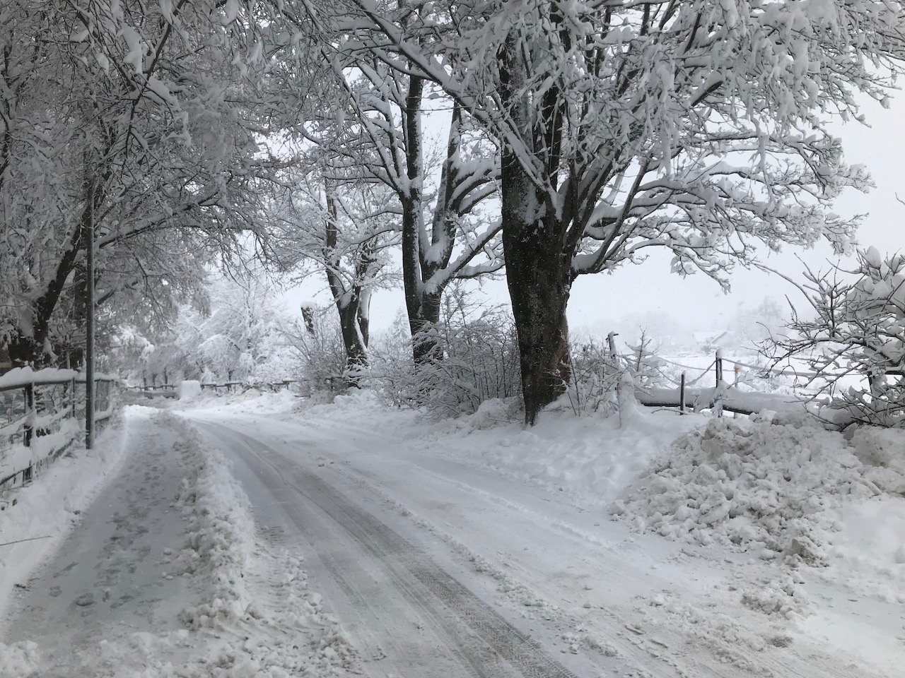
Die Tannenhütte oberhalb von Garmisch-Partenkirchen lässt sich auf mehreren Wegen erreichen: Einer davon führt durch die romantische Schalmeischlucht, eine Schlucht, die zwar nicht mit der berühmten Partnachklamm vergleichbar ist, aber mit beeindruckenden Felswänden aufwartet. Alle Wanderwege beginnen in der Altstadt von Partenkirchen.

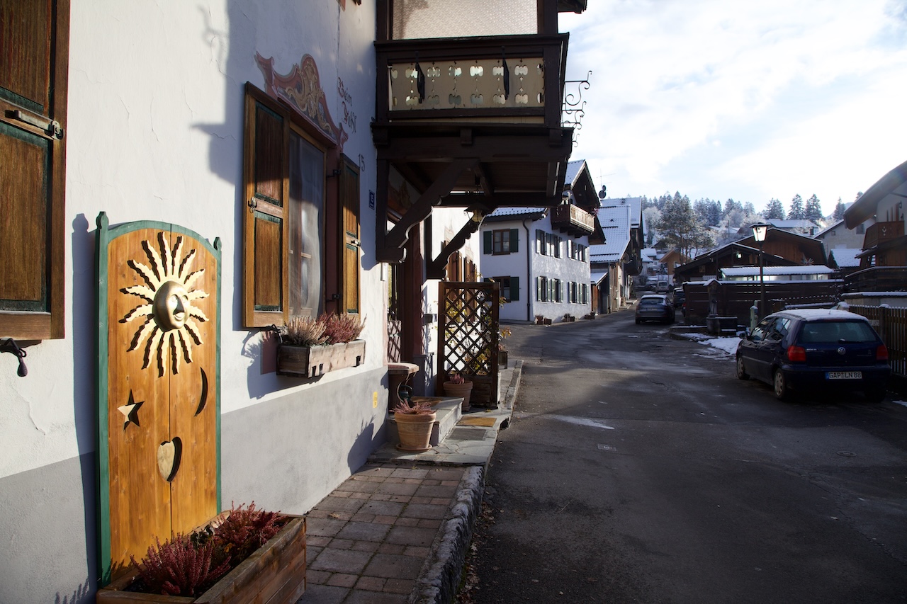
Partenkirchen: Traditionelle Häuser und das Flair eines typischen Alpenortes. Die Straße führt zum Ausgangspunkt des Weges.

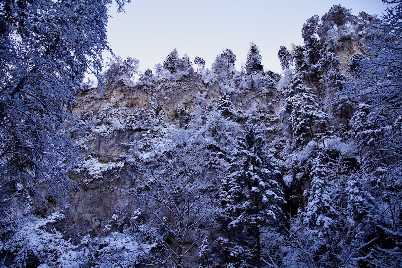
Über einen der Wanderwege gelangt man in die wildromantische Schalmeischlucht. Ein echter Geheimtipp in Garmisch-Partenkirchen.

Ein anderer Weg ist einfacher und ein breiter Pfad, der auch der Transportweg zur Hütte ist. Im Winter ist dies sicherlich die ungefährlichere Wahl, da der steile Bergweg in der Schalmeischlucht leicht rutschig werden kann. Kurz vor der Tannenhütte befindet sich eine beeindruckende Hängebrücke. Wer Probleme mit solchen Brücken hat, kann sie umwandern und erreicht die Hütte ohne Probleme.

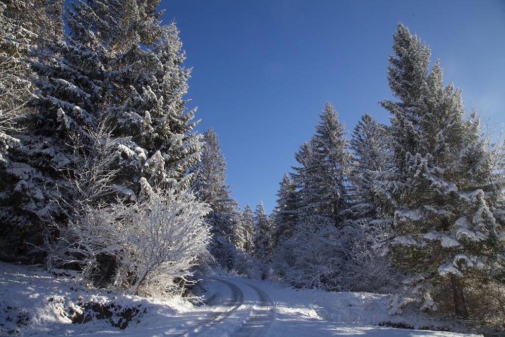
Der andere Weg ist einfacher und führt durch einen majestätischen Bergwald.

Garmisch-Partenkirchen ist von München und Innsbruck aus leicht mit dem Zug zu erreichen. Vor allem an Wochenenden sind die Straßen sehr voll, daher ist der Zug eine gute Option. Entweder man geht zu Fuß nach Partenkirchen oder man wartet auf den Bus (Nr. 4+5). Wanderwege führen weiter um das Wankbergmassiv. Es gibt auch eine Seilbahn auf den Gipfel des Wank.

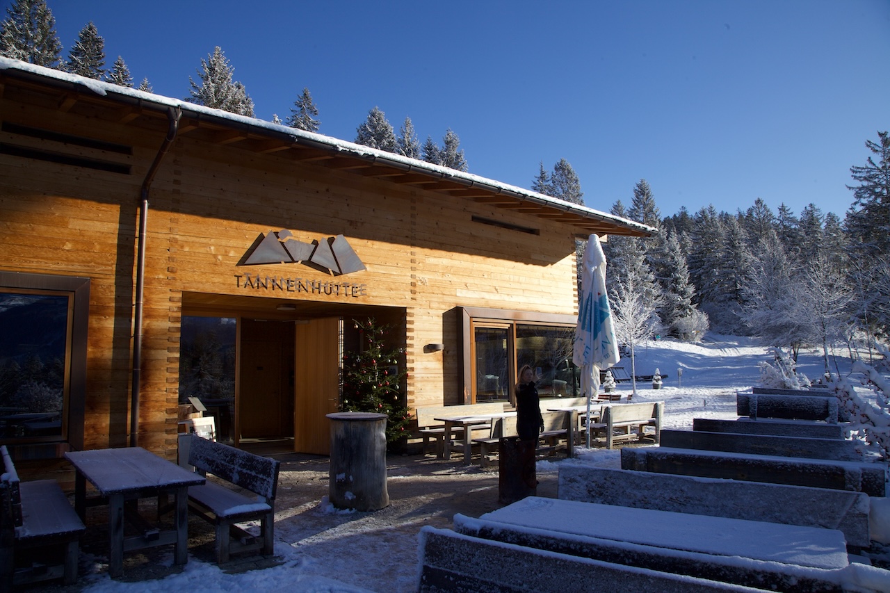
Die moderne Tannenhütte ist ein faszinierendes Ziel auch für diejenigen, die sich für zeitgenössische alpine Architektur interessieren.

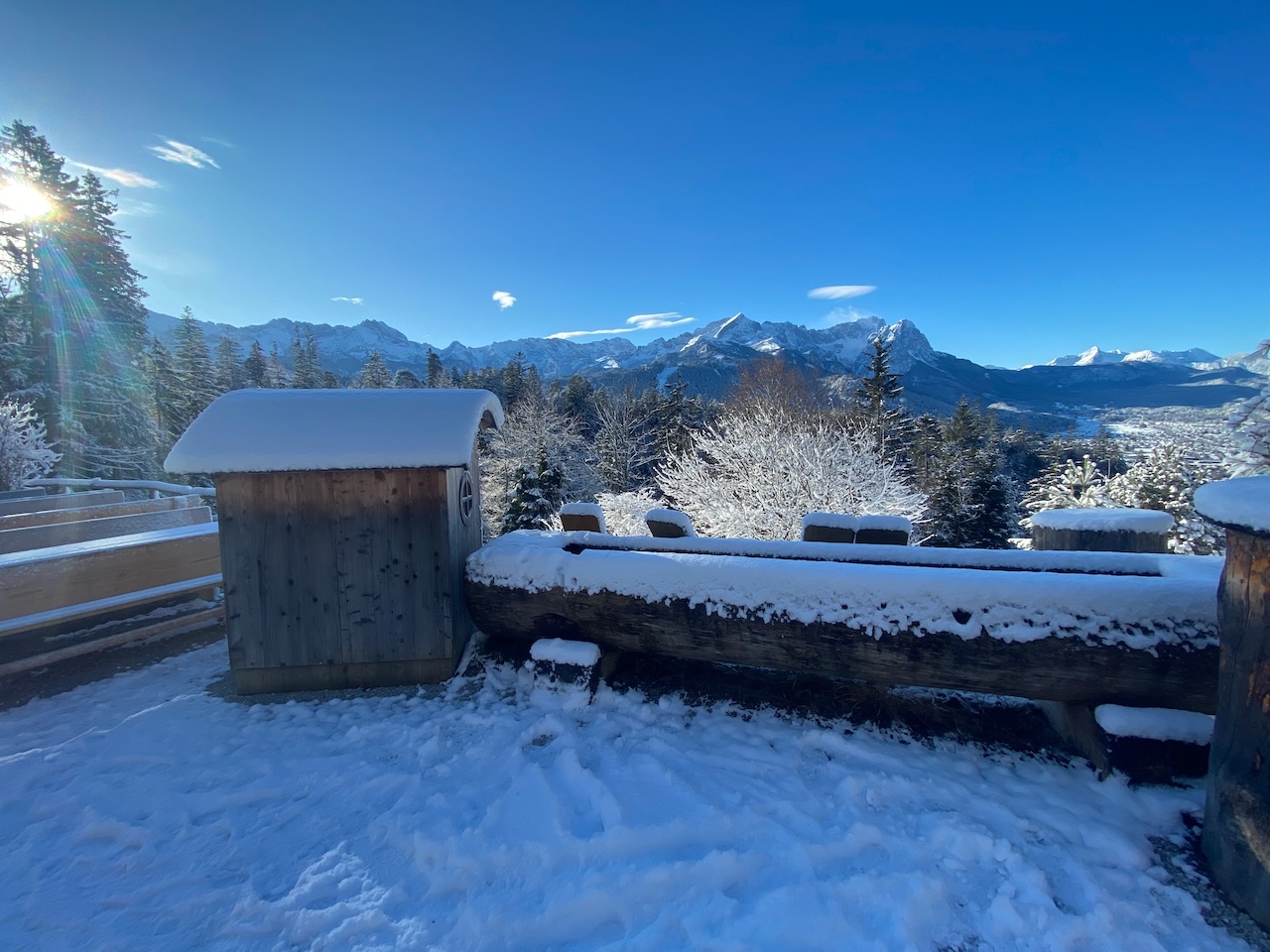
Ein großartiger Aussichtspunkt für Wanderer, Fotografen und Videofilmer

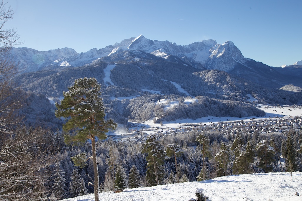
Von hier aus kann man das gesamte Zugspitzmassiv sehen. In der Mitte ist die Alpspitze

Fotografen schätzen den fantastischen Blick über ganz Garmisch-Partenkirchen. Der Blick reicht weit in den Westen.

© Deutsche Übersetzung: Susanne Niemuth-Engelmann / Redaktionsbüro Niemuth, https://redaktionsbuero-niemuth.de/ / 26.01.25

An Alpine Winter Wonderland And The Different Forms Of White Frost

Peter Engelmann, January 2025

Trees, Bushes, and grass frozen with layers of hoarfrost are great motives. Landscape photographers love these meteorological phenomena because they create fantastic, enchanted landscapes. True magic Winter Wonderland.

On January 1, 2025, such extraordinary scenery could be explored in an Alpine Valley close to the famous Ettal-monastery in Bavaria.

The Graswang Valley is always a spectacular spot for photographers and filmmakers. It begins with a grand rocky mountains-like scenery and a road leads to one of the fairytale-king Ludwig II’s beloved castles, Linderhof.

It’s no wonder the region has a reputation as a romantic fairytale country that also inspired artists. It is in midst of the nature park Ammergauer Alps. Here is the highly recommended website for further informations: https://www.ammergauer-alpen.de/

But some days make it even more fascinating and let us forget our modern rational world even if a lot of traffic due to tourism is never far away.

Weather plays a huge part in this.

Around Christmas and New Year 2025, Middle Europe and Southern Germany were under a long-lasting high-pressure system and a so-called inversion layer. This means that temperatures on top of mountains were higher and temperatures in valleys or lower parts of the country remained low. These inversion layers in Winter lead to a lot of fog.

The fog is very different: It can be more like clouds when there is high fog (low stratus). Mountain highs are often above this fog and from atop the fog it looks like a sea of fog. Or it is a grey cloud cover if you are in a valley. Sometimes there are sheets of ground fog with limited sight or constant changes with a milky sun breaking through the fog over midday.

Wet areas like bog or stream valleys often create their own microclimate with fog. In the Graswang valley, there is not only the Ammer but a number of springs and lots of smaller streams coming from the mountains and wetlands – perfect conditions for fog and hoarfrost.

But why do these layers of ice-crystals around trees and branches so thick?

One possibility:

Fog creates its special sort of hoarfrost which is in German called “Raueis”, ROUGH ICE. It is a bit different than the original hoar frost.

Rough Ice emerges when fog freezes. Fog consists of very small water droplets. If these droplets come in contact with colder surfaces rough ice is created whereas hoar frost is a frozen precipitation of water vapor in ice form. 

Rough Ice and rime are hexagonal crystals of frozen water. The bond between hydrogen and oxygen creates this hexagonal shape, which is transparent but appears white due to the diffuse reflection.

This makes hoar frost and rough ice so fascinating for photographers. Combined with some snow and stable cold weather conditions which add more and more ice crystals we can experience these magical landscapes.

If you want to take such pictures it’s good to follow weather reports – and often be there in the morning. The sun usually melts the ice on the trees quickly.

Topography

One of the special circumstances here in the valley is that during winter the sun never reaches the bottom of the valley in some parts. So, if you look for these types of scenery a valley or gorge with a stream where in Winter the shadow of the mountains is there all day is a good option. The valley runs from the West to the East and has openings here to the East which affects airflow too.

Cold temperatures and shadow all day on the Southern side of the valley.

Great motives in the neighbourhood: Ettal Abbey

Always worth a visit. The Ettal Abbey is close to the Graswang valley. The Ettal Abbey was found in 1330. Today 50 monks live in the Benedictine monastery. The impressive building is a baroque rebuilding after the original building was destroyed. On the other side the road through the Graswang valley leads to the famous Linderhof Castle, the German austrian border and the Plansee, a long alpine lake.

DIRECTIONS

The Graswang Valley is accessible from Garmisch Partenkirchen, from Oberammergau and from Reutte, Tyrol.

Trains stop in Garmisch Partenkirchen and Oberammergau. From Oberammergau there is a bus, Line 9622. During summer a special attraction is the “Ringbus” a special bus for tourists and hikers starting in Oberau.

OROGRAPHIC CLOUDS AND A BREATHTAKING VIEWPOINT ABOVE GARMISCH-PARTENKIRCHEN IN BAVARIA

Peter Engelmann, December 2024

The world-known Olympic town of Garmisch Partenkirchen is famous for Germany’s highest mountain Zugspitze, breathtaking gorges, and its spectacular scenery.

But it also has its unique weather phenomena. Similar to the Matterhorn the Zugspitze is a place where certain stationary orographic clouds as Banner clouds and Stratocumulus lenticularis or  Altocumulus Standing Lenticular Clouds can be seen.

These orographic clouds are of particular interest to photographers as they add a unique and magical atmosphere to landscape photography.

STRATOCUMULUS LENTICULARIS

Stratocumulus lenticularis are sometimes looking like Ufo’s and were indeed mistaken for them but they are orographic clouds often connected with the Foehn phenomenon (even Foehn winds are not necessary). 

In December 2024 on a fantastic winter day, there was this stack of pancakes cloud near Zugspitze. 

But what are these mysterious clouds and what make them?

December 21, 2024: A cap on top of the Zugspitze

According to the National Weather Service Altocumulus Standing Lenticular Clouds are “associated with waves in the atmosphere that develop when relatively stable, fast-moving air is forced up and over a topographic barrier that is oriented more or less perpendicular to the direction from which the upper-level wind is blowing. This deflection creates a gravity wave downwind of the topographic barrier not unlike a wave you might generate by throwing a pebble into a pond. When sufficient moisture is present above the mountain-top level, ACSL clouds develop within the crest of these mountain waves where the air is rising. ACSL clouds are continually developing and dissipating in the vicinity of the wave's crest and immediately downwind of the crest, respectively. That is why they appear to remain stationary (hence the name) even though winds are swiftly (sometimes very swiftly) moving through the entire cloud.”

The phenomenon happens often in winter and here are some impressions of this December morning.

The orographic cloud later disappeared and in the afternoon a weather change ended the magical episode in the morning of December 21, 2024. 

But where to watch such interesting phenomena? The Zugspitze Mountain might be close but the opposite side of the valley is better suited for such observations: Here is the Wank-Mountain or the Kramer Mountain with a famous trail. At the flank of the Wank there is a stunning modern cabin with an excellent restaurant, the Tannenhuette. Here you can enjoy a breathtaking sight of the whole Zugspitz-Mountain-Range. The pyramid-shaped Alpspitze is prominently displayed.

A couple of trails lead from the old town of Partenkirchen to the Tannenhuette. The walk takes approximately one hour.

BANNER CLOUDS

But we also have to talk about other orographic clouds which can be seen here. So-called “Banner Clouds” appear also near Zugpitze or Matterhorn.

Like the Standing Lenticular Cloud, the Bannercloud is another orographic cloud which means they are related to the relief of the landscape.

Banner Clouds seem attached to the mountain and look like a flag or a banner. The clouds appear on the leeward side of the mountain where there is no wind. Their dynamics are a field of ongoing research. This type of cloud can also be seen in Mountains like the Matterhorn or the Zugspitze.

HOW TO GET TO THE VIEWPOINT?

A couple of ways lead to the Tannenhütte above Garmisch-Partenkirchen: One trail leads through the romantic Schalmeischlucht, a gorge, not comparable to the famous Partnach Gorge but with impressing rockfaces. All trails begin in the old town of Partenkirchen.

Partenkirchen: Traditional houses and the flair of a typical alpine town. The road leads to the start of the trail.

One of the trails leads to the wild and romantic Schalmei-Gorge. A real insider tip in Garmisch Partenkirchen

Another trail is easier and a broad path which is also the transport path for the cabin. This is certainly a safer choice in winter because the steep mountain trail in the Schalmeischlucht can easily become slippery. Shortly before the Tannenhuette, there is an impressive suspension bridge. Those who have problems with such types of bridges can take a walk around them and reach the cabin without problems. 

The other trail is easier and leads through a majestic mountain forest.

Garmisch-Partenkirchen is easily accessible by train from Munich and Innsbruck. Particularly on weekends, the streets are very crowded, thus the train is a good option. Either take a footwalk to Partenkirchen or wait for the bus (Nr.4+5). Trails are leading further around the Wank Mountain massive. There is also a cable car to the top of the Wank.

The modern Tannenhütte is a fascinating destination also for those who are interested in contemporary alpine architecture.

A great scenic viewpoint for hikers, photographers, and videographers.

The whole Zugspitze Mountain range can be seen from here. In the middle is the Alpspitze.

Photographers appreciate the fantastic view over the whole of Garmisch Partenkirchen. The view extends far to the west.

Record Snow, Chaos, And Winter Wonderland

That was an unexpected start to the winter. Used to often warmer winters over the last years the tons of snow on the First Advent in the region North of the Alps and Austria had an American feeling of real winters in the North or simply the times before climate change, when cold winters with lots of snow were normal.

On December 1, 2023, a 5B Weather Situation and an air mass limit led to new record snowfall in Upper Bavaria. In only a few hours a thick layer of snow stopped trains and airplanes around Munich, causing over 90 traffic jams and many blackouts on Saturday, December 2.

A surprise in the morning: A thick layer of snow on the table.

There was so much snow that even on December 2, an emergency state in the capital of Bavaria lasted. One reason is that every weather event is different: In this case, the snow was wet and lasted on branches of trees. Some trees feel or parts of the trees broke apart. Therefore police and first responders had a lot of work.

It began in the afternoon hours on December 1 when the rain turned more and more into white blobs. The evening hours saw intense snowfall. It was snowing and snowing and in a few hours, the landscape was completely under a thick layer of white. That was too much for winter services to cope with.

In the morning hours of December 2, it was clear that it would take a lot of time and effort to clear streets, garages, and gardens from the mass of snow. Snowing didn’t stop before late afternoon. A cold night followed. On Sunday the weather calmed but it became even colder.

That first advent will be remembered as a true Winter Wonderland dream. Frost, the thick sheets of snow and ice created fantastic scenery in Bavaria and in the Alps.

Due to the nature of this weather event where snow often was attached to trees and other things it formed interesting sculptures.

With a little imagination, the fields were filled with strange creatures and an endless variety of forms.

Warmer temperatures and a cold night led to these interesting effects.

The trees were veiled in sheets of snow, ice, and frost. In one place there was an ice-curtain.

Here is a little red contrasting the white:

Antennas weren’t spared.

This fence had a lot of frost crystals.

The early morning hours are the best time to capture Winter Wonderland scenery. The cold air is very clear and a deep blue sky contrasts the white trees and fields.

It is always a good idea to bring some elements into the picture that add to the atmosphere as old barns or houses.

An attraction is small streams that are not yet frozen. If the water is warmer it creates often a thin veil of mist which looks great when illuminated by the sun.