Berlin, July 22, 2017: The Flood Again

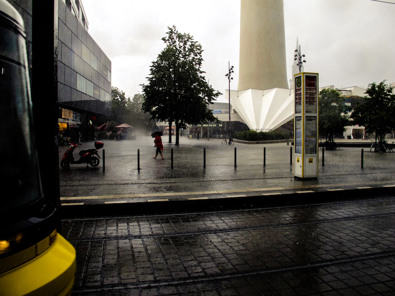
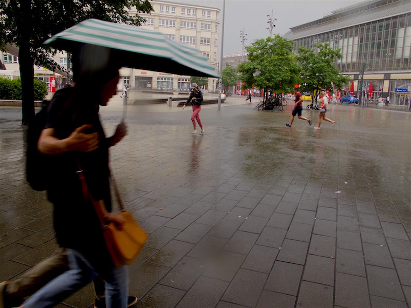
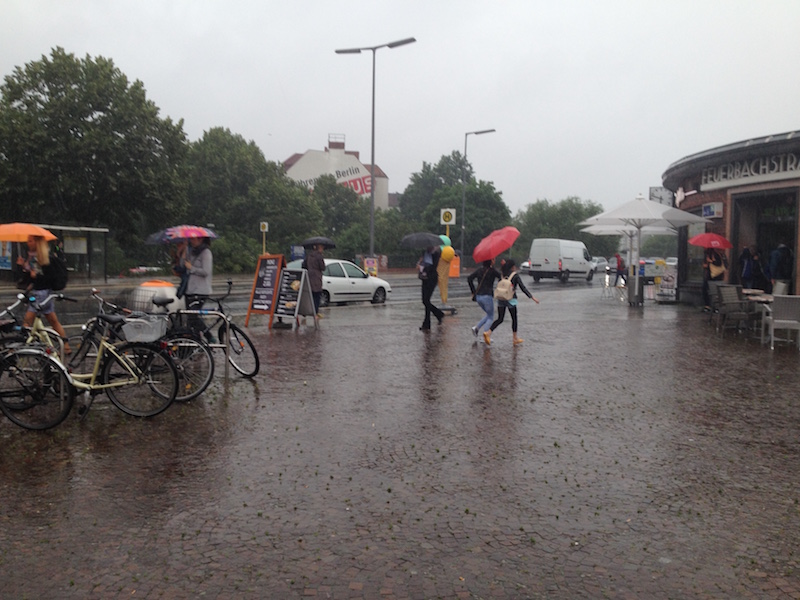
Again scenes looking like from Roland Emmerich’s “Day After Tomorrow”. Roughly three weeks after the flooding with lots of damage the German capital was again hit by severe weather. A thunderstorm and torrential rain hit the city on Saturday afternoon when many people were celebrating the Christopher-Street-Day-Parade. Luckily it didn’t affect much of the parade, but also this time there was a state of exception.

In some parts of the city particularly in the North and North-East but also in the South-West a lot of rain came down, and in Pankow, a storm left a trace of destruction. Trees fell on cars, the S-Bahn Linie 2 commuter train was interrupted in the North for some time, also the tracks of a street-car were affected.

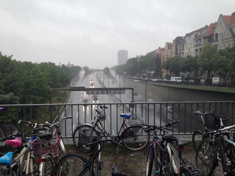
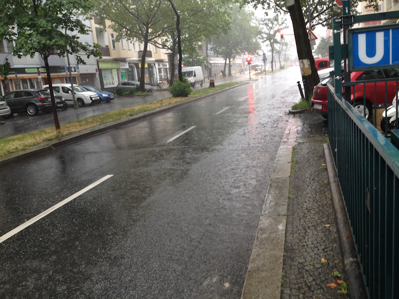
Also again there was a lot of water on some streets turning them into canals like three weeks before. It’s noteworthy that often car drivers are obviously not conscious about the danger for their cars and perhaps also for themselves: if you drive into a puddle of water and the level of water is high enough its possible the water is sucked into the air filter. Subsequently, the engine could be completely destroyed. Cars could also become deadly traps if the car is drowning in a flooded underpass and the doors cannot any longer be opened.

If possible try to avoid driving when these type of flash-floods occur which are a novelty in Germany with this kind of intense rain and also the fact that we have now repeated events of that kind in shorter time-periods during summer.
<


It certainly looks like one of the predicted effects of climate change; for a long time, scientists warned of higher levels of moist air in the atmosphere during summertime. These wet air masses can lead to more extreme weather like heavy thunderstorms and extreme rain.

Obviously, it’s not yet possible to have a more precise forecast or nowcast about thunderstorms with extreme flooding. Forecasts were very precise this day about the time when the bad weather was supposed to arrive around 3-4pm in the afternoon, and there was also a warning about heavy rain, but it’s, of course, impossible to say where exactly the most extreme events do happen.

For example, the south-west of Berlin is usually less affected by severe thunderstorms as the North but there are exceptions from the rule. This time an underpass in Zehlendorf (South-West) got flooded. During the last event, the biggest mass of rain hit quarters in the west (Wilmersdorf) and a city north of Berlin, Oranienburg, where thunderstorms are more often.

Luckily the rain didn’t last as long as two weeks ago. Therefore it was another extreme day for police and fire-starters but it should be less damage as during the previous extreme weather event.


June 29, 2017: State Of Exception In Berlin Due To Epic Rainfall

Berlin and North-East-Germany have an increasing problem due to climate change: it’s getting too dry. Statistically, the annual precipitation amount in Berlin is around 550mm or less. The City and Brandenburg, which is the driest province in Germany, are situated between the continental climate regions in Eastern Europe and the West of Germany which is influenced by a more maritime climate. Often rainfall from low-pressure systems coming in from the west side doesn’t reach Berlin. But with every new year, there was even less rain.

In June 2017 there was news about problems with sinking phreatic levels and lakes in the Barnim ( a region in the North-East of Berlin) even dried out. This was shortly before a big surprise which kept fire-starters and police awake for more than 24 hours.

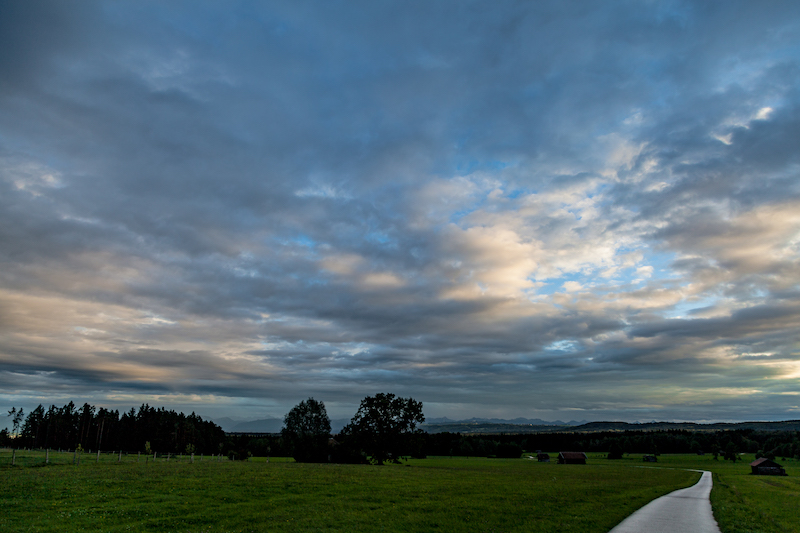
June 29 will be a day remembered for a historically unseen weather event. The day before brought already some severe weather with thunderstorms but at sunset, things looked calm. After some rain meadows and fields were covered with a thin layer of mist.

Only the typical cirrus clouds and weather reports indicated rain coming in for the next day.

There was indeed a flood warning in place but what happened then exceeded all expectations. In 24 hours there were 196,9 mm liters of rain per square meter in Tegel, which is the quarter of the city with the airport in the North-West. But all other parts of the city were hit by the epic flashflood too. It was like Noah’s Flood since the torrential rain didn’t stop for many hours.


Luckily there were so far no casualties but dramatic damage in various places: The U9 subway in the west was affected when parts of a tunnel were flooded, airplanes couldn’t land, many streets were underwater and a building had to be evacuated because of fears it could collapse. An endless number of cellars got flooded. Berlin’s fire-starters did an incredible job. There were over 2000 emergency responses. It was not before afternoon the next day that the state of emergency was canceled.

However, it is an eery silence at the moment. For some hours it was dry but in the late afternoon, there were again some torrential rain showers. The situation is still dangerous because trees could fall and levels of rivers are rising. There is more rain predicted for the next days.

The reason for this epic flood was an unusual weather-pattern with two low-pressure systems and extreme wet air in the Berlin-Brandenburg region. The wind was blowing from different directions. The clouds were circling around and some of them even moving back again due to the conditions in the atmosphere.

Not any extreme weather event is related to climate change but this type of tropic torrential rain is very unusual and fits in certain patterns which were predicted by scientists a long time ago. On the other side there was a flood in Berlin on April 14, 1902, which left strong memories long before global warming was an issue.

In any case, its time to take some precautions. Berlin will build new and huge water storages for the future. Today we are in praise for our firefighters who helped so many.

Dangerous Storm – Berlin And Brandenburg, Germany, March 17, 2017

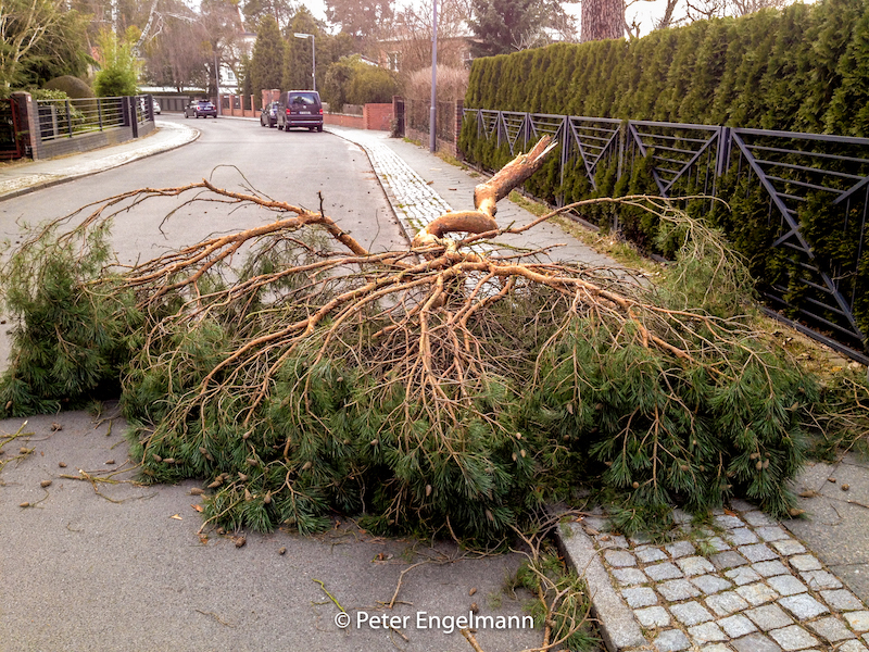
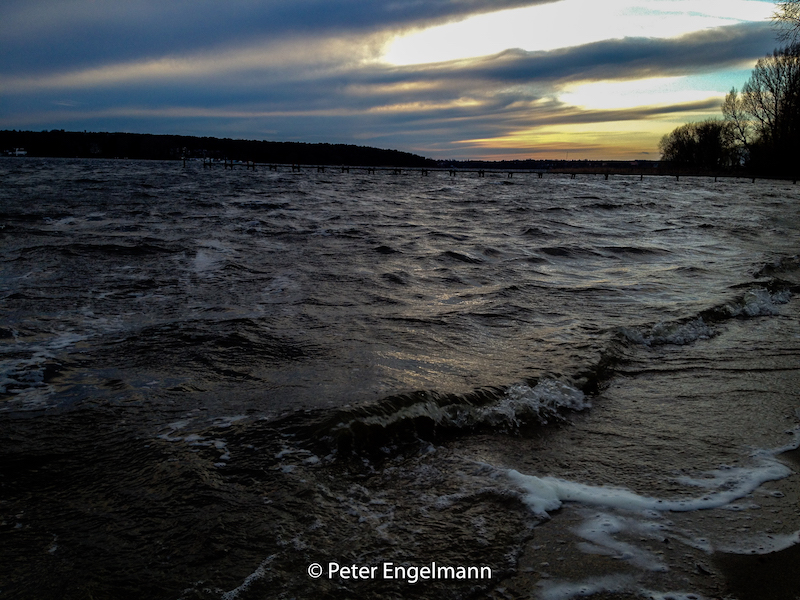
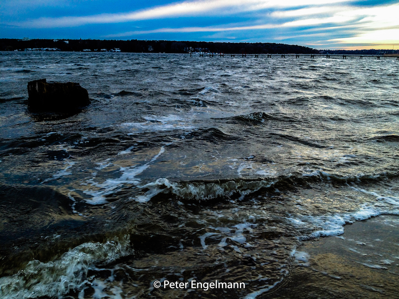
On Saturday, March 18, an unexpected storm hit the capital Berlin and Brandenburg. The wind freshed up after noon and lasted till afternoon. A wind gust with 100 km/h was registered. The Fire starters got over 300 calls. Damage in the city was limited but in the surrounding Brandenburg the storm caused a tragic event when one person was killed in a car which was hit by a fallen tree. In Potsdam an advertising sign was flying around and did hurt three people.   The storm called “Eckhard” emerged on the southern side of another storm system in Northern Europe. It proved that storms are still difficult to predict. In this case the storm warning occured not before the storm had already hit. But most of the time the weather service warns one or two days before  a storm does happen. Storms often occur in weather-models a couple of days before. Nevertheless the challenge is to exactly predict the path of a coming storm. Furthermore the strength of a storm could differ from the estimated strength. And – as in the case of Eckhard – there are surprises. Storms are a very typical weather pattern in February/March in Middle/Northern Europe. It is the time between winter and spring and there are big differences between cold air in the North and warm air in the South. Some storms during this time could be really destructive and can destroy whole forests. In this case the storm ripped off branches of trees (picture above) and felled trees. The S-Bahn in Berlin was interrupted for hours. Storms with a maximum of 9 or 10 Beaufort also create bigger waves on the havel-lakes like lake Wannsee on the westside of Berlin. These winds are also a problem for sailors or row-boats because the waves are unpredictable. In the late afternoon of Saturday typcial storm clouds could be seen. In the evening the sky was clear again. The next day it rained and it became significantly warmer. March was so far too warm in many areas, even there was still snow in the mountains and skiing was possible.      

Winter Storm – Severe Weather In The Bavarian Alps, January 7-8, 2017

January 2017 began with very cold temperatures in Middle Europe. In some places it was 20 degrees below zero. Then it became warmer and in Upper Bavaria and in the Alps there was heavy snowfall. In Mittenwald, which is very close to the Austrian-German border, there was a mass of snow. Snow began falling on Saturday, January 7 and lasted on Sunday for the whole day. This made a big difference to previous years when there was no snow in the Bavarian alpine valleys during the same time of the year and it was much too warm. The severe weather during the first weeks of January caused many traffic accidents but in the alpine region people are well prepared for winter weather. However a weather pattern with a series of low-pressure systems in winter with sudden jumps in temperature pressing against the Alps from the North-West-Atlantic can lead to extreme dangerous situations. In Galtür, Austria, one of the biggest disasters happened in February 1999: afters days of extremr snowfall enormous avalanches hit the village and killed 38 and many people got injured. The village was isolated from the outside-world for days and ended in a spectacular rescue mission with a fleet of helicopters. The catastrophy lead to investigations about responsibility and a a lot of new measures to protect the valley from deadly avalanches. Even today with modern technologies avalanches are a constant danger in the alps. Tourists are always advised to check with local authorities and not leave secured paths during winter. In this situation here the weather calmed down after the weekend of January 6-7. Tourist can enjoy now the valley of Mittenwald and the municipality which has a rich history. It is situated in the valley of the river Isar on the historical route between Germany and Italy. It was also the route from the South to the North in the times of the Roman Empire. Even today you can see an Italian influence in Mittenwald. The municipality is also famous for the manufacture of violins.
/a> Rakuten Affiliate Network Welcome Program There are many walking-paths and streets leading to hotels and cabins in the surrounding mountains. On the East-side there is the impressing Karwendel, a mountain massive with steep rock faces and high mountains. The Karwendel is a extreme territory with a wilderness. On the west side you can get into the Leutasch-Tal, which is on the South-Side of the Zugspitze. Mittenwald is not far from Garmisch-Partenkirchen. There is also a cabin built by King Ludwig II not far away, The Schachenhaus, which can be visited during summertime. Furthermore there is the luxury hotel ELLMAU which was the place of a G7 meeting recently.