THE JAPANESE GARDEN IN AUGSBURG, BAVARIA

The Japanese Garden is a dream in every time of the year. In autumn, the colors are an unparalleled firework of yellow and red. You don’t need to go to Japan to enjoy the fascination of a Japanese garden and the many motives it has to offer.

In Augsburg, Bavaria, not far from the city center is one of the most impressive and representative Japanese Gardens in Europe. Japanese landscape architect Yoshikuni Araki designed the Garden of Friendship. He created an outstanding experience with a unique setting where trees, plants, boulders, and water are in a special combination.

Water is a central element of the Japanese garden. The garden architects made use of Augsburg’s special landscape where water plays a pivotal role. There are two rivers, Lech and Wertach, and a huge number of channels in and around Augsburg, which previously helped the city to become an important industrial center. The channels, the water management system, and the industrial installations are UNESCO WORLD HERITAGE.

One of the many streams runs through the Botanical Garden and the embedded Japanese Garden in Augsburg. On one side, the water cascades over boulders and disappears under a bridge on the northern side of the Japanese garden.

The Japanese garden was built as a present for the 2000th anniversary of Augsburg in 1985. It presents also the friendship with partner cities Amagasaki and Nagahama. The friendship was initiated by Magokichi Yamaoka, president of Yanmar. There is also a Japanese memorial in the Wittelsbacher Park in Augsburg. Yamaoka intended to honor German Rudolf Diesel.

Augsburg’s Japanese Garden presents the Japanese Art Of Gardening at its best. These gardens are works of art. They present a landscape and have a spiritual quality. There are two entries to the garden and you can explore new angles that show different perspectives for hours. Uneven curved paths are a typical element and they lead you to the most interesting points. The center of the Japanese Garden is a lake (Euchi). It symbolizes the sea. Typical stone lanterns (Ishidoro) are placed at significant points. An open building (Pavillion) resembles a temple and is a great place to rest there. Tons of boulders were transported from the Fichtelgebirge, a mountain range in Northern Bavaria, to Augsburg. Inspiration for the garden came from Kyoto.

The waterfall and the boulders create the impression of a mountain landscape:

A magical place: Boulders with lichen and moss, a thick canopy, and water cascading over stones.

Trees and perennials play an important role in the Japanese garden. The typical cherry trees there and many other sorts of plants are typical for Japan. Due to the different climates, there are some compromises.

The Japanese Garden is an attractive place throughout the year. Highlights are festivities in spring and of course the interesting colors in autumn. Green, Yellow, and intense red are dominant colors. There are many opportunities for photographers here. On weekends there are many visitors in the garden. A good time is certainly shortly after the botanical garden opens.

More info is available at www.augsburg.de/botanischergarten

The Japanese garden inside the Botanischer Garten is easily accessible for a little entry fee. There is a huge parking space around and, you can get there by Bus 32 from Augsburg Hauptbahnhof. The Botanical Garden is surrounded on one side by the Siebentisch-Wald, which is a huge landscape park and forest.


Devastating Super-Cell Storms August 2023 Over Bavaria

August 2023 saw extreme weather events in Middle Europe. It wasn’t so many events, but a couple of significant storms. A number of super cells in Germany led to damage. There were some typical weather patterns in Upper Bavaria along the alps, where notorious hail-stripes are well-known, but the intensity of extreme weather was surprising.

One of the most significant extreme weather events happend on August 26 in the afternoon. Two supercells brought incredible amounts of hail in Southern Germany. A number of 123 places were affected, according to German Weather Service DVD. The separate weather systems rolling over Bavaria with a distance of 100 km. The two super-cells left a trail of destruction at a length of 130 km. The strip of hail had a width of 15 km. In that zone there was a lot of destruction in Benediktbeuern with a well-know monastery and Bad Bayersoyen. In some places hail had diameters more then 5cm, which turns them into bullets with high speed. Between the strips there was no such destruction but strong gusts of wind. The maps of the Europan Severe Weather Database deliver an impression of the two trails of destruction.

Heavy Thunderstorm on August 13 with intense lightning

Before these events, there were also heavy thunderstorms on August 13. These storms were coming from Baden-Wurttemburg. The video on the stormypictures.de Youtube Channel shows how the storm quickly intensifies. There was also a remarkable amount of lightning. The immense rate of lightning lit the sky and lasted unusually long.

There are no fundamental new weather patterns here, but what happened is what climate-researchers predicted a long time ago. A hotter and wetter atmosphere contains more energy. This energy is a precondition for stronger storms as these super-cells. And it is not only a warmer atmosphere. Early this year, researchers detected unusual warm surface temperatures in the oceans for example the atlantic ocean near Florida.

Here is the development of the thunderstorm in the early evening hours of August 13 in Upper Bavaria, close to lake Ammersee:

The late sun illuminates towering thunderstorm clouds

At first sight the huge tower of clouds looked  impressive but not as monstrous it became.

There was an incredible dynamic in the chaotic atmosphere

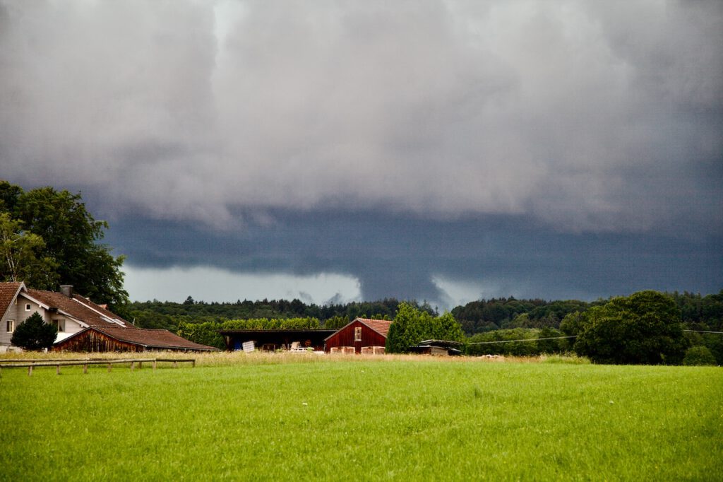
Within minutes the sky changes and dark clouds approached fast. In the upper half a rotating pattern appeared.

Lighting strikes came close very fast and a huge curtain with fall stripes appeared.

This storm brought intense rain and hail in some places. Later there was intense lightning.

The supercell storms on August 26 seen from a ship on a lake

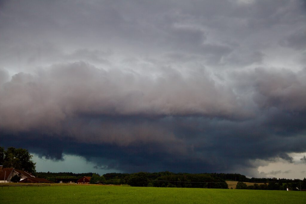
There had been further dramatic weather events after August 13. On August 17 a monster thunderstorm set parts of Nuremberg in Northern Bavaria under water after a flash flood. The series of severe weather peaked on August 26 with the two super cells in Southern Bavaria and also dangerous thunderstorms in between. The pictures below were taken on a ship on Lake Ammersee. Here it was very hot and the sky was clear til middle of the afternoon. Then, dark clouds were arriving very fast. The orange flashing lights on the storm warning lights were activated. It was important that sailors headed back to harbour in time because the line of thunderstorms arrived fast with strong winds and rainfall later.

An unusual sight

Weather is always unique. Compared to the previous thunderstorms, the sky “looked” more like it was typical rain clouds. However these was a severe weather system at any place. The wind picked up very fast and the normally peaceful lake turned into a raging water with remarkable waves. Strong rainfall let the shore disappear in a sort of mist minutes after the wind gusts appeared. Later the evening, the weather calmed down. However the damage in many regions was dramatic.

Dark clouds approaching from South-West

The clouds quickly become darker.

Still some sunshine in the Alps before the super cell system arrives

It’s getting pretty dark even during the afternoon.

Gusts of storm at the westside of Lake Ammersee in Bavaria. A motor boat makes it barely into the harbour.

Aktivieren Sie JavaScript um das Video zu sehen.
https://www.youtube.com/watch?v=UVsCcEgCoa0&t=52s

What came after the storm

The super cell weather systems were the harbingers of more extreme weather in the alps. The days later there was heavy rain and a flood created more damage in Austria. On August 28 the famous Oetztal was cut off from the outer world after a mudslide destroyed the only road. Many tourists could only leave via the Timmelsjoch mountain pass. Helicopter’s brought food and other stuff into the valley.

Only days later a high pressure system brought calm and unusually warm weather in September. The super cell storms and the following devastating floods were dire reminders what living in a new climate triggered by climate change means. It means coping with a different world, less comfortable, more unpredictable and more violent. August 2023 was also one of the hottest summers on record.

Kuhflucht Falls, Upper Bavaria

Not far from Garmisch-Partenkirchen, a great motive and an adventure trail presents a unique experience and many opportunities for photographers. The Kuhflucht Falls are not as famous as the world-known Partnach Gorge, but they are worth the trip.
It’s good to know some things in advance to plan a trip there. The Kuhflucht Waterfalls have a height of 270 meters, but please do not expect one big waterfall. The stream cascades over some steps and contains three big falls. One particularly impressive cascade is near the bridge over the stream.
The falls are in some places inside a canyon. You can’t see the whole falls (except using a drone, which would require a permit), but there are many impressive motives along the way.
There are two parking lots in Farchant. One lot is where the trailhead of the hiking trail to the waterfall begins. The trail is connected to an adventure and experience trail leading through a forest with a lot of information about nature and a playground.


The lower part of the trail and the other trail offer a lot for families, and many people come here.
If you look for dramatic pictures, the season and the time of the day are important: These pictures were taken during spring after days of rain, and the snow melts. That makes a difference because much more water is cascading down over the boulders. It’s a different picture in a dry summer.
Late morning seems a good time since there is enough sunlight entering the canyon. High mountains and a dense forest with large trees surround the falls.


The trail is very comfortable in the lower part. The community of Farchant put a tremendous effort into this trail and some attractions there. After a severe storm with massive damages, the trail was repaired and reopened. Thanks to this effort, visitors can enjoy these romantic falls throughout the year. After approximately 750 metres the trail reaches a bridge over the stream.
Before the bridge, a smaller trail departs, where you can hike up a few meters to a viewpoint that offers an impressive view over the fall. After the bridge, the broad trail turns into a steep mountain path.
That path that leads higher up the mountain has a different quality. You should only do this hike if you are an experienced hiker. There is one scenic view, approximately 20 minutes from the bridge, where you can see the upper part of the gorge, but please be careful there!

You can also hike back on the “Philosophenweg” to Garmisch-Partenkirchen.
The Kuhflucht Falls are accessible via Train-Stop Farchant and by bus from Garmisch Partenkirchen.

The biggest fall is impressive after days of rain in spring or when the snow melts.

Standing close to the big cascades is a good feeling, it is not only the experience of majestic nature but the little water particles in the air open the airways and have a comforting effect. The effect is similar to standing at the shore of the sea and breathing the air close to the waves.

Above the bridge is a scenic view which allows a breath-taking perspective

The Kuhflucht Falls is an alternative or additional trip to the well-known destinations in the region.

Blautopf, Blaubeuren – Ein Ort romantischer Sagen und Märchen

von Peter Engelmann, 10. August 2022


Habt ihr schon einmal nach einem Motiv gesucht, um die deutsche Romantik in Reinform darzustellen? Der Blautopfsee bei Blaubeuren auf der Schwäbischen Alb ist genau so ein Motiv.

Der Blautopfsee ist die zweitgrößte Karstquelle Deutschlands und dient als Quelle des Flusses Blau. Seine Besucher sehen ein magisch erscheinendes Gewässer, dessen intensive Farbe zwischen Blau und Smaragdgrün changiert und sich immer wieder verändert. Der Blautopf sieht aus wie ein riesiges Auge oder wie ein Portal zu einer anderen Welt. 

Was brauchen wir noch für eine romantische Märchenkulisse? Genau: ein rauschendes Mühlrad, eine geheimnisvolle Schmiede und eine mittelalterliche Stadt – es ist alles vorhanden. 

Jede Menge Motive

Genau gegenüber vom tiefblauen See befindet sich eine historische Hammerschmiede. Auch wenn das heute darin untergebrachte Café und das Informationszentrum für Touristen uns zurück in die Gegenwart holen, stören diese Einrichtungen den romantischen Eindruck nicht im Geringsten. Wer hätte schon etwas gegen eine Tasse Kaffee am Ufer des Blautopfes, mit Blick auf die glitzernde Wasseroberfläche, die die umgebenden Baumkronen spiegelt? 

In unmittelbarer Nähe schließt sich das Städtchen Blaubeuren mit seinen zahlreichen pittoresken Fachwerkhäusern im alemannischen Stil, teilweise noch mit  mittelalterlicher Bausubstanz und unter strengem Denkmalschutz, und seiner berühmten spätgotischen Klosteranlage an. Um das romantische Panorama zu komplettieren, thronen malerische Burgruinen auf den Hügeln über dem Tal.

Der Blautopf und Blaubeuren liegen inmitten eines breiten Tals unweit von Ulm, der größten Stadt in der Nachbarschaft. Sie sind beliebte Touristenziele.

Romantische Fantasie

Es ist kaum verwunderlich, dass der Blautopf mit seiner außergewöhnlichen Farbe und seiner unauslotbaren Tiefe eine Inspiration für viele Volksmärchen und romantische Geschichten war. Angeblich stahlen Nixen regelmäßig das Tiefenlot, wenn Forscher versuchten, Messungen vorzunehmen. Schriftsteller wie E. T. A. Hoffmann oder Ludwig Tieck und Maler wie Caspar David Friedrich und Johann Friedrich Overbeck prägten im frühen 19. Jahrhundert das Zeitalter der Romantik. In dieser Ära wurde die Karstquelle zunehmend bekannter, weil sie die romantische Fantasie anregte. Die Übergänge zur nachfolgenden Epoche des Biedermeier waren fließend, und auch ihre Dichter ließen sich noch vom Blautopf inspirieren. 

Die schöne Lau

Eduard Mörike, ein bekannter deutscher Romancier und Dichter des Biedermeier, verarbeitete viele Geschichten aus der Region in seinem Märchen „Das Stuttgarter Hutzelmännlein“ (1853). Es ist die Geschichte eines Wandergesellen, der von Stuttgart nach Blaubeuren reist. In diese Rahmenhandlung baute Mörike mehrere Binnengeschichten ein, darunter die „Historie von der Schönen Lau“: Die Meerjungfrau Lau lebt mit ihrem Mann, einem Wassernix, an der Donaumündung. Weil sie nicht lachen kann, wird sie von ihm verstoßen und auf den Grund des Blautopfes gesperrt. Schließlich kommt ihr die Wirtin des Gasthauses Nonnenhof, eine waschechte Schwäbin, mit ihren Scherzen zu Hilfe – Lau kann herzlich lachen und ist rehabilitiert. Eine kleine Statue am See erinnert an ihre Geschichte, doch viel romantischer ist es, sich vorzustellen, dass das Gras auf der Wasseroberfläche in Wahrheit ihre langen Haare sind, die aus der Tiefe emporsteigen …

Eines der beeindruckendsten Wasserhöhlensysteme Deutschlands

Moderne wissenschaftliche Entdeckungen in der Region sind indes noch fantastischer als die reiche Imagination romantischer Schriftsteller. Offiziell ist das Quellbecken 22 Meter tief, aber auf seinem Grund ist man noch lange nicht am Ende: Der Blautopf ist der Eingang zu einem unglaublichen Höhlensystem. Taucher nutzen den Blautopfsee als Einstiegspunkt für Expeditionen in das monumentale Höhlensystem „Blauhöhle“. Es ist in der Tat ein Portal zu einer anderen Welt.

Höhlentauchen ist ein gefährlicher Sport. Weil es unter Hobbytauchern immer wieder zu Unfällen kam, darunter auch tödliche, hat die Gemeinde den Blautopf seit den 1980er-Jahren für die Allgemeinheit gesperrt. Es gibt nur wenige Sondergenehmigungen, darunter für den Verein „Arbeitsgemeinschaft Blautopf“, der das Höhlensystem erforscht. Die Wasserhöhle wurde in den Jahren 1960–62 entdeckt. Später machte der Forscher und Taucher Jochen Hasenmayer weitere unglaubliche Entdeckungen. Die meisten Teile der Höhle befinden sich unter Wasser, aber es gibt riesige Gewölbe, die aus ausgetrockneten Unterwasserseen und riesigen Stalaktiten bestehen. Höhlenforscher sind fasziniert von dieser geheimen unterirdischen Welt, die noch viele Geheimnisse birgt. Bis heute ist dies ein gefährliches Terrain, das für die Öffentlichkeit nicht zugänglich ist. Es gibt jedoch erstaunliche Dokumentationen über Expeditionen in das Höhlensystem, wie „From The Blue, Into The Dark“, die sehr zu empfehlen sind.

Praktische Hinweise

Die beste Zeit für Fotografie und Videografie sind im Sommer die Morgenstunden. Der Blautopf ist ein Motiv, das besser aussieht, wenn die Sonne scheint. Seine beeindruckende blaugrüne Farbe entsteht durch die nanoskaligen Kalksteinpartikel. Sie sind dicht im See verteilt und bewirken einen Streulichteffekt.

Vielleicht solltet ihr aber auch den Herbst für einen Besuch in Betracht ziehen. Bei den umgebenden Bäumen handelt es sich nämlich überwiegend um Laubbäume. Mit dem magisch blauen See auf der einen Seite und den rot und gelb gefärbten Blättern auf der anderen ergibt sich eine wunderbare Farbpalette.

Anfahrt und Weg

Das Blautopf ist leicht erreichbar. Vom Bahnhof Blaubeuren sind es 25 Gehminuten. Blaubeuren ist ca. 16 km von Ulm entfernt. Die Bahnfahrt beträgt ab Ulm ca. 12 Minuten; Züge fahren häufig. Stuttgart ist ca. 80 km von Blaubeuren entfernt. In der Nähe des Blautopfs befindet sich ein großer Parkplatz.

Ein schöner Rundweg führt um den Blautopfsee. Von dort gibt es viele verschiedene Perspektiven auf das blaue Wasser und die Hammerschmiede.

Nach der Umrundung des Blautopfs führt der Weg direkt in das mittelalterliche Städtchen Blaubeuren.

In der Nähe des Blautopfs befindet sich das spätmittelalterliche Kloster Blaubeuren, in dem ein Museum untergebracht ist. Auf dem Klostergelände liegt auch das historische Badehaus der Mönche, das ebenfalls besichtigt werden kann. Wenn noch Zeit bleibt, ist das URMU, das Urgeschichtliche Museum, ein weiteres Highlight in dieser erstaunlichen Stadt. Spuren menschlicher Präsenz auf der Schwäbischen Alb reichen bis 40 000 v. Chr. zurück, und das Museum zeigt einige außergewöhnliche Relikte. Zu ihnen gehört der „Löwenmensch“, der als geheimnisvollstes und größtes Kunstwerk der jüngeren Altsteinzeit gilt.

Deutsche Bearbeitung: Redaktionsbüro Niemuth

Kategorien: Naturwunder, Sommer, Reisetipp, Unkategorisiert

Tags: Baden-Württemberg, Blaubeuren, Blautopf, Blautopfsee, Höhle, Karstquelle, Schwäbische Alb, Wasserhöhle