Aussichtspunkt: Hügel bei Wessobrunn in Oberbayern

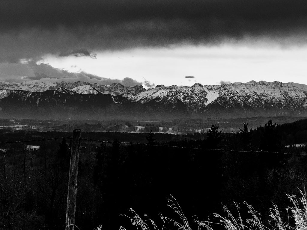
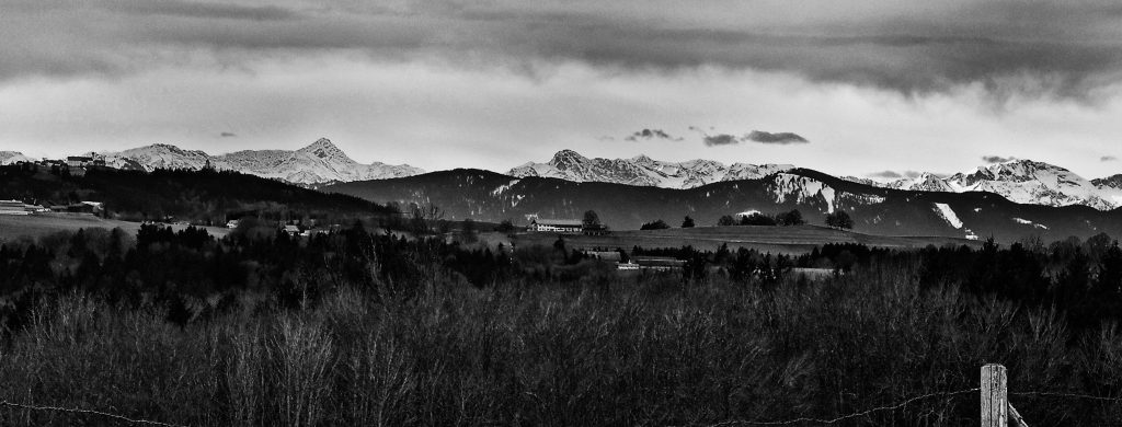
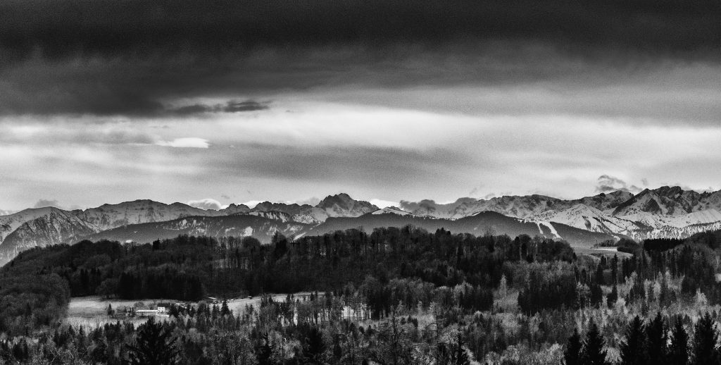
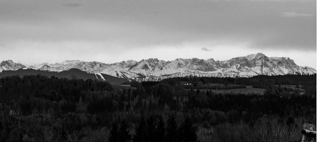
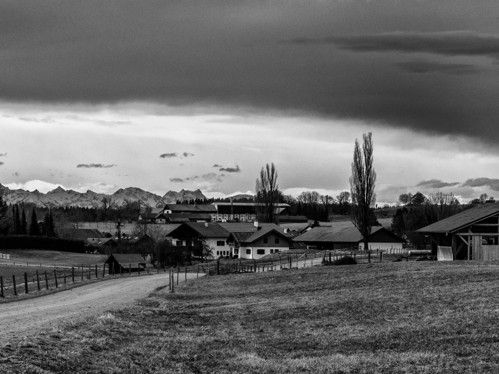
In Oberbayern gibt es eine endlose Zahl von großartigen Aussichtspunkten. Daher mag die Wahl etwas willkürlich erscheinen. Sicherlich wird es deshalb mehr Plätze geben, die noch portraitiert werden, aber kürzlich habe ich einen Aussichtspunkt entdeckt, der mir wegen der einzigartigen Szenerie besonders gefallen hat. Es ist ein Dorf in der Nähe, Wiesen und Wälder und eine freie Sicht auf die ganze Alpenkette.

(Tip: zum Vergrößern der Bilder auf das Bild klicken)

Der Aussichtspunkt ist gut erreichbar, da er in der Nähe des berühmten Klosters Wessobrunn liegt. Dort befindet sich auch ein Parkplatz etwa einen Kilometer vom Aussichtspunkt entfernt. Dieser ist genau genommen eine schmale Straße und eine Hügelkuppe auf dem Weg nach Diessen am Ammersee.

Ich habe den Aussichtspunkt bei einer Wanderung auf einem Abschnitt des König-Ludwig-2-Wanderwegs entdeckt zwischen Diessen und Wessobrunn. Der Aussichtspunkt ist sicherlich der Höhepunkt dieser Wanderung. Es ist möglich diesen Abschnitt in einem Stück zu gehen und auch zurück (nicht so sehr bei großer Hitze zu empfehlen), jedoch muss man wissen, dass es zwischen Diessen und Wessobrunn keinerlei Einkehr gibt. Aufgrund der Länge der Tour (wenn man sie hin- und zurück macht) ist das eigentlich die ideale Fahrradtour.


Der Sonntag, 11 März, war der erste wirklich warme Tag im Süden Deutschlands (17 Grad) nach einer Perode arktischer Kälte (“Beast From The East”). Das war aber hauptsächlich durch den Föhn verursacht, so wie es manchmal in der Winterhälfte passiert. Der Föhn führt zu einem erstaunlichen rapiden Anstieg der Temperaturen.

Die Luft wird dann sehr klar, und man kann die Berge mit vielen Details sehen. Diesen Tag gab es aber auch ein ganz besonderes Phänomen zu sehen, eine sogenannte Föhnkante. Das ist eine ausgeprägte Grenze zwischen den Wolken und den weniger bewölkten Teilen des Himmels.  Sie entsteht wenn der Föhn zusammenzubrechen beginnt. Folglich war es die nächsten Tage auch kälter und eher wieder wie im Winter.

Im März gibt es noch kaum Grün und wenn die Sonne noch hinter hohen Wolken fast verborgen ist, sind die Farben fürs Fotografieren nicht besonders reizvoll. Aber diese Zeit zwischen Winter und Frühling hat auch ihr Potential: jetzt kann man Strukturen gut in Bildern festhalten.

Als ich eine Weile mit der Bearbeitungssoftware dies und jenes probiert hatte entschied ich mich, diese Serie in Schwarzweiss zu präsentieren. Das ist oft eine interessante Option und kann die besondere Atmosphäre eines Ortes oder eines Motivs erst richtig zum Ausdruck bringen.

Der Trick dabei ist nicht einfach auf Schwarzweiss zu schalten, sondern verschiedene Dinge auszuprobieren mit der Software. Spannende Filter gibt es auch in der NIK-collection Software.

Der Aussichtspunkt ist gut zugänglich wenn man den Parkplatz am “Tassiloweg” hinter dem Kloster Wessobrunn benutzt. Dort geht ein steiler Weg hinauf zur Schloßbergstraße. Die Schloßbergstraße führt zur Siedlung Haid, aber man biegt nicht dorthin ab, sondern folgt dem Weg geradeaus. Es geht bergauf. Die Straße wird sehr schmal (besser nicht mit dem Auto dahin fahren, es gibt keine Parkmöglichkeit). Es ist auch zudem ein sehr schöner Spazierweg vom Kloster Wessobrunn aus. Am Ziel findet man auch eine Parkbank. Ein großartiger Platz für eine Rast und selbstverständlich zum Fotografieren.

/a>


Dieser Aussichtspunkt ist nicht mehr weit vom Hohen Peissenberg  entfernt. Beide Plätze eignen sich hervorragend zur Wetterbeobachtung und zur Wetterfotografie. Der Platz bei Wessobrunn könnte auch speziell für Sonnenaufgang und Sonnenuntergang sehr spannend sein. Er präsentiert jedenfalls eine ganz typische oberbayerische Landschaft.

KelbyOne. Learn Photography from the World's Best Instructors.

Der dominanteste Berg in der Siluette ist natürlich die Zuspitze. Vom Aussichtspunkt in Wessobrunn hat man direkt davor den Hohen Peissenberg mit der großen Antenne im Blick. Es ist gut so einen Tag wie diesen Föhntag zu erwischen um die ganzen Details einzufangen. Die niedrigeren Berge im Vordergrund und die großen Gipfel im Hintergrund erlauben Bilder mit einer besonders plastischen Tiefe, wenn die Luftbedingungen passen.

Das Bild oben ist am Aussichtspunkt aufgenommen und zeigt den Hohen Peissenberg. In der Mitte ist die Wallfahrtskirche, auf der rechten Seite ist ein kleiner Turm, der Teil der Wetterstation des Deutschen Wetterdienstes ist. Auf der linken Seite und auch auf dem Bild darunter ist die große Antenne zu sehen.

 

Panoramic Viewpoint: Hilltop Near Wessobrunn, Upper Bavaria

In Upper Bavaria, you can find an endless number of panoramic viewpoints. Thus the choice might appear a bit arbitrary. There will be certainly more places to be portrayed in the future but recently I discovered a viewpoint I particularly liked because of the extraordinary setting. There is a village nearby, meadows and woods and there is a free sight of the whole chain of mountains in the south.

It is easily accessible because it is close to the famous Wessobrunn monastery, where there is also a parking space, approximately one kilometre from the viewpoint which is basically a small road and a hilltop leading towards Diessen am Ammersee.

I discovered this viewpoint when I did part of the “King Ludwig 2 Trail” between Diessen am Ammersee and Wessobrunn. The viewpoint is certainly the highlight of this section of the trail. It is possible to do this (not recommended if it gets too warm) but there is no restaurant or such thing between Diessen and Wessobrunn. Due to the length of this part, it might be most suitable for a bicycle tour.

Sunday, March 11, was the first really warm day (17 Celsius) after the period of the arctic cold (“Beast From The East”) in Southern Bavaria. This was mostly due to the Foehn-Effect, which happens often during the wintertime. Foehn leads to an unusual rise in the temperature. The air becomes very clear and there is a clear sight of the mountains with many details. This day, however, there was also a special phenomenon, the so-called “Föhnkante”. This is a distinct border between clouds and the clearer part of the sky. It appears when the Foehn-Effect starts to break down. Subsequently, the following days were much colder and more winter-like.

In March there is little green and if the sun is behind higher-clouds colour in the landscape isn’t much appealing. But this time of the year between winter and spring could be interesting to capture structures in photography. After some time where I played a bit around with the pictures, I decided to present it in black and white. Black and white is often an interesting option and could reveal much of the special atmosphere of a place. The trick is not just to switch to black and white but trying different things with the software. There are also very good black and white filters in the NIK-collection software.

The viewpoint can be reached easily: you can use the parking space at the “Tassiloweg” behind the monastery. From there a steep path leads to the “Schloßbergstr.” The “Schloßbergstraße” leads to a settlement called “Haid” but do not walk towards the settlement but straight. The street becomes a small single road (better not go by car there because it is really very narrow and there is no parking space). It is great for a walk. There is also a seat there near the viewpoint and its fantastic for a rest – and of course to take pictures.

/a>


The viewpoint is also not so far from the Hohen Peissenberg. Both places are very suitable for weather-photography. The place near Wessobrunn could be also of particular interest for sunsets or sunrise. It presents a very typical Upper Bavaria landscape setting.

KelbyOne. Learn Photography from the World's Best Instructors.
The most dominant mountain in the silhouette in the south is the Zugspitze. Seen from the viewpoint near Wessobrunn you have the Hohen Peissenberg with the big antenna in the foreground before the Zugspitze. It is good to choose a day like this one with the Foehn-Effect or come very early to capture the whole dimension of the view. The lower hills and the bigger mountains in the background add to the depth of the scenery.

The picture above is taken from the viewpoint and shows the whole Hohen Peissenberg. In the middle, there is a church. On the right side, there is a small tower, which is part of the weather station of Deutsche Wetterdienst. On the left side and also in the picture below is the big antenna.

Weather Lookout Points: Solitüde, Flensburg Fjord

Between Germany and Denmark is the Flensburg Fjord (Flensburger Förde). This is a long stretched and curved bay similar to a Scandinavian fjord. It belongs to the Baltic Sea. The Fjord ends in the famous town of Flensburg, which was sometimes a Danish and sometimes a German town. There are also famous tourist spots there as Glücksburg, a small city, and Holnis, a peninsula.

The area is frequented by tourists and sailors a lot and is also a favorite place for painters. A lot of people come from Berlin in the summer. On the other side, in Denmark, there are three little islands, “The Ochseninseln”. Unlike the flat “Nordfriesland” on the west side, the surroundings of the Fjord make a more England-like landscape with its green hills and many woods.

The Fjord is also a great place for weather-watching and photography. There are many viewpoints in Flensburg, on the Danish Coastline or at the top end of the Holnis Peninsula where there is a steep bank (visitors be careful!). It’s also a great place for watching birds or sunsets.

The destinations on the German side along the Flensburg-Fjord are connected by a highway, the “Nordstraße”. There are more fantastic lookout points in Langballig and Habernis.

However it isn’t necessary to do a long car ride, there are also great places within the city-limits of Flensburg: One example is the “Solitüde”, a beach and a quarter of Mürwik on the north-east side of Flensburg. It’s very popular among the inhabitants of Flensburg. Since a long time, there is also a restaurant and a small shipping pear. It’s great for swimming as long as are not so many jellyfish around.

But even more, it’s a great place for photography. It’s worth to visit the place all time of the year. Particularly, if the tourists are gone there is a unique atmosphere.

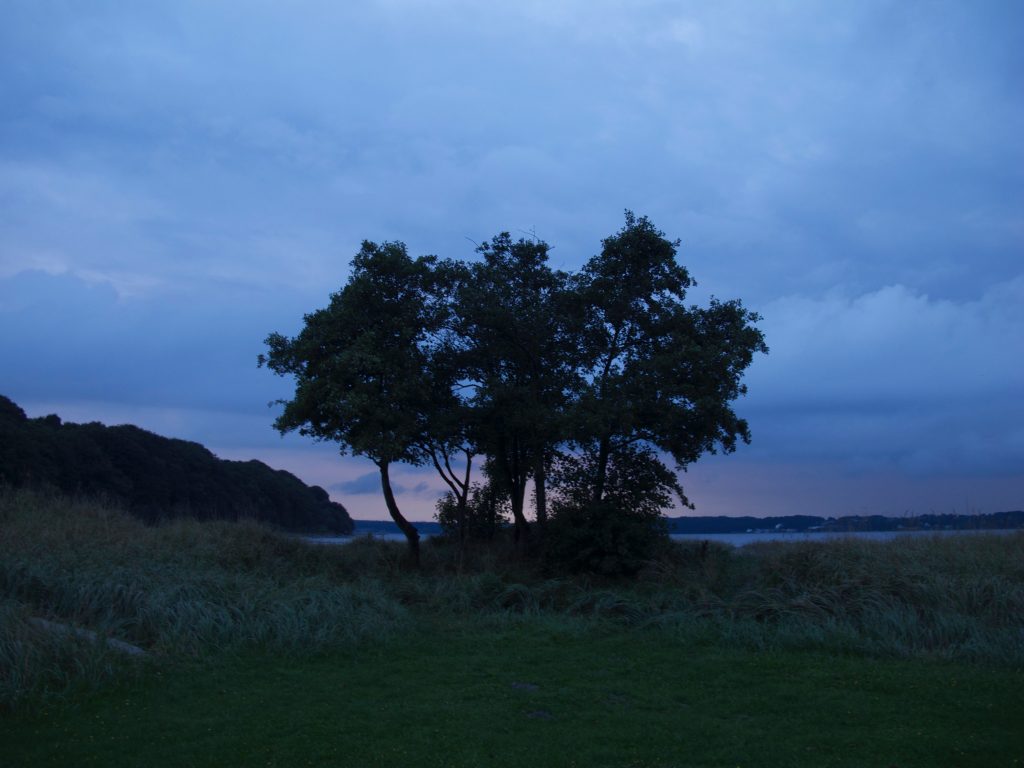
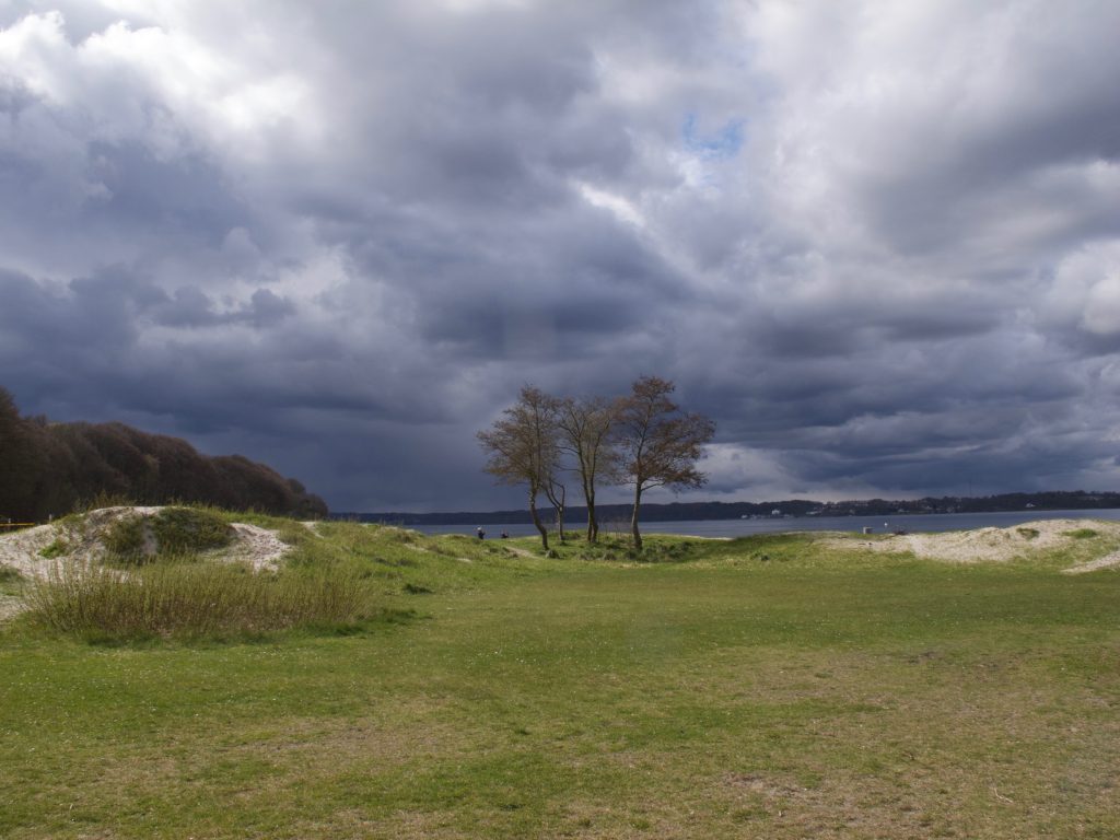
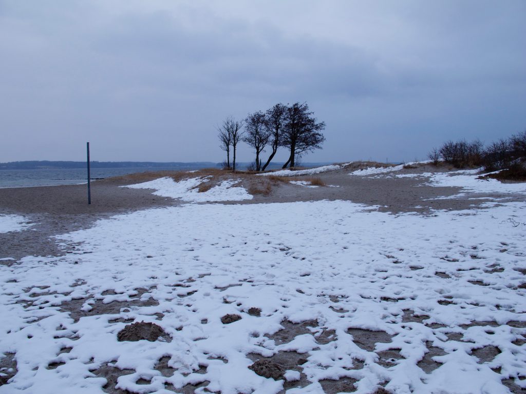
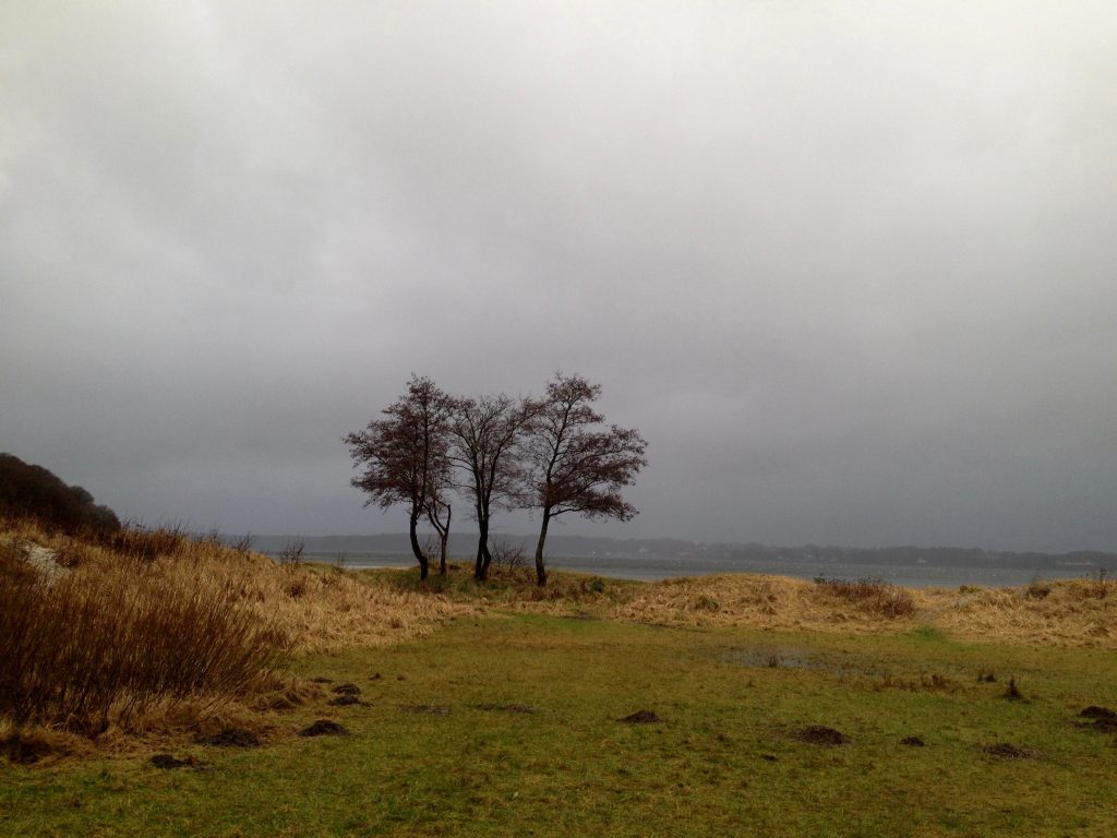
The shore consists of a beach and some meadows. Since I can remember there is a group of trees standing there. They never grew very big. They remind me always of a certain Tarkovsky-Film.

The place is an example of something which had been mentioned before: If you do weather-photography or video it’s always good to have good lookout points in mind, perhaps do an inventory of interesting places in a notebook, with their specific conditions. The Solitüde-Beach in Flensburg is a good example. It is quickly accessible and its a great backdrop. When I was there I always had been watching “great dramas” in the sky. Mostly if the wind is coming in from the North-West, it can be an interesting place.

There is wind most of the time. Weather is often changing quickly here and you have often completely different conditions within a few hours. However, it’s less extreme as on the west side of Germany’s Schleswig-Holstein with the Northern-Sea.

Contrast and color are also different most of the time as on the west-coast but there are many variations in atmospheres. The color of the Fjord’s water also changes all the time.

Even there is no tide on the Baltic-Seaside, water levels are changing too since if there is the wind coming in from the east-side it presses the water into the Fjord. Sometimes there is even flooding in the harbor of Flensburg.

If you do weather-pictures, it is useful to keep a list of landmarks and significant objects like these trees. It adds to the pictures if it’s not only clouds and some meadow and you could do a series over the years. The images with the trees below are an example.


SaveSave

KelbyOne. Get better at travel photography.