Alpine Wildnis, leicht zugänglich: Das Oytal als Top-Location für Landschaftsfotografie

von Peter Engelmann, April 30, 2022

Das Oytal ist ein hochalpines Tal an der Südspitze Deutschlands und eines der beliebtesten Ziele für Touristen und Wanderer, die in Oberstdorf wohnen. Ausflüge dorthin beginnen direkt an der Talstation der Nebelhornbahn. Von hier aus führen mehrere Wanderwege ins Oytal. 

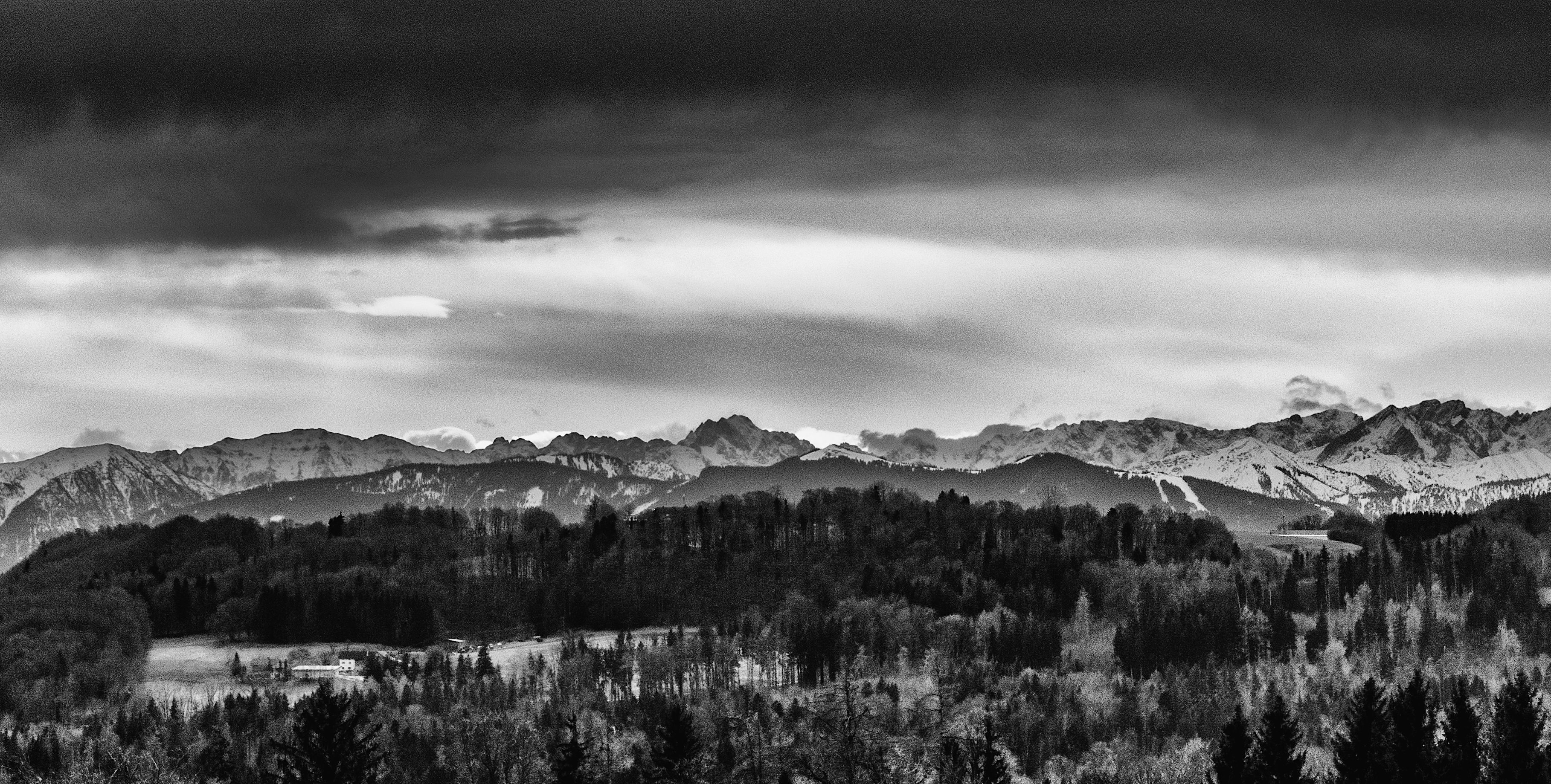
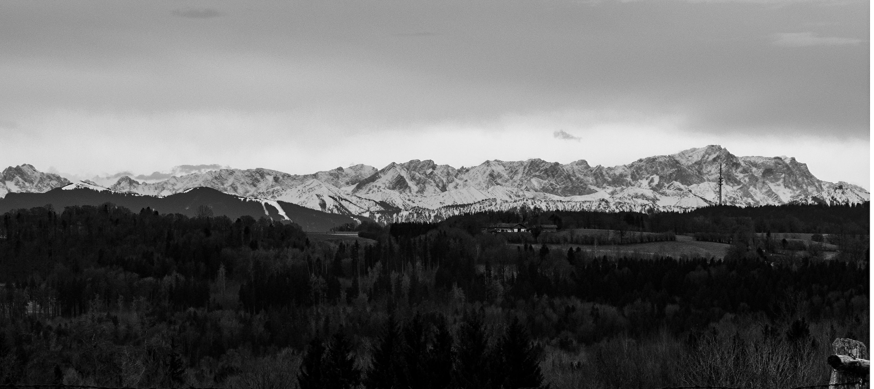
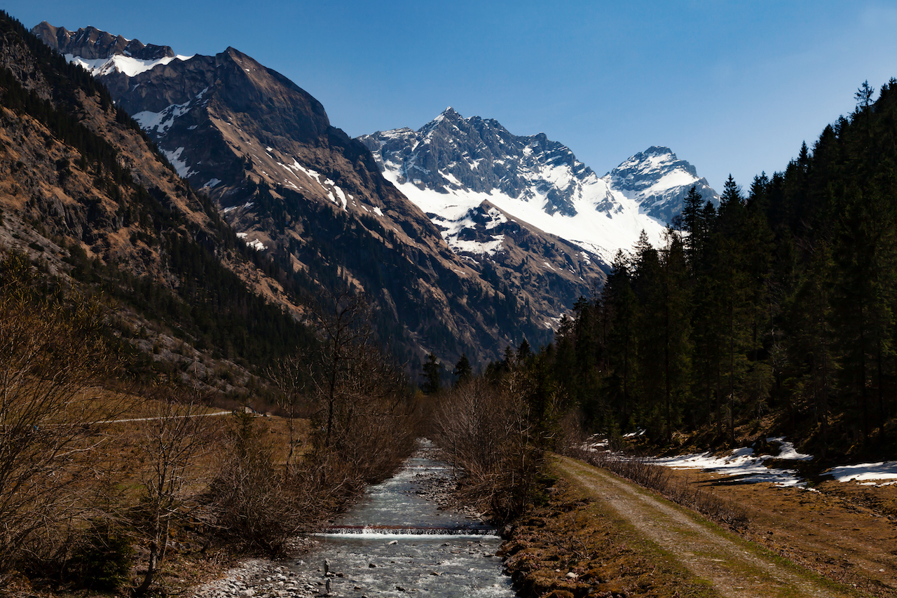
Einer der Wege bringt euch zunächst ins malerische Trettachtal (wo an einer Abzweigung das Oytal beginnt) und zu einem ersten grandiosen Ausblick mit den Gipfeln der Allgäuer Alpen im Hintergrund. Ein weiterer Weg führt hoch über den unteren Teil des Tals und bietet viele Ausblicke. Auch für Filmemacherinnen und Fotografen ist das Oytal das ganze Jahr über ein Top-Ziel.

.


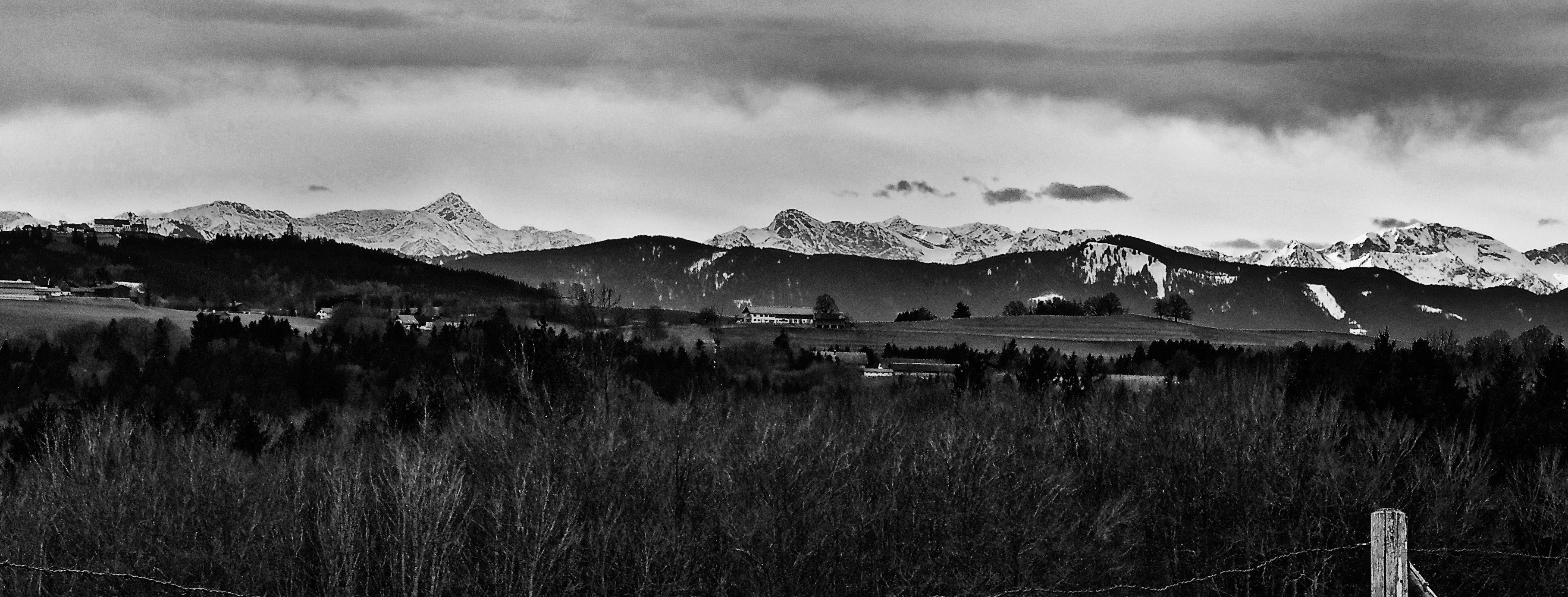
Das Trettachtal bei Oberstdorf

Das Besondere hier ist, dass niemand die Straße oder die bequemen Wege verlassen muss, um an Orte mit fantastischen Foto- und Video-Motiven zu gelangen. Es gibt eine Straße (für den normalen Verkehr gesperrt), die zum Oytalhaus führt, einem traditionellen Berggasthof mit ausgezeichnetem Essen und noch spektakuläreren Aussichten. Ihr erreicht dieses schöne Berggasthaus nach nur 1,5 Stunden Wanderung.

Leichte Wege ohne starke Anstiege

Die Wege von der Nebelhornbahn bis zum Oytalhaus sind für normale Wanderer kein Problem und leicht begehbar. Der kontinuierliche, leichte Anstieg ist ohne steile Abschnitte. Der untere Weg, der bei der Brücke über die Trettach beginnt, heißt Dr. Hohenadl-Weg. Er führt durch einen beeindruckenden Bergwald.

Nach ein paar Kurven tauchen die imponierend hohen Gipfel der monumentalen Berge auf. Dann erreicht der Weg eine schöne Baumallee, eine weitere Besonderheit im Oy-Tal. Während der Saison wird diese Straße von zahlreichen Touristen genutzt, unter ihnen viele Radfahrende.

Das Tal wird breiter und auf der linken Seite kommt die bekannte Seebachwand in Sicht, eine gigantische, geradezu einschüchternde Felswand, an der mehrere Wasserfälle zu erkennen sind. Tatsächlich befindet sich hier einer der höchsten Wasserfälle Europas, direkt gegenüber dem Berggasthof Oytal-Haus. Falls ihr Fotos von den Wasserfällen machen wollt, ist die beste Zeit dafür im Frühling, wenn viel Wasser herunterkommt. Die Wasserfälle im unteren Teil des Tals liegen in einiger Entfernung, und es ist sinnvoll, eine lange Brennweite zu benutzen. Sowohl im Frühling als auch im Herbst kann man in dieser einzigartigen Bergwildnis wunderschöne Farben sehen.


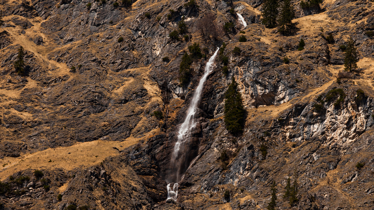
 Seebachwand: Beeindruckende Wasserfälle


Der Weg zwischen dem Oytalhaus und einigen Almen führt zu immer eindrucksvolleren Ausblicken auf die Gipfel und ihre einzigartigen Formen. Auch hier ist der Frühling eine gute Zeit zum Filmen und Fotografieren, solange die Berggipfel noch weiß vom Schnee des letzten Winters sind. Links und rechts davon befinden sich Almwiesen mit seltenen Alpenpflanzen. Bitte seid vorsichtig, denn dies ist ein Naturschutzgebiet, und ihr solltet mithelfen, Tiere und diese seltenen Pflanzen zu schützen. Es gibt ausreichende Möglichkeiten für Video- und Fotoaufnahmen direkt auf dem Weg.
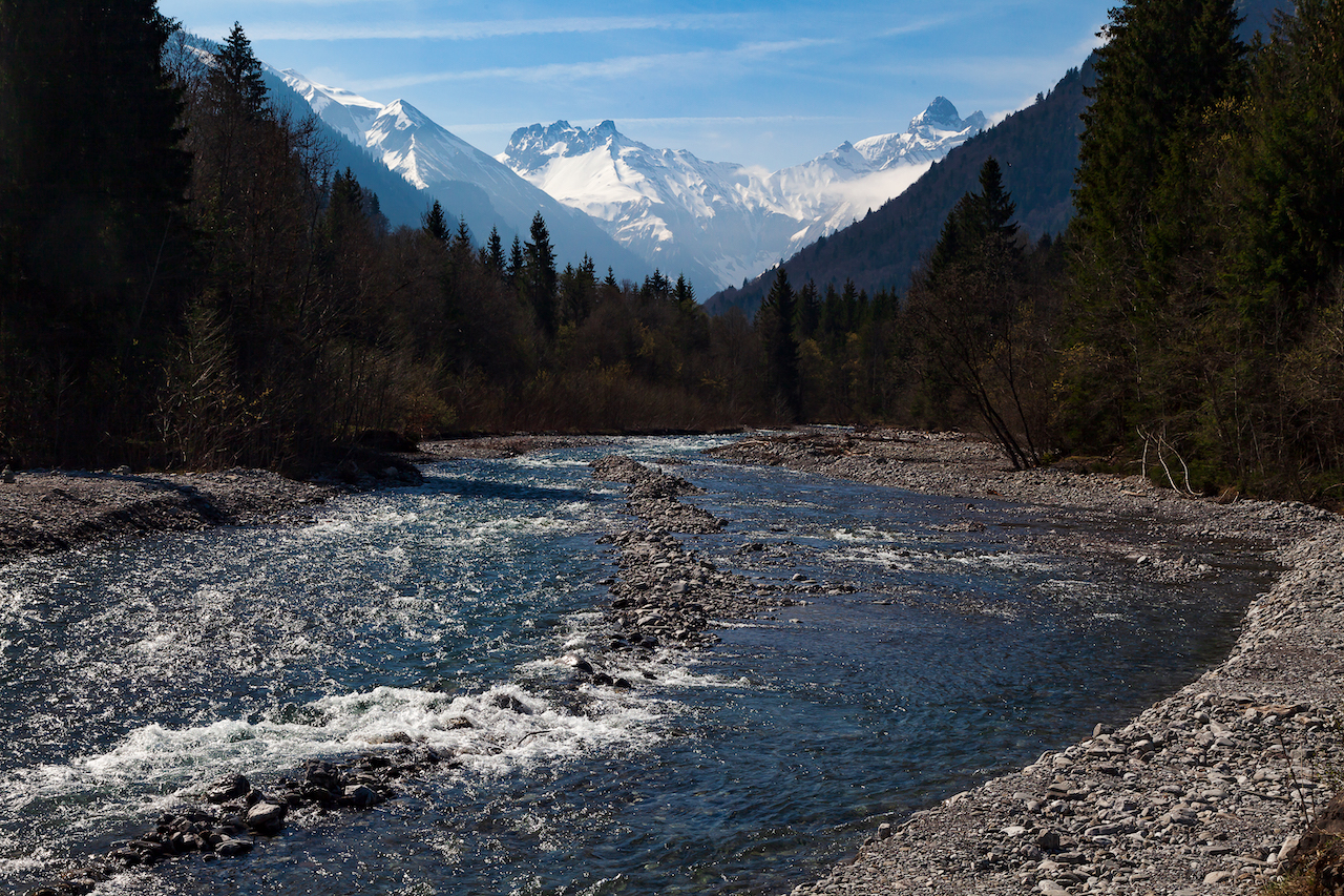

Das Oytal

Wenn ihr Fotos machen wollt und eine ruhige Atmosphäre braucht, ist die Zeit während der Woche, vor oder nach den Hauptferienzeiten oder an einem Tag mit bewölktem Wetter, eine gute Wahl. Im Sommer könnt ihr  für die Rückfahrt auch Bergroller mieten – das geht schnell und macht mega viel Spaß! An den Wochenenden kann es im Oytal sehr voll werden. Auch Mountainbiker sind häufig anzutreffen. Trotzdem gibt es genug Platz für jeden, um die fantastische Natur zu genießen.

Der Weg von der Trettachtalbrücke und dem Oytal-Haus ist nur Teil eines viel größeren Wegenetzes, das hoch in die Berge führt. Er ist eine Zeit lang noch sehr gemütlich (bis zur nächsten Alm), aber er ist langwierig und im oberen Teil gibt es einen steilen Anstieg. Dort oben gibt es weitere Almen, die im Sommer Getränke und regionale „Schmankerln“ anbieten. Ein weiterer großer Wasserfall, der Stuibenfall, befindet sich weiter unten auf dem Weg. Er liegt näher am Weg als die ersten und sieht fantastisch aus, aber um ihn zu erreichen, macht man noch einmal einen 1,5 Stunden langen Spaziergang vom Oytalhaus.


In einigen Gebieten liegt im April noch Schnee.


Typisch für diese Region sind die grasbewachsenen Berge. Sie sollten von Bergsteigern nicht unterschätzt werden, da sie sehr anspruchsvoll sein können. Die Region ist aufgrund ihrer unterschiedlichen Gebirgsformen und der Materialien, aus denen sie bestehen, für Geologie-Interessierte sehr spannend. Ihr seht außergewöhnliche Gesteinsformen und Berge aus verschiedenen Erdzeitaltern.
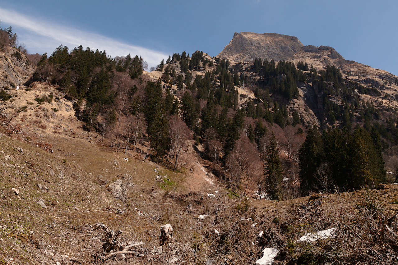

Hoher Grasberg

Wie immer in alpinem Gelände ist eine gute Vorbereitung das A und O. Das Oy-Tal ist leicht zu erreichen, aber man sollte wissen, welche Entfernungen (Gehzeiten) und welche weiteren Möglichkeiten es gibt. Im Sommer ist auch eine anstrengendere Rundtour mit einem Abstieg in ein anderes Bergtal möglich. Diese ist jedoch eher etwas für Leute mit guter Kondition. Auch die Wetterbedingungen können sich schnell ändern.

Im Frühjahr kann es vorkommen, dass im oberen Teil des Tals Wasser in kleinen Bächen über den Weg fließt. In manchen Jahren kann auch im späten Frühjahr noch Schnee in den schattigen Teilen des Tals liegen (geeignetes Schuhwerk dringend empfohlen!). Im Sommer sind die oberen Bereiche der Sonne ausgesetzt.

Beim oberen Teil mit Berggipfeln und weiteren Attraktionen wie dem Eissee hoch über dem Tal solltet ihr bedenken, dass dort ganz andere Bedingungen herrschen als im unteren Teil des Tals mit bequemen Straßen und Wegen. Es handelt sich um schwieriges felsiges und alpines Terrain. Solch ein Gebiet erfordert Erfahrung im Bergwandern. Es ist ein faszinierendes, aber auch potenziell gefährliches Wildnisgebiet. Die Fremdenverkehrsbüros in Oberstdorf und anderen Orten im Allgäu können euch sicherlich mit ihren Ratschlägen weiterhelfen. Dort erfährt man auch, ob die Wanderwege geöffnet oder geschlossen sind und ob die Berghütten offen sind. Die Oytal-Wanderwege sind mit der Bahn und mit dem Auto erreichbar. In der Nähe der Nebelhornbahn-Station befindet sich ein großer Parkplatz. Zug und Busse verkehren häufig und sind – wie meist – eine gute Alternative zum Pkw.

© Deutsche Übersetzung: Susanne Niemuth-Engelmann / Redaktionsbüro Niemuth, https://redaktionsbuero-niemuth.de/ / 27.01.25

An Alpine Wilderness Easy Accessible For Landscape Photography – Oy Valley

by Peter Engelmann, April 30, 2022

The Oy valley or Oytal is a high alpine valley at the Southern tip of Germany. It is one of the most popular destinations among tourists and hikers staying in Oberstdorf. Trips into the Oytal start straight near the valley station of the Nebelhornbahn ropeway. From here a couple of trails lead towards the Oy valley. One trail leads to the pitoresque Trettach valley first (where the Oy valley begins at a fork) and to a first grand scenic view with the tops of the Allgäuer Alpen in the background. Another trail leads high up over the lower part of the valley and offers many vistas. The Oy valley is top destination also for filmmakers and photographers throughout the year.

Trettach Valley near Oberstdorf

What’s special here is that nobody has to leave the road or very comfortable trails to get to places for fantastic motives for video and photo. There is a road (closed for normal traffic) leading to the Oytalhaus, a traditional mountain inn with excellent food and more spectacular views. You reach this lovely mountain inn after 1 1/2 hours walk.

The trails from the Nebelhornbahn ropeway til the Oytalhaus are no problem for normal walkers and easy accessible. There are no steep climbs. It’s more a continuous ascend. The lower trail beginning at the bridge over the Trettach is called Dr. Hohenadl Weg. It leads through an impressing mountain forest.

After a few bends the high and intimidating high peaks of huge mountains show up. Then the trail reaches an alley with trees which is another unique feature in the Oy valley. During the season a lot of tourists use this road.

The valley broadens and on the left side the well-known Seebachwand comes into view. It is a huge intimidating rock-face. Here are some water falls and indeed there is one of the highest waterfalls in Europe here right across the Oytal Haus Mountain inn. If you want to takes pictures of the falls the best time is in spring when a lot of water comes down. The water falls in the lower part of the valley are in some distance. It’s good to have a long focal length. Both in spring and autumn you see wonderful colors in this unique mountain wilderness.

Impressive water falls, Seebachwand

The trail between the Oytalhaus mountain inn and some alpine farms leads to more and more impressive sights of the peaks and their unique shapes. Spring is again a good time as long as the mountain tops are white with snow from the last winter. To the left and to the right there are alpine meadows with rare alpine plants. Please be careful, because this a nature reserve and help to protect animals and these rare plants. There is really plenty to shoot for video and photography straight from the trail.

Oytal Valley

If you want to take pictures and need a quiet atmosphere during the week, for or after the main holiday seasons or on a day with cloudy weather conditions is a good time. During afternoon in summer tourists can rent special scooters for a fast journey back. And there can be a lot of people out there on weekends. There are also plenty of mountain bikers often. Nevertheless there is enough room for anybody to enjoy the fantastic nature.

The trail from the Trettach valley bridge and the Oytal Haus is only part of a much bigger network of trails which lead high up into the mountains. It is for some time still very comfortable (til the next alpine farm) but its lengthy and in the higher part there is a steep ascent. There are more alpine farms up there which offer food and drinks during the summer time. Another huge waterfall is further down the trail (Stuibenfall), which is closer to the trail then the first ones and it looks fantastic, but this is another one and a half hour walk from the Oytalhaus.

In some areas there is still snow in April

A typical thing for these regions are grassy mountains. They should never be underestimated by climbers because they can be very challenging. The region is due to its different type of mountains and the materials they are made of highly interesting for people who are into geology. You see outstanding forms of rock, mountains and different earth ages.

High grass mountain

Good preparation is key as always in alpine terrain. The Oy valley is easy accessible but its good to know about distances (walking times) and what are further options. During summer there is also an exhausting round trip possible with a descend into another mountain valley. However, these might be more for people with a good condition. Weather conditions could change quickly, too.

Sometimes, in spring, water runs in small creeks over the trail in the upper parts of the valley. There might be also snow even in late spring some years in shadowy parts of the valley (proper shoes for hiking strongly recommended). In summer the upper parts are exposed to the sun.

For the high part with mountain peaks and more attractions like the Eissee high above the valley please keep in mind that there are completely different conditions as in the bottom of the valley with comfortable roads and trails. It’s difficult rocky and alpine terrain. It requires experience with hiking in the mountains and it’s a fascinating but also potentially dangerous wilderness region. Tourist offices in Oberstdorf and other towns and villages in the Allgäu-Region can certainly help with good advice. They can tell you also if trails are open or closed or if moutain huts are open. The Oytal trails are accessible by train and by car. There is a huge parking slot near the Nebelhornbahn ropeway station. But it’s great to use the train and the buses, which run frequently.

Aussichtspunkt: Hügel bei Wessobrunn in Oberbayern

In Oberbayern gibt es eine endlose Zahl von großartigen Aussichtspunkten. Daher mag die Wahl etwas willkürlich erscheinen. Sicherlich wird es deshalb mehr Plätze geben, die noch portraitiert werden, aber kürzlich habe ich einen Aussichtspunkt entdeckt, der mir wegen der einzigartigen Szenerie besonders gefallen hat. Es ist ein Dorf in der Nähe, Wiesen und Wälder und eine freie Sicht auf die ganze Alpenkette.

(Tip: zum Vergrößern der Bilder auf das Bild klicken)

Der Aussichtspunkt ist gut erreichbar, da er in der Nähe des berühmten Klosters Wessobrunn liegt. Dort befindet sich auch ein Parkplatz etwa einen Kilometer vom Aussichtspunkt entfernt. Dieser ist genau genommen eine schmale Straße und eine Hügelkuppe auf dem Weg nach Diessen am Ammersee.

Ich habe den Aussichtspunkt bei einer Wanderung auf einem Abschnitt des König-Ludwig-2-Wanderwegs entdeckt zwischen Diessen und Wessobrunn. Der Aussichtspunkt ist sicherlich der Höhepunkt dieser Wanderung. Es ist möglich diesen Abschnitt in einem Stück zu gehen und auch zurück (nicht so sehr bei großer Hitze zu empfehlen), jedoch muss man wissen, dass es zwischen Diessen und Wessobrunn keinerlei Einkehr gibt. Aufgrund der Länge der Tour (wenn man sie hin- und zurück macht) ist das eigentlich die ideale Fahrradtour.


Der Sonntag, 11 März, war der erste wirklich warme Tag im Süden Deutschlands (17 Grad) nach einer Perode arktischer Kälte (“Beast From The East”). Das war aber hauptsächlich durch den Föhn verursacht, so wie es manchmal in der Winterhälfte passiert. Der Föhn führt zu einem erstaunlichen rapiden Anstieg der Temperaturen.

Die Luft wird dann sehr klar, und man kann die Berge mit vielen Details sehen. Diesen Tag gab es aber auch ein ganz besonderes Phänomen zu sehen, eine sogenannte Föhnkante. Das ist eine ausgeprägte Grenze zwischen den Wolken und den weniger bewölkten Teilen des Himmels.  Sie entsteht wenn der Föhn zusammenzubrechen beginnt. Folglich war es die nächsten Tage auch kälter und eher wieder wie im Winter.

Im März gibt es noch kaum Grün und wenn die Sonne noch hinter hohen Wolken fast verborgen ist, sind die Farben fürs Fotografieren nicht besonders reizvoll. Aber diese Zeit zwischen Winter und Frühling hat auch ihr Potential: jetzt kann man Strukturen gut in Bildern festhalten.

Als ich eine Weile mit der Bearbeitungssoftware dies und jenes probiert hatte entschied ich mich, diese Serie in Schwarzweiss zu präsentieren. Das ist oft eine interessante Option und kann die besondere Atmosphäre eines Ortes oder eines Motivs erst richtig zum Ausdruck bringen.

Der Trick dabei ist nicht einfach auf Schwarzweiss zu schalten, sondern verschiedene Dinge auszuprobieren mit der Software. Spannende Filter gibt es auch in der NIK-collection Software.

Der Aussichtspunkt ist gut zugänglich wenn man den Parkplatz am “Tassiloweg” hinter dem Kloster Wessobrunn benutzt. Dort geht ein steiler Weg hinauf zur Schloßbergstraße. Die Schloßbergstraße führt zur Siedlung Haid, aber man biegt nicht dorthin ab, sondern folgt dem Weg geradeaus. Es geht bergauf. Die Straße wird sehr schmal (besser nicht mit dem Auto dahin fahren, es gibt keine Parkmöglichkeit). Es ist auch zudem ein sehr schöner Spazierweg vom Kloster Wessobrunn aus. Am Ziel findet man auch eine Parkbank. Ein großartiger Platz für eine Rast und selbstverständlich zum Fotografieren.

/a>


Dieser Aussichtspunkt ist nicht mehr weit vom Hohen Peissenberg  entfernt. Beide Plätze eignen sich hervorragend zur Wetterbeobachtung und zur Wetterfotografie. Der Platz bei Wessobrunn könnte auch speziell für Sonnenaufgang und Sonnenuntergang sehr spannend sein. Er präsentiert jedenfalls eine ganz typische oberbayerische Landschaft.

KelbyOne. Learn Photography from the World's Best Instructors.

Der dominanteste Berg in der Siluette ist natürlich die Zuspitze. Vom Aussichtspunkt in Wessobrunn hat man direkt davor den Hohen Peissenberg mit der großen Antenne im Blick. Es ist gut so einen Tag wie diesen Föhntag zu erwischen um die ganzen Details einzufangen. Die niedrigeren Berge im Vordergrund und die großen Gipfel im Hintergrund erlauben Bilder mit einer besonders plastischen Tiefe, wenn die Luftbedingungen passen.

Das Bild oben ist am Aussichtspunkt aufgenommen und zeigt den Hohen Peissenberg. In der Mitte ist die Wallfahrtskirche, auf der rechten Seite ist ein kleiner Turm, der Teil der Wetterstation des Deutschen Wetterdienstes ist. Auf der linken Seite und auch auf dem Bild darunter ist die große Antenne zu sehen.


Panoramic Viewpoint: Hilltop Near Wessobrunn, Upper Bavaria

In Upper Bavaria, you can find an endless number of panoramic viewpoints. Thus the choice might appear a bit arbitrary. There will be certainly more places to be portrayed in the future but recently I discovered a viewpoint I particularly liked because of the extraordinary setting. There is a village nearby, meadows and woods and there is a free sight of the whole chain of mountains in the south.

It is easily accessible because it is close to the famous Wessobrunn monastery, where there is also a parking space, approximately one kilometre from the viewpoint which is basically a small road and a hilltop leading towards Diessen am Ammersee.

I discovered this viewpoint when I did part of the “King Ludwig 2 Trail” between Diessen am Ammersee and Wessobrunn. The viewpoint is certainly the highlight of this section of the trail. It is possible to do this (not recommended if it gets too warm) but there is no restaurant or such thing between Diessen and Wessobrunn. Due to the length of this part, it might be most suitable for a bicycle tour.

Sunday, March 11, was the first really warm day (17 Celsius) after the period of the arctic cold (“Beast From The East”) in Southern Bavaria. This was mostly due to the Foehn-Effect, which happens often during the wintertime. Foehn leads to an unusual rise in the temperature. The air becomes very clear and there is a clear sight of the mountains with many details. This day, however, there was also a special phenomenon, the so-called “Föhnkante”. This is a distinct border between clouds and the clearer part of the sky. It appears when the Foehn-Effect starts to break down. Subsequently, the following days were much colder and more winter-like.

In March there is little green and if the sun is behind higher-clouds colour in the landscape isn’t much appealing. But this time of the year between winter and spring could be interesting to capture structures in photography. After some time where I played a bit around with the pictures, I decided to present it in black and white. Black and white is often an interesting option and could reveal much of the special atmosphere of a place. The trick is not just to switch to black and white but trying different things with the software. There are also very good black and white filters in the NIK-collection software.

The viewpoint can be reached easily: you can use the parking space at the “Tassiloweg” behind the monastery. From there a steep path leads to the “Schloßbergstr.” The “Schloßbergstraße” leads to a settlement called “Haid” but do not walk towards the settlement but straight. The street becomes a small single road (better not go by car there because it is really very narrow and there is no parking space). It is great for a walk. There is also a seat there near the viewpoint and its fantastic for a rest – and of course to take pictures.

/a>


The viewpoint is also not so far from the Hohen Peissenberg. Both places are very suitable for weather-photography. The place near Wessobrunn could be also of particular interest for sunsets or sunrise. It presents a very typical Upper Bavaria landscape setting.

KelbyOne. Learn Photography from the World's Best Instructors.
The most dominant mountain in the silhouette in the south is the Zugspitze. Seen from the viewpoint near Wessobrunn you have the Hohen Peissenberg with the big antenna in the foreground before the Zugspitze. It is good to choose a day like this one with the Foehn-Effect or come very early to capture the whole dimension of the view. The lower hills and the bigger mountains in the background add to the depth of the scenery.

The picture above is taken from the viewpoint and shows the whole Hohen Peissenberg. In the middle, there is a church. On the right side, there is a small tower, which is part of the weather station of Deutsche Wetterdienst. On the left side and also in the picture below is the big antenna.