Wild Tyrolean Valley After Severe Winter


Musau, Austria, May 19, 2019

In April 2019 there were many fears in Central Europe that 2019 would repeat its extreme weather patterns with a drought in many parts of Germany. Luckily, in May 2019 weather turned back to normal patterns with rain and colder temperatures. Unlike other areas, there had been a lot of precipitation in the Alps during winter 2018/2019. In some places, there were tons of snow. Devastating avalanches threatened some alpine valleys. There had also been some storms which did severe damage in the mountain forest.

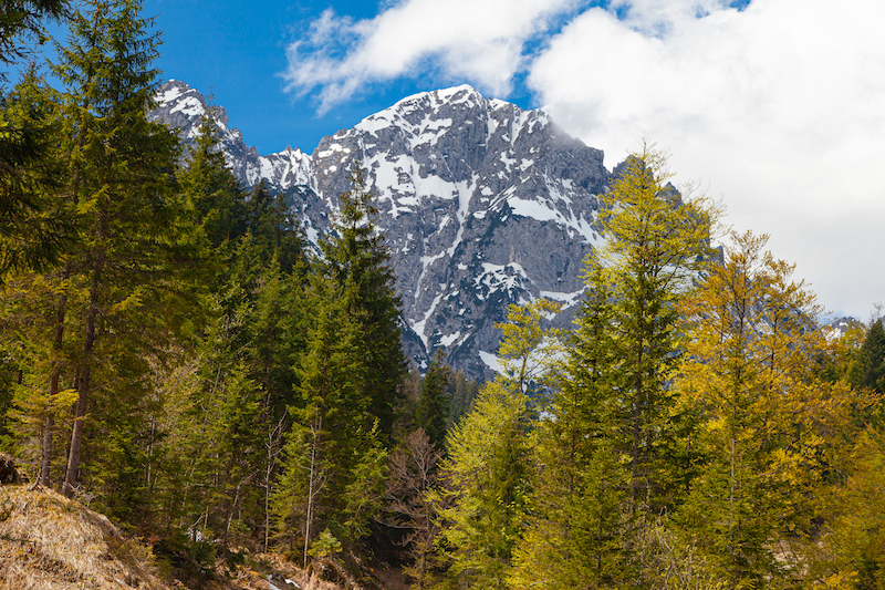
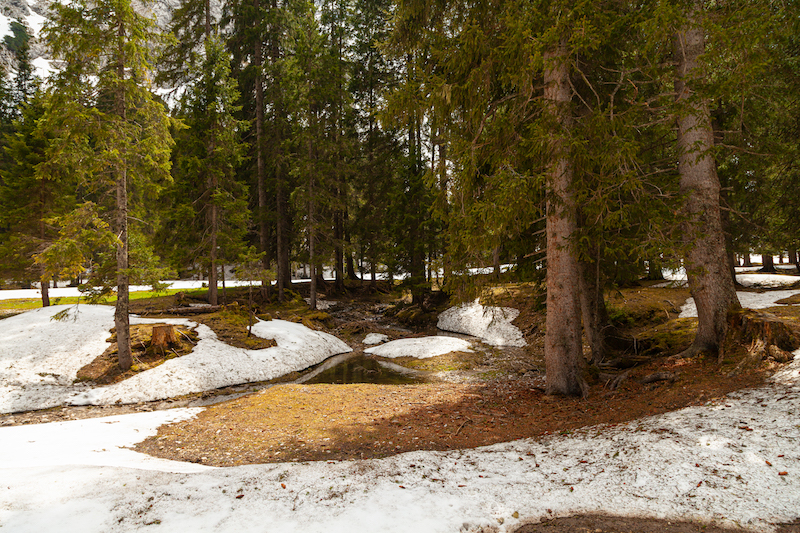
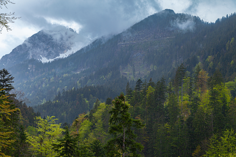
A trip into the Alps in May is a fascinating thing. Particularly after a period with the above-mentioned weather extremes. In the higher regions, a hike can begin in “summer” with green meadows and warm temperatures but winter isn’t very far. It is also a chance to see the power of nature. It is the time of devastating thaws when the huge mass of snow melts quickly. And there are many traces of this last winter: Nature is recovering from avalanches and in the mountain forest we see the destructive force of severe storms.

Spring happens late in the mountains. It is a short time span when life returns to the frozen world. It is time to experience both the destructive power of the elements and its incredible beauty.

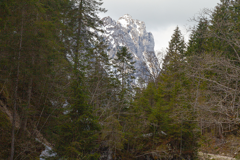
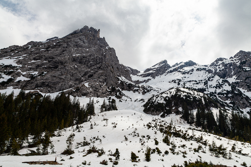
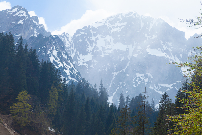
The Rein valley near Musau in Tyrol offers it all. It is perfect for a trip and is easily accessible. It is one of the most impressive valleys in the Northern Alps. Steep Rock faces, a raging river, a very natural forest and high peaks of the “Allgäuer Berge” makes it an unparalleled experience.

In Musau there is both a train station but also a parking spot, “Bärenfalle” at the beginning of the hike. The first half hour of the walk is in the forest and a steep ascent. After a while, the trail reaches the first vantage points. The peaks of the mountains become visible.

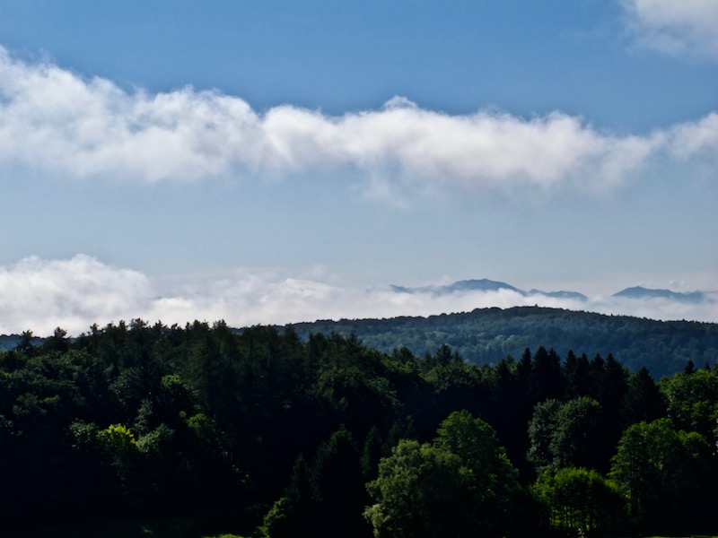
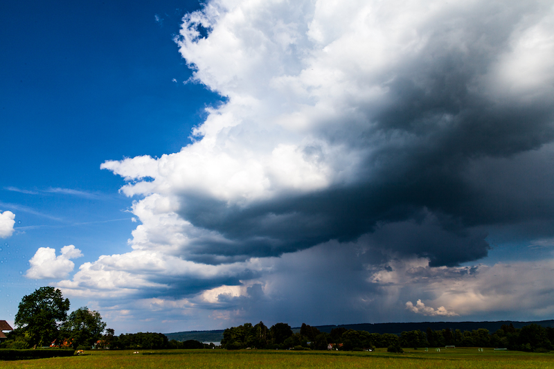
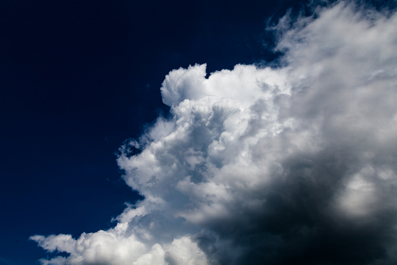
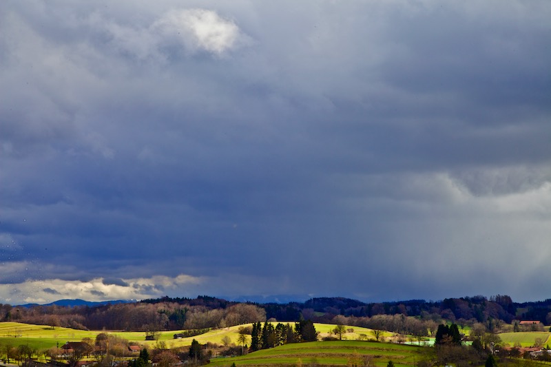
Sunday, May 19, started as a sunny and slightly cloudy day. However, there was a severe weather warning in place. It was said that thunderstorms would already occur before noon. The good weather lasted longer as expected.

Majestic Mountains in the background.
Mountain Forest In The Rein Valley

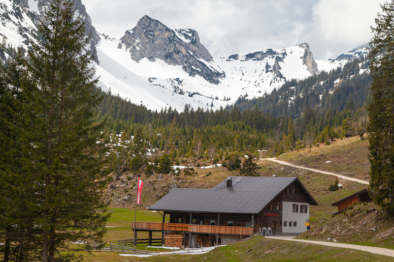
The trail is also a forest road which connects the village with the Musauer Alm and the Cabins, the Otto Mayr Hütte and the Füssener Hütte.

Road In The Rein Valley
Spring Flowers

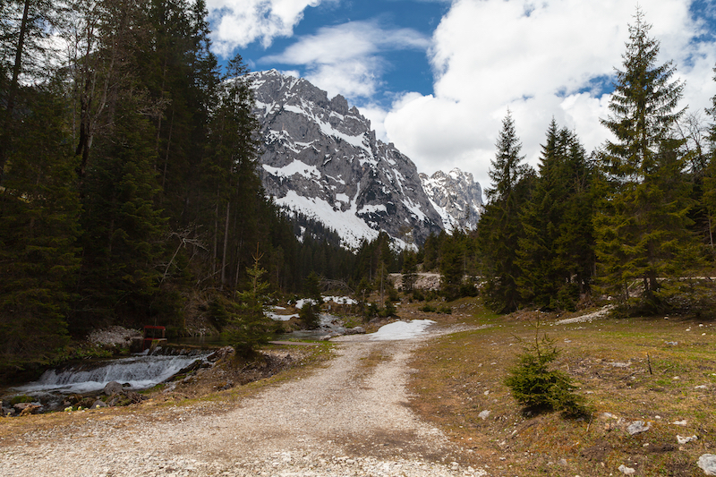
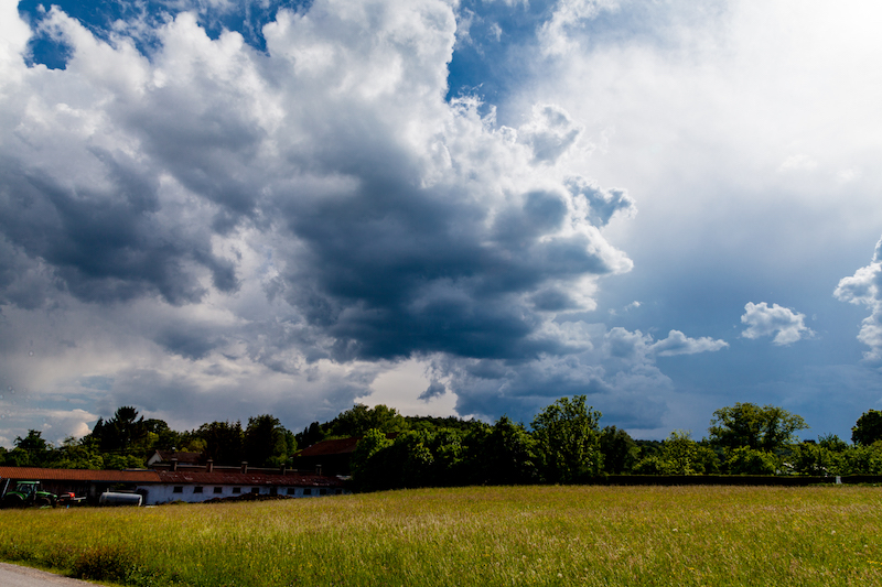
After approximately one and a half hour of walking the cosy Musauer Alm comes into sight. It is the perfect opportunity for a stop and getting some good food in a very friendly atmosphere. After the stop which was in the middle of the day, the weather still looked fine. It seemed that the weather forecast wasn’t right. But in the mountains, you need to be very attentive and conditions can change very quickly.

Musauer Alm

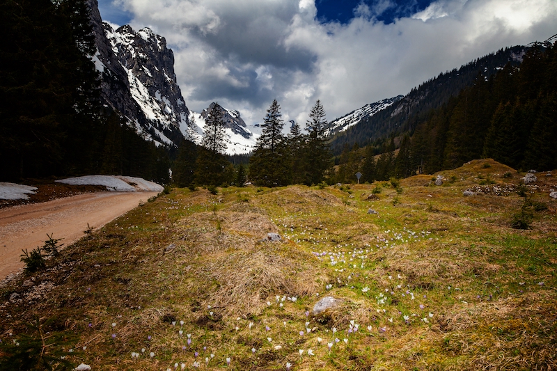
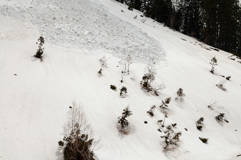
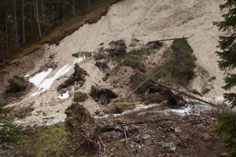
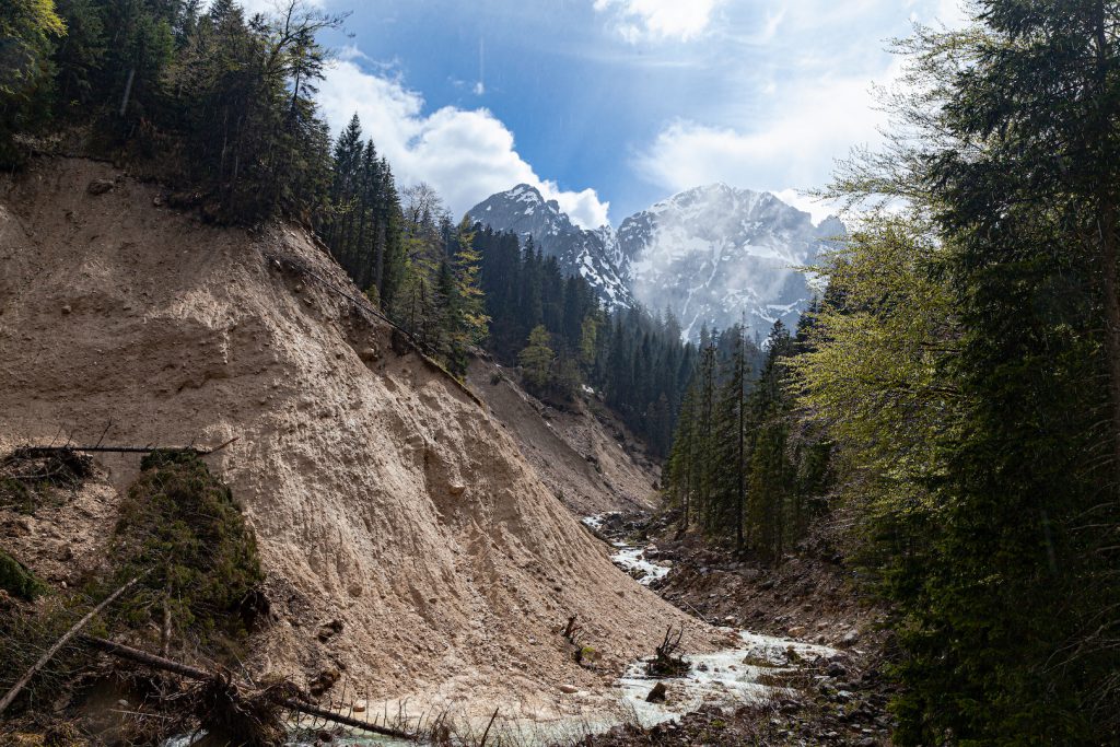
Behind the Musauer Alm, the trail leads higher up into the valley. Here the image changed completely. Instead of the romantic green valley, it looked more and more like a battlefield of the forces of nature. Overturned trees, the remains of an avalanche and huge fields of snow left a deep impression. One could see what the severe winter in the alps did. In some places, it changed the face of the landscape.

After the severe winter
Avalanche
There is still a lot of snow.

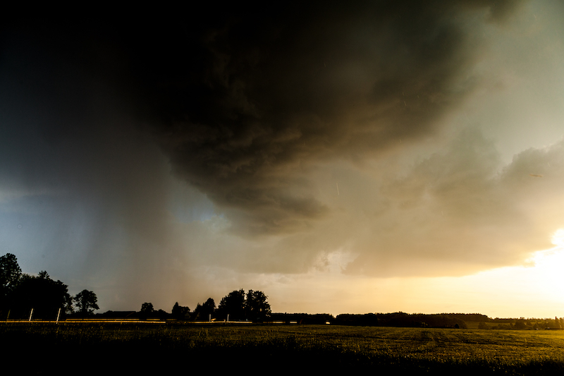
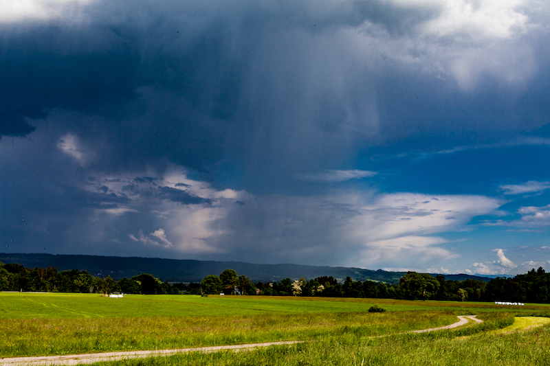
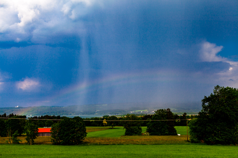
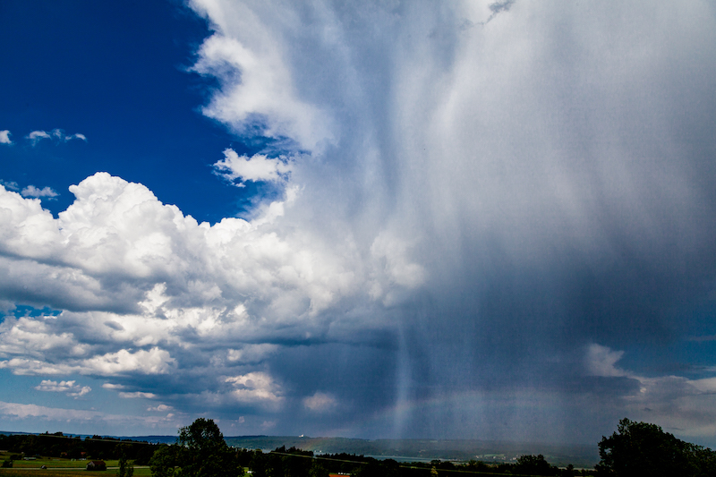
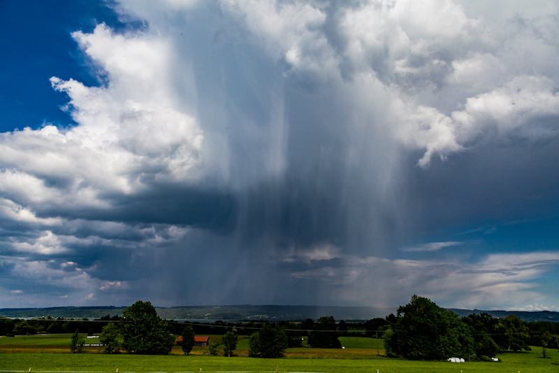
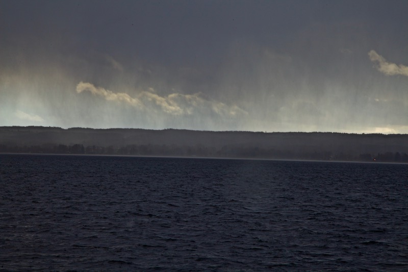
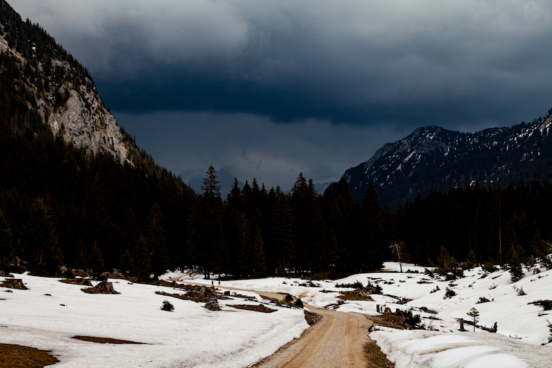
Then it happened. It wasn’t too long and early afternoon when the weather changed completely. Rain and thunderstorm clouds appeared quickly from the east. It was time to turn around and head back down into the valley.

Arrival Of A Thunderstorm In The Mountains.

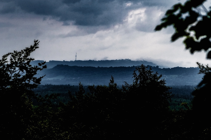
Faster than expected the sun appeared again after a heavy rain shower and some thunder in the clouds. It was then when there was a special magic in the landscape.

Winter And Summer At The Same Time

It was also an opportunity to study the work of erosion near the river. Rain and tough conditions led to mudslides and other destruction.

Massive Destruction

Erosion near the “Saba Bach”

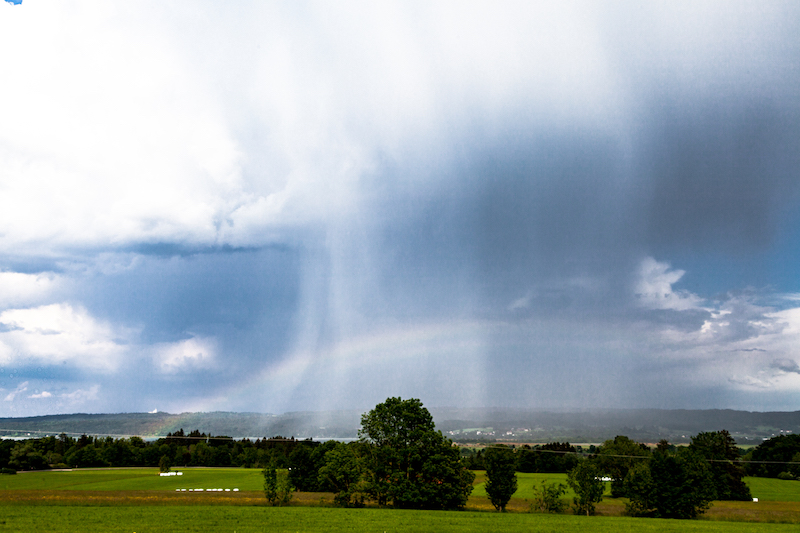
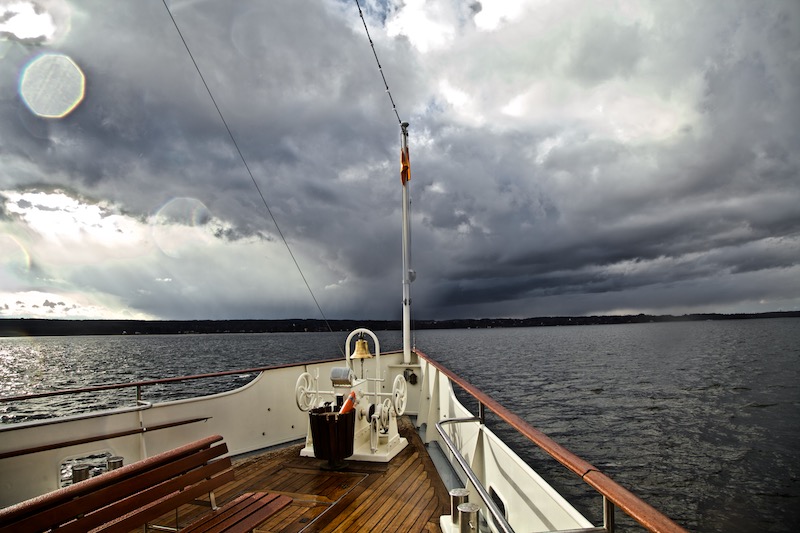
Later in the afternoon, the sky was overcast. After the rain mist ascended from the forest. It was a completely different, more mystical air. It proved again that rainy weather is often the most interesting weather condition for dramatic pictures in the mountains.

Rain Clouds and The Green Trees

The wet weather attracted also a special animal, which is rare to see. The black salamander.

Salamander

The spectacular valley and the Musauer Alm is not far from the famous town of Füssen (with the prominent Neuschwanstein castle). On the Austrian side, Reutte and the “Lechtal-Region isn’t far. The Lechtal with the river Lech is one of Europe’s last river wilderness regions. It contains different types of forest, rich animal life and more spectacular mountain sceneries.

In some places, there was indeed severe weather on May 19. In East-Germany flooding was reported and there were heavy thunderstorms. It was also the beginning of a long rainy period with some flooding in Southern Germany. This is not unusual for May. In 1999 and 2005 there were floods which led to a lot of destruction. The events of 1999 gave reason to improve precautions against flooding for example in Garmisch-Partenkirchen in Upper Bavaria.

A Waterfall In The Sky: Thunderstorms In May And Fallstripes

May is often a time in the year of short-lived thunderstorms and some cooler rainy days in Middle Europe. However, since some years there is also more severe weather with flash floods and even tornados in May. 2018 had been particularly unusual with new temperature records in April. It was too dry in many areas and it still is. A big problem is that it seems that steady rain is missing more and more. Long lasting rain was a common weather pattern every year which wasn’t very amusing for tourists but important for nature and farming. That changed. As predicted by climate change researchers we have more showers and thunderstorm with extreme flooding now.

When I was younger I remember May not as a very warm month. In some years there was still a lot of snow in the mountains. Often it was very cold in the middle of the month. But this year it was more like midsummer rather than spring.

In Southern Germany, the dry period ended to a certain extent and more and more showers and thunderstorms happened.

The first thunderstorm in my area close to lake Ammersee in Upper Bavaria developed on early evening May 12.

It was very impressing because of the late sun which illuminated the clouds and rain at a low angle. May is a good time for taking pictures of thunderstorms because often the light is better as in July and the air is often more clear. Furthermore, it is a good time to photograph fall stripes of rain which look like curtains and can create very interesting patterns.

The following days more thunderstorms occurred. Weather forecasters had a tough time during May. A couple of time stable, warm weather was predicted. But weather doesn’t behave like it was supposed to be. On Pentecost, May20+21, it should have been warm and dry but there were thunderstorms and showers. May 20 indeed was a surprise, because that “summer day” was more or less a dark day with a heavy thunderstorm and flooding in a village between Murnau and Garmisch Partenkirchen. Already on May 18 an open-air event had to be cancelled due to a thunderstorm in Fürstenfeldbruck, a city not far from Munich.


This is what Sunday, May 20, happened: In the afternoon the sky was loaded with dark clouds and rain. There were also shrouds of mist surrounding the Hohen Peissenberg, which can be seen in the background. Some lightning could be seen in the South. In the evening the weather calmed down.

Morning, May 21, began with a misty sky. There was a low hanging layer of mist between the mountains an the lower areas. The mist soon disappeared and the sky became clear:
The air was still humid and the sun was hot. Perfect conditions for the development of further thunderstorms. In the late afternoon, a thunderstorm cell moved towards lake Ammersee. It was very interesting to follow this thunderstorm since there were fascinating patterns of fall stripes. Furthermore, there was also a rainbow.

It was remarkable that this year in May the thunderstorms were often moving in unusual directions. Sometimes there were moving from South-East to South-West or from North to South. Mostly weather systems are moving from West to East. An unusual constellation of pressure systems in Europe was one reason for the long dry period and the further development.

The thunderstorm on May 21 was coming closer for some time but then stopped. Perhaps the huge lake had an influence. It happens often that lakes are influencing local weather.

In this case, it was again good to know some viewpoints in the area before. It made it easier to follow the weather pattern.

The higher position was particularly helpful to see the rainbow which developed during the thunderstorm.

The rainbow was barely visible for some time but then intensified.

However the most special thing was the development in the upper part of the thunderstorm-cloud.

There were not only fall stripes below the cloud but in this case, it was clearly visible that rain came from the upper levels.

It was indeed like a “waterfall” in the sky.

The unstable weather continued.The title picture was taken a few days later, May 24.

There were further dramatic events in the middle of Germany with flooding. There was also a tremendous portion of hail in some places.
KelbyOne. Get better at landscape photography.

April Weather

April weather has a certain reputation. It is often non-predictable. The German term “Aprilwetter” means usually a rapid change between sunshine and rain. It means a day with a lot of showers and sunshine. But April weather is also about extremes: It happens a lot that winter returns with snow and frost as last year (2017). In some years there is also a first heat wave. I remember years when people in Berlin went swimming in the lakes in April.

Such a little heat wave has happened currently in Middle Europe. However, it seems that this year “April Weather” is a candidate for new extremes: We just heard about many new temperature records in Germany (Jena 29,7 Celsius on Thursday, April 19).

But why is April weather so special? There are a couple of factors involved: In April it gets warmer but there is a difference between the landmass and the sea. The sea is still very cold. Furthermore, the Northern regions are still very cold. At the same time, it is already very warm in the South (Southern Europe, North-Africa).

Typical “April weather” happens when cold air from the Northern Atlantic and the Northern Sea reaches middle Europe and has become more an more humid. Now – over land – the air is getting warm and rises. The condensed water vaporizes and is turned into shower clouds. The whole mass of air is not stable. Since it is still very cold in the upper levels of the atmosphere there is sleet, hail, snow, and rain.

The effect is completed when cold air descends and creates larger areas of clear air between the shower clouds. This way the typical “April Weather” effect is created: a mix of showers and moments of sunshine.

“April Weather” is a normal weather phenomenon, which is a powerful demonstration of the struggle between winter and summer. Some people suffer not only because you could easily get a cold but this weather pattern also triggers headaches.

It can be also a challenge for farmers: for example, the late return of winter in 2017 led to crop failures due to frost. Fruit trees are particularly vulnerable and late frost can seriously damage them.


For photographers this weather pattern is a great opportunity: it is maybe the best time of the year to capture rainbows. Furthermore, the dark shower clouds create impressing and dramatic sceneries in the sky especially in the late afternoon, early evening or in the morning.

The pictures are taken around lake Ammersee in Upper Bavaria on April 1, 2018. During a boat trip, the weather changed between intense sunshine and a lot of rain.

Weather forecasters announced an end of the significant heatwave after the weekend, April 21-22. Then we will most probably see thunderstorms and possibly severe weather. Due to the increased risk of forest fires rain is welcomed.

A better way to learn Photoshop, Lightroom, and Photography.