Photo Tip: Showers and Thunderstorms shortly before sunset
What is the best time to catch the most dramatic sceneries in the sky? It is, of course, the early morning light or when it is getting dark. In Europe, it is often in May or in August when there are opportunities to catch dramatic thunderstorm clouds in the late daylight. Particularly in August, the days are getting shorter and there isn’t so much dust in the air.
Taking pictures around sunset with fast moving clouds however are always a challenge. The light conditions change quickly. If possible choose raw mode since there are more opportunities to improve material later. A tripod or putting the camera in a stable position is also important. Furthermore a remote Release/timer can be a very useful tool in these situations.
A couple of lightning storms in August
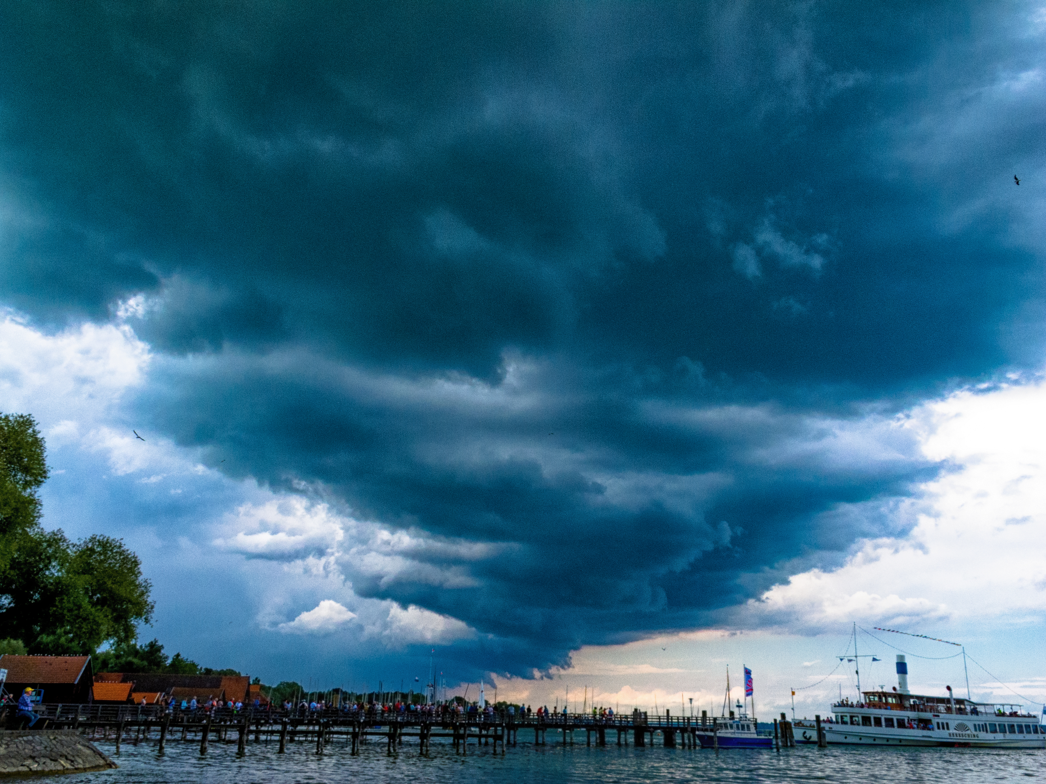
Early August 2018 offered some possibilities to capture thunderstorm and shower clouds in the early evening. The strange summer with the headline provoking heatwave and the drought continued in many parts of Europe. There was still no longer lasting rain. In Bavaria, there were showers and thunderstorms happening close to the Alps as before.
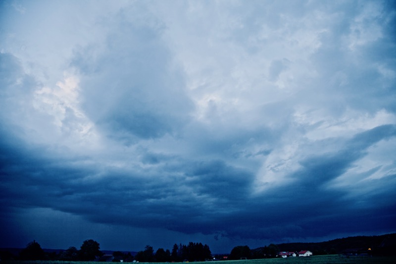
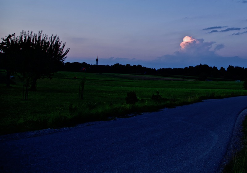
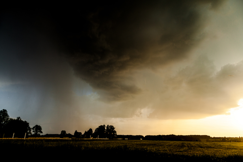
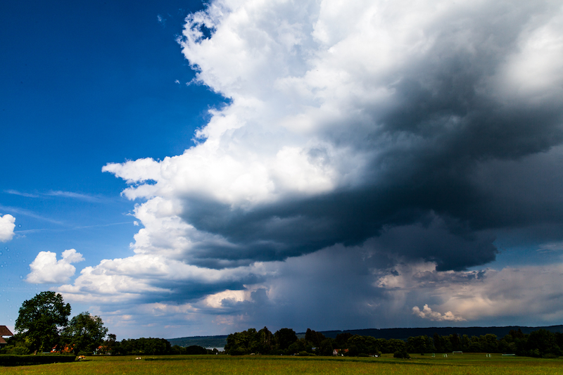
Intense Thunderstorm Bavarian Alps, August 9, 2018
August 9 there was severe weather in Germany. The storm cell above arrived around sunset and this is the backside of the storm. There was little time left to take pictures since the daylight faded away.
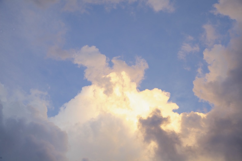
A few days later huge clouds could be seen before sunset. In the west, the sun illuminated the clouds in red and yellow. This was only visible for a short time. The tops of the clouds were shining in bright yellow for some time. As the lower parts of the clouds were in shadow and appeared in dark colours there was dramatic contrast.
Since conditions how the clouds are illuminated are changing sometimes quickly it is important to act very fast. Therefore it is good to wait at a view-point which is already familiar before sunset and not wasting time with looking for the right position.
For one evening there was already an autumn air. It was a bit colder and the scenery with the low hanging dark clouds created that impression. This is not unusual in Middle Europe in Mid-August. But this year’s extreme weather conditions led to a quick return to typical hot summer weather. The drought meanwhile is causing dramatic damage. More and more researchers say that 2018 is an extreme never seen before.
Filming clouds and thunderstorms during sunset: There is a particular challenge when doing videos. If possible shut down all automatic functions and set speed, aperture, ISO manually, since the camera will automatically adjust to changing light conditions and causing unwelcomed “jumps”(video getting suddenly brighter). Videos are a lot of try and error since no weather situation repeats itself exactly in the same way. Every shot needs different adjustments.
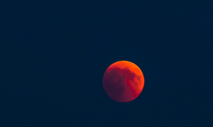
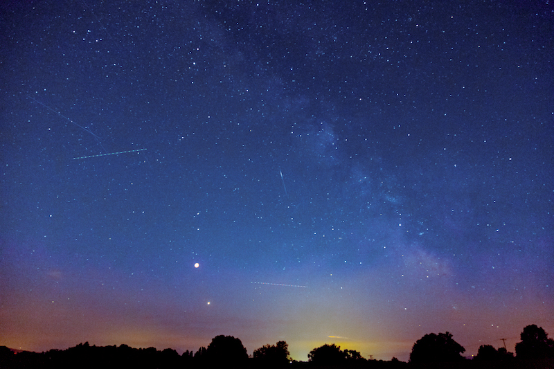
A mostly clear sky in Upper Bavaria offered really good opportunities to watch the epochal astronomy event of the year: the total eclipse of the moon announced as the “Blood-Moon”. The eclipse would last longer than any other in this century. Furthermore, a bright planet Mars was close to the eclipsed moon. In the evening hours also Venus and Jupiter were visible. Around 10.30pm the International Space Station happened to fly over Germany.
I chose a meadow with a good view of the Eastern and Southern horizon as a viewpoint. It proved to be a good choice and I got company by several other watchers coming from the Ammersee-Lake-region.
It was a hot day and there were some higher clouds in the South-East. There was also a layer of dust close to the horizon. Therefore the moon could not be seen when it rose. It was around 09.20pm when a small sickle appeared between the clouds. This was because the moon wasn’t totally eclipsed.
Shortly before the total eclipse of the moon. A sickle appears between a layer of clouds.
Soon later it became an orange-red disk, the so-called “Blood Moon”. For some time it wasn’t really dark and the moon wasn’t as prominent as it would be normally. It was more like a barely visible shape in the blue sky.
But then it became more and more impressive minute by minute as night was falling.
I detected some thunderstorm clouds in the distance before and later sheet lightning in the far distance added to the upcoming spectacle.
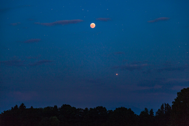
Finally, Mars appeared above the dust in the South. It was a tremendous sight: Mars was much brighter as the eclipsed moon but both objects shared these orange-red shining light. It was a strange sky.
Red Moon And Mars. The Mars in direct opposition to the sun from our view from Earth.
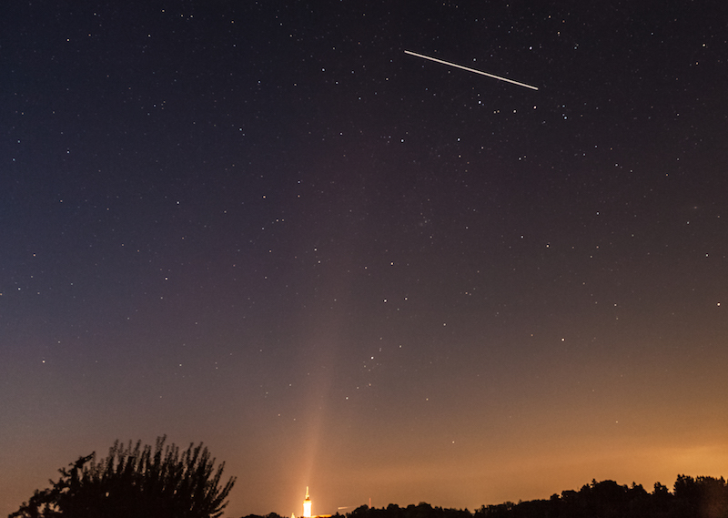
Around 10.00 pm I regretted not having brought a jacket since it became distinctively colder. This is normally a big advantage during the heat-wave this year that it is cooling down in the countryside close to the mountains and it is not like the tropical nights in the big cities. The fantastic event made me forget the colder temperatures during the later evening. The appearance of the ISS was also a great sight.
As the sky became really dark the spectacle unfolded completely as a big unforgettable experience: It was after the passage of the ISS which was flying over us very high above the horizon when the Milky-Way became visible.
Normally the Milky-Way can’t be seen when there is bright moonshine. This night it was a fantastic sight.
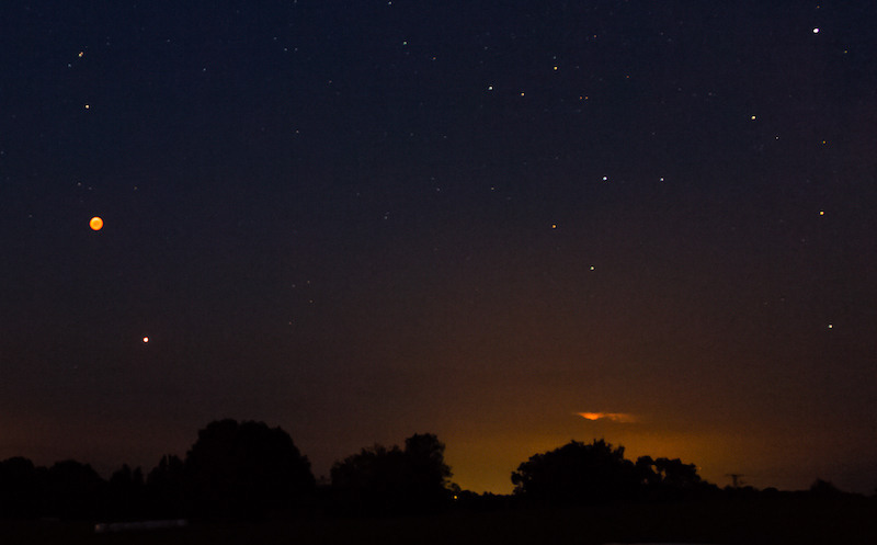
Obviously, there were longer lasting thunderstorms somewhere in the Alps, since there was sheet-lightning in the South.
Red Moon, Mars And Sheet Lighting Over The Alps
A lot of people had gathered and looked at the sky with awe. It indeed was an awesome event. As long as the moon was fully eclipsed there was a palpable otherworldliness. After 11.00 pm the total eclipse ended and the moon became soon brighter and brighter. The milky way couldn’t be seen any longer but the extraordinary sight will always last in my memory.
Red Moon, Mars, Milky Way
Photography can capture the atmosphere only in parts. It is also a bit challenging due to constantly changing conditions of light. Using longer exposure times lead of course to visible movement of the moon in the picture and the object is not any longer sharp.
But even with an equipment which is normally not supposed to do astrophotography, it is possible to get some impressive shots when using a tripod and a timer. The best idea is to take a lot of pictures with different exposure times.
I used ISO 400 when the eclipse began, then 640, 1000 and some shots with ISO 3200. Noise then can become a problem, therefore I did some noise-reduction with photoshop.
Today is July 22, 2018, and this morning was the first time for months that light rain has fallen for a longer time. In my place and in middle Europe this is usually a most common weather pattern. Or it has been for a long time. Probably 2018 will be seen in history with a record of new weather anomalies.
A normal rainy day is nearly an extraordinary event this year. When it comes to rain it is often extreme and short lived.
The most impressing phenomenon is that weather anomalies seem to happen not only in Europe but on a global scale. There are heatwaves, droughts, bushfires in many unusual places like Northern Europe. In Sweden, a huge bushfire couldn’t be kept any longer under control.
In Germany, there was very little rainfall since April. This is the most unusual part. There weren’t so far any extreme heatwaves but a strong aberration from the usual. Sun was shining most of the time. Temperatures are continually too hot.
It seems that the climate is really changing now at a higher level. In some areas in Germany but also in England there are dramatic consequences. The lack of rain is destroying the harvest. The sunny summer has become a nightmare.
Probably there are many aspects of modern life affected and authorities are well advised to be concerned and to be aware of these changes in nature. Even if things turn back to normal for a while the overall tendency shows a huge change in our seasons and the meteorological conditions.
German newspaper “Tagesspiegel” published recently an excellently researched article about the earth becoming too hot everywhere and the article informs about the meteorological explanation responsible for these anomalies.
Basically, currents in the atmosphere have been slowing down and there isn’t enough movement. High-pressure systems keep their position over months. Therefore the air can heat up. In Europe, the usual low-pressure systems coming from the Atlantic are failing to reach the continent.
The scary thing about this phenomenon is that we see this happen for some time. A lack of movement in the atmosphere was also identified as the reason for extreme weather in the UK when monster-waves hit the shores for a longer time.
This is something which seems to be related to the predicted climate change but my impression is that physics of the atmosphere is not understood so far. We don’t really know why this is happening (I do not know if the scientists would agree, but we had a couple of surprises over the last years).
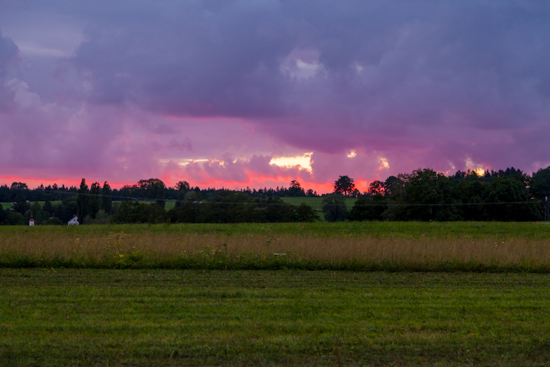
These anomalies in the weather need adaption strategies. In Southern-Germany, Berlin, Mecklenburg Vorpommern there had been flashflood-events (very strong rain with flooding). This is the other side of the long lasting dry periods. They were caused by showers and thunderstorms.
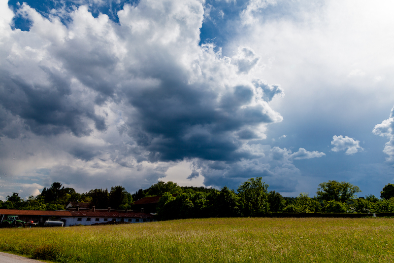
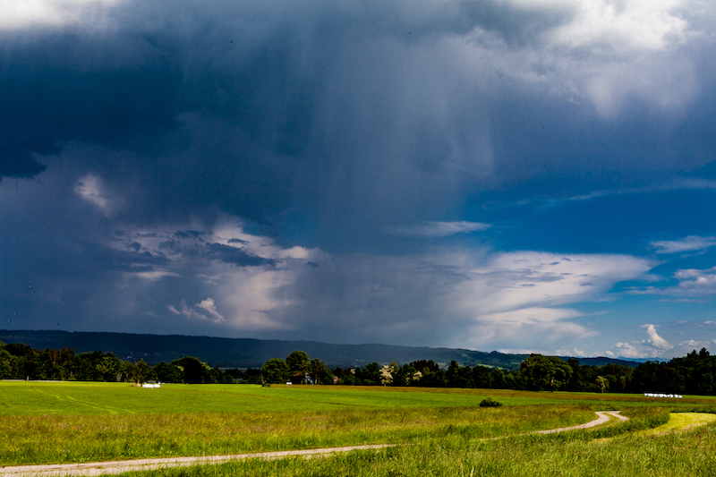
Shower Clouds In Bavaria. During some days it rained always for some time in the afternoon.
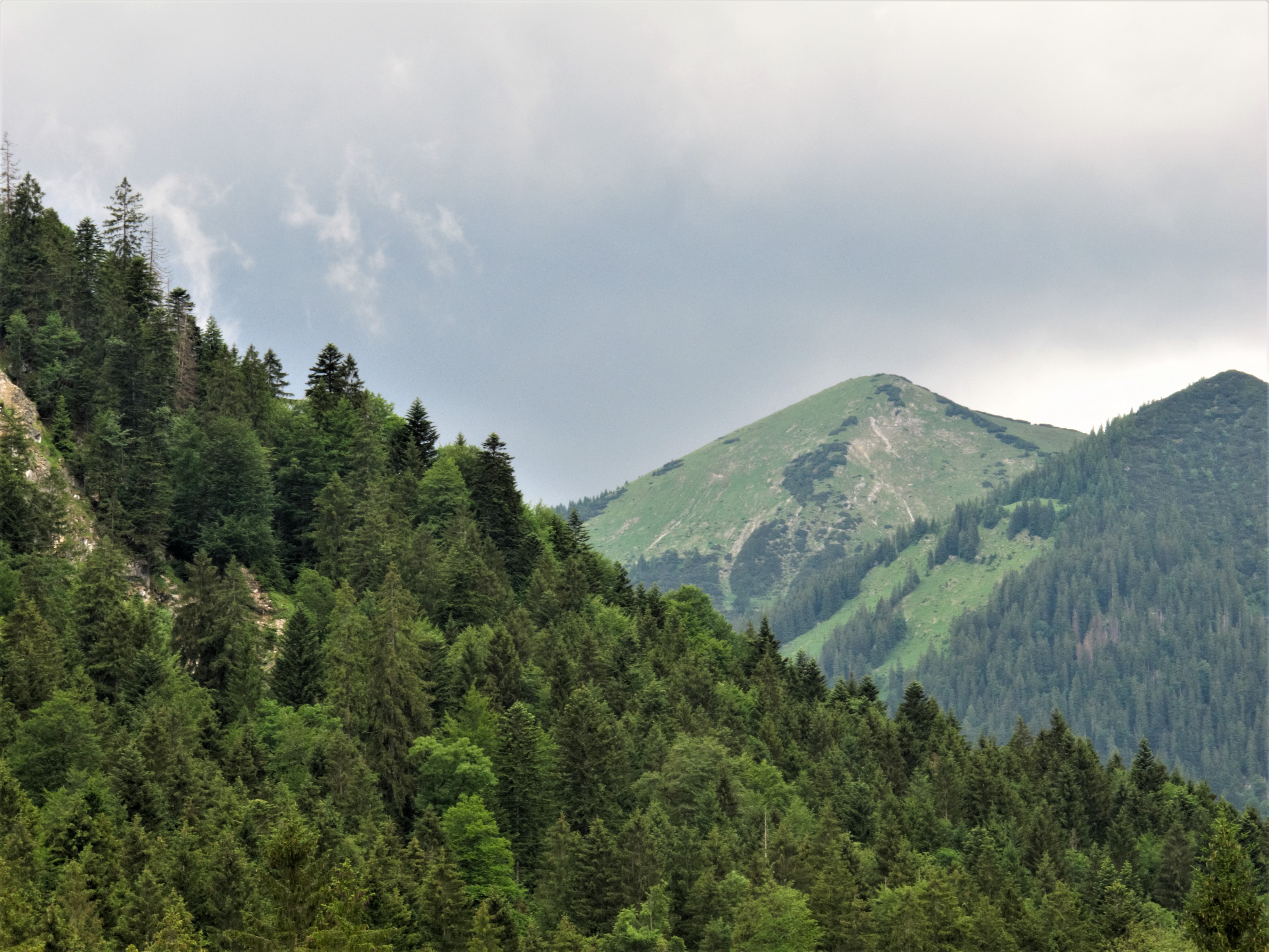
Showers and thunderstorms can’t outweigh the effects of the drought. Except in areas close to the alps, there were many showers over several days. Here it was much better but also not anywhere. There are also areas in Southern-Germany where it is too dry.
The alpine region benefited from the special conditions in the mountains with some rain
The anomaly could also be experienced in areas where thunderstorms and showers were more often. It was kind of a timelapse-spring and things seemed growing too fast. It is also for many people a problem if the weather is far from the inner rhythm and own experience.
This is certainly an area which needs attention from researchers and authorities: we know definitely that high temperatures cause much more traffic accidents. Also, criminal behavior is affected by weather. But we know very little how our working capabilities suffer from disturbing experiences. One effect seems to be that people getting tired and easily exhausted. There might be also health risks not only related to sudden heatwaves but also with longer periods of weather which is not normal compared to the usual weather pattern in a given season or a certain month.
Many weather forecasters are already aware of the situation that this is not a great summer and that “rain and clouds are not a bad thing” but it is strange that some public voices still seem to have no idea what’s going on.
A higher awareness of the situation could not only save lives if we see further extreme weather but create a preparedness which is needed in the given situation: farmers need our help in restructuring, many institutions like nursery homes urgently need conditioners. A situation like 2003 – the first year with a long lasting extreme heatwave – when in Europe thousands of elderly or sick people died is not acceptable for a civilized society. Thus we need understanding and a better sense of the seriousness of the situation.
Do we really know what’s going on in our atmosphere?
May is often a time in the year of short-lived thunderstorms and some cooler rainy days in Middle Europe. However, since some years there is also more severe weather with flash floods and even tornados in May. 2018 had been particularly unusual with new temperature records in April. It was too dry in many areas and it still is. A big problem is that it seems that steady rain is missing more and more. Long lasting rain was a common weather pattern every year which wasn’t very amusing for tourists but important for nature and farming. That changed. As predicted by climate change researchers we have more showers and thunderstorm with extreme flooding now.
When I was younger I remember May not as a very warm month. In some years there was still a lot of snow in the mountains. Often it was very cold in the middle of the month. But this year it was more like midsummer rather than spring.
In Southern Germany, the dry period ended to a certain extent and more and more showers and thunderstorms happened.
The first thunderstorm in my area close to lake Ammersee in Upper Bavaria developed on early evening May 12.
It was very impressing because of the late sun which illuminated the clouds and rain at a low angle. May is a good time for taking pictures of thunderstorms because often the light is better as in July and the air is often more clear. Furthermore, it is a good time to photograph fall stripes of rain which look like curtains and can create very interesting patterns.
The following days more thunderstorms occurred. Weather forecasters had a tough time during May. A couple of time stable, warm weather was predicted. But weather doesn’t behave like it was supposed to be. On Pentecost, May20+21, it should have been warm and dry but there were thunderstorms and showers. May 20 indeed was a surprise, because that “summer day” was more or less a dark day with a heavy thunderstorm and flooding in a village between Murnau and Garmisch Partenkirchen. Already on May 18 an open-air event had to be cancelled due to a thunderstorm in Fürstenfeldbruck, a city not far from Munich.
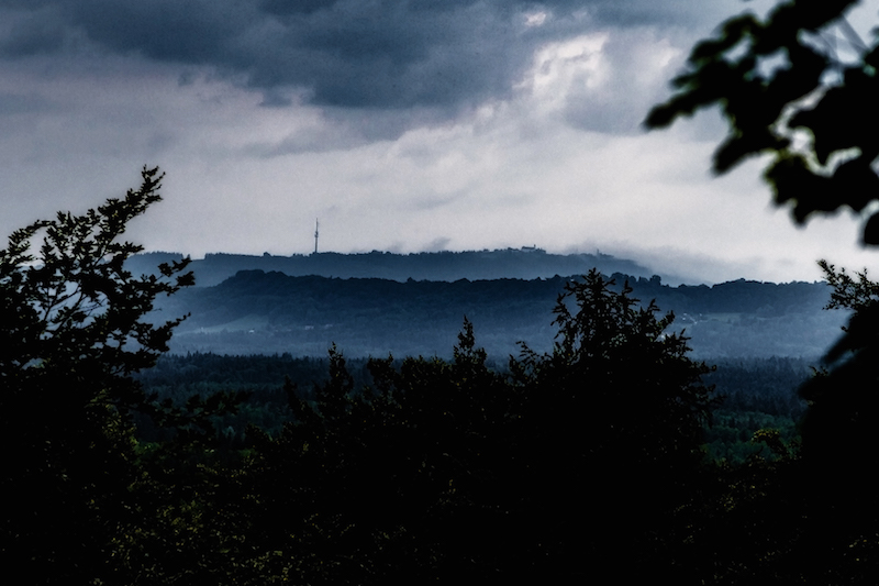
This is what Sunday, May 20, happened: In the afternoon the sky was loaded with dark clouds and rain. There were also shrouds of mist surrounding the Hohen Peissenberg, which can be seen in the background. Some lightning could be seen in the South. In the evening the weather calmed down.
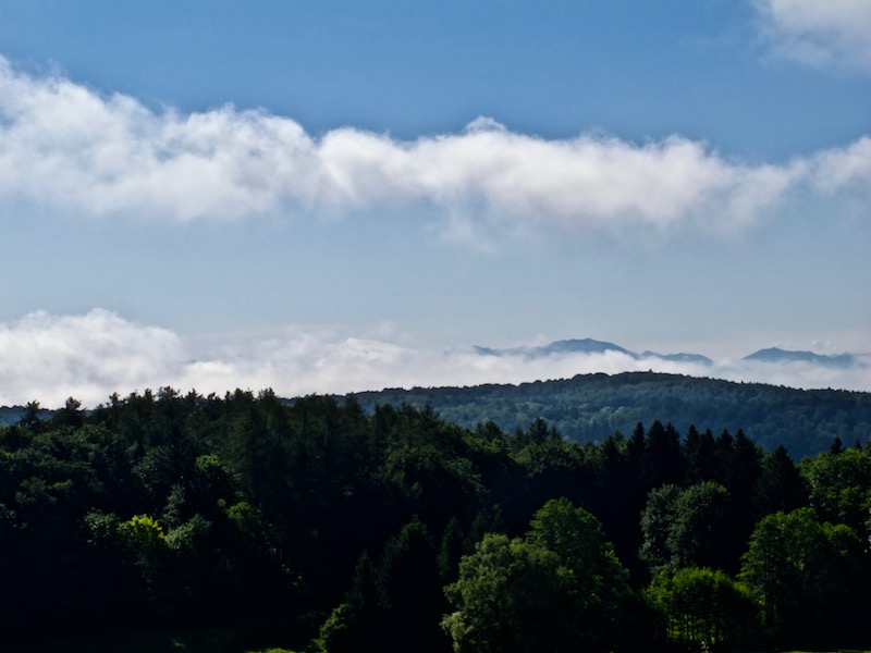
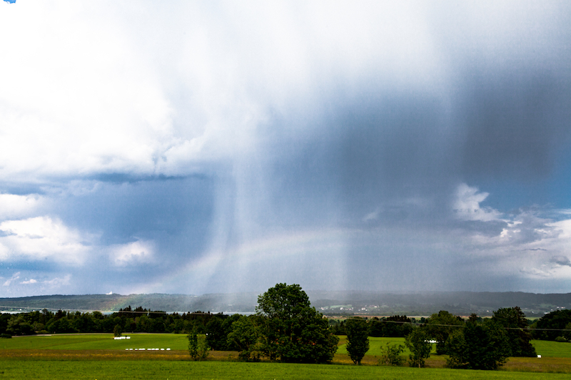
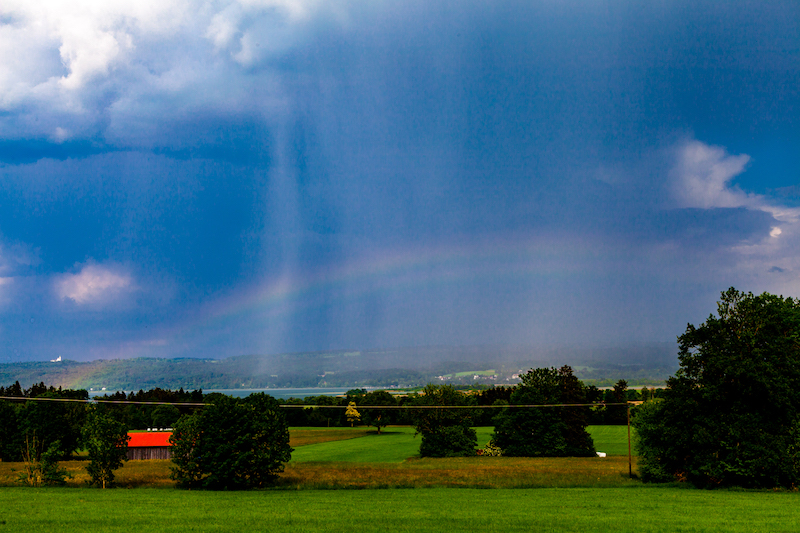
Morning, May 21, began with a misty sky. There was a low hanging layer of mist between the mountains an the lower areas. The mist soon disappeared and the sky became clear: The air was still humid and the sun was hot. Perfect conditions for the development of further thunderstorms. In the late afternoon, a thunderstorm cell moved towards lake Ammersee. It was very interesting to follow this thunderstorm since there were fascinating patterns of fall stripes. Furthermore, there was also a rainbow.
It was remarkable that this year in May the thunderstorms were often moving in unusual directions. Sometimes there were moving from South-East to South-West or from North to South. Mostly weather systems are moving from West to East. An unusual constellation of pressure systems in Europe was one reason for the long dry period and the further development.
The thunderstorm on May 21 was coming closer for some time but then stopped. Perhaps the huge lake had an influence. It happens often that lakes are influencing local weather.
In this case, it was again good to know some viewpoints in the area before. It made it easier to follow the weather pattern.
The higher position was particularly helpful to see the rainbow which developed during the thunderstorm.
The rainbow was barely visible for some time but then intensified.
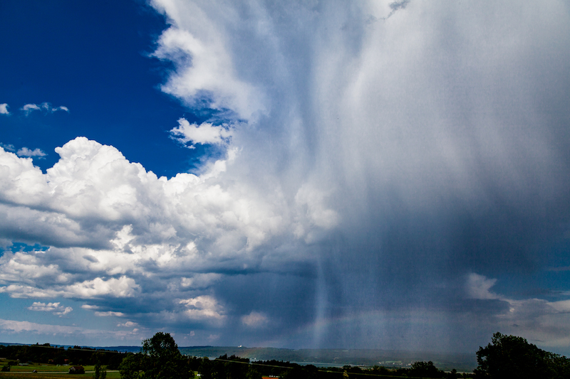
However the most special thing was the development in the upper part of the thunderstorm-cloud.
There were not only fall stripes below the cloud but in this case, it was clearly visible that rain came from the upper levels.
It was indeed like a “waterfall” in the sky.
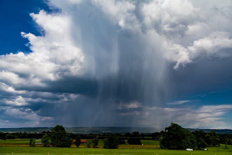
The unstable weather continued.The title picture was taken a few days later, May 24.
There were further dramatic events in the middle of Germany with flooding. There was also a tremendous portion of hail in some places.