Series Of Strong Windstorms In March 2019

After a period of warm days in February 2019 with a constant high-pressure system over Middle Europe weather became more dynamic. With the jet stream moving to Europe a series of low-pressure systems reached the continent. It was very windy for a couple of days. Severe weather was included with European windstorms as “Bennet” and “Eberhard” (known as Freya in the UK) and even a tornado. In Germany, (Nordrhein-Westfalen in particular) France and Switzerland wind gusts led to serious damage. There is an estimate that in Germany insured property losses of around EUR 800 million happened. Travel by train was stopped for one day creating chaos for travellers in Middle Europe.

Storm Eberhard arrives March 10, 2019 in Upper Bavaria with winds of 10 Beaufort strength

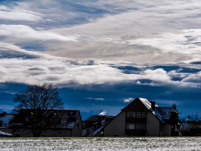
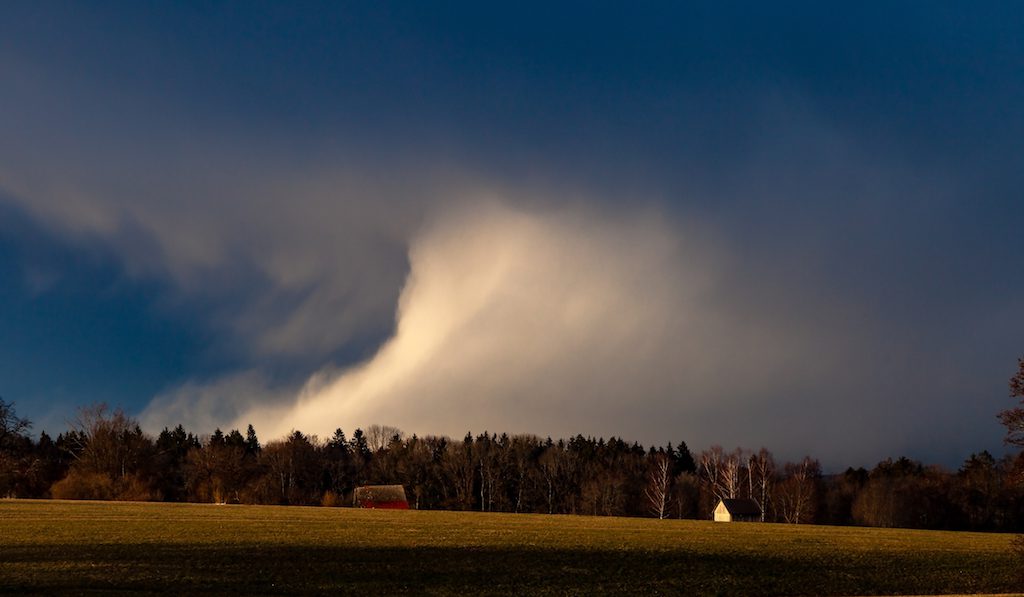
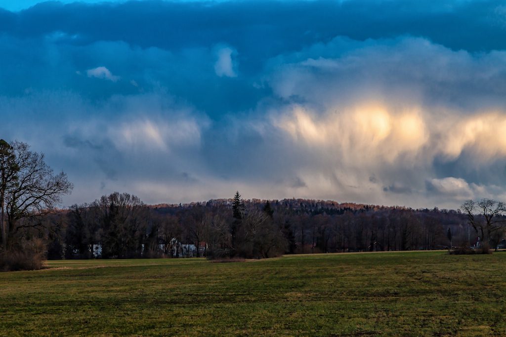
The sky was always turbulent with many interesting cloud patterns which allowed some impressing storm pictures. In Germany and Europe, the change in weather was welcomed because there is still a need for rain. Last year’s extreme drought left a lot of problems. Particularly the forest areas need still a lot of water to recover from the drought. It did indeed rain a lot in some areas but there is still a need for much more rain in the next months. The weeks in February with unusual long lasting dry weather raised already concerns for a new drought coming in 2019.

Storms are pretty normal in March. There had been even extreme windstorms in previous decades. Thus, the period of days with windy weather is no exception from the rule. But it was interesting that wind was blowing for many hours with strong wind gusts. This led to questions if this is a normal weather pattern. Honest answers prove to be difficult.

The rising numbers of weather anomalies due to climate change during the last years provoke a higher-sensibility to unusual weather phenomena. However, the weather is always like a big drama. There is an incredible variety of extremes. Researchers need to observe weather over long time spans to identify anomalies and unusual trends.

On the other side, Europe is affected by a number of winter windstorms over the last 30 years with the most damaging storms 1989/90. Insurances are alarmed about the rising cost of damage. Since these storm events are still relatively rare further research is required. The UK Met-office published recently a study with the most important findings of winter windstorms.

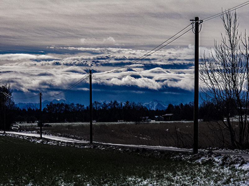
The series of storms showed some interesting developments. The wind came mostly from the west, sometimes South-West. In Upper-Bavaria there were days where there was a very good long distant view. The Alps appeared very clearly.

Waves hitting shore and a clear sight of the Alps in the background, Saturday, March 16, Lake Ammersee.

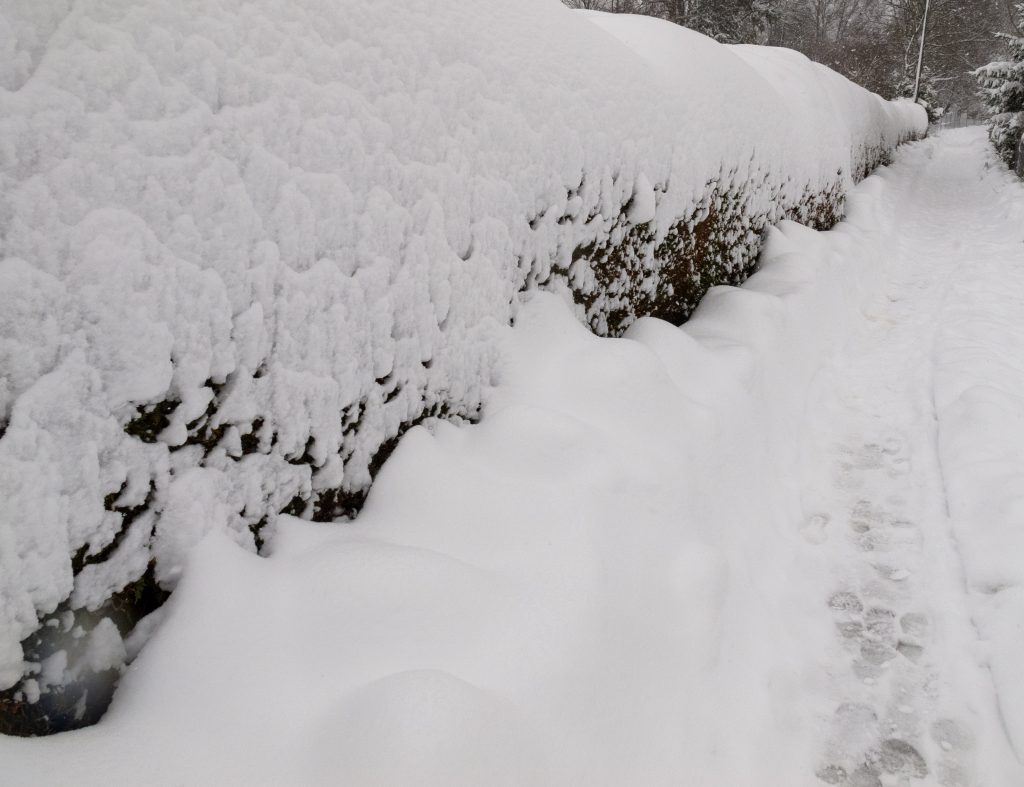
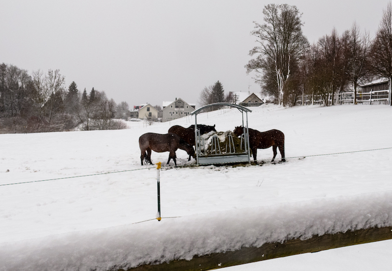
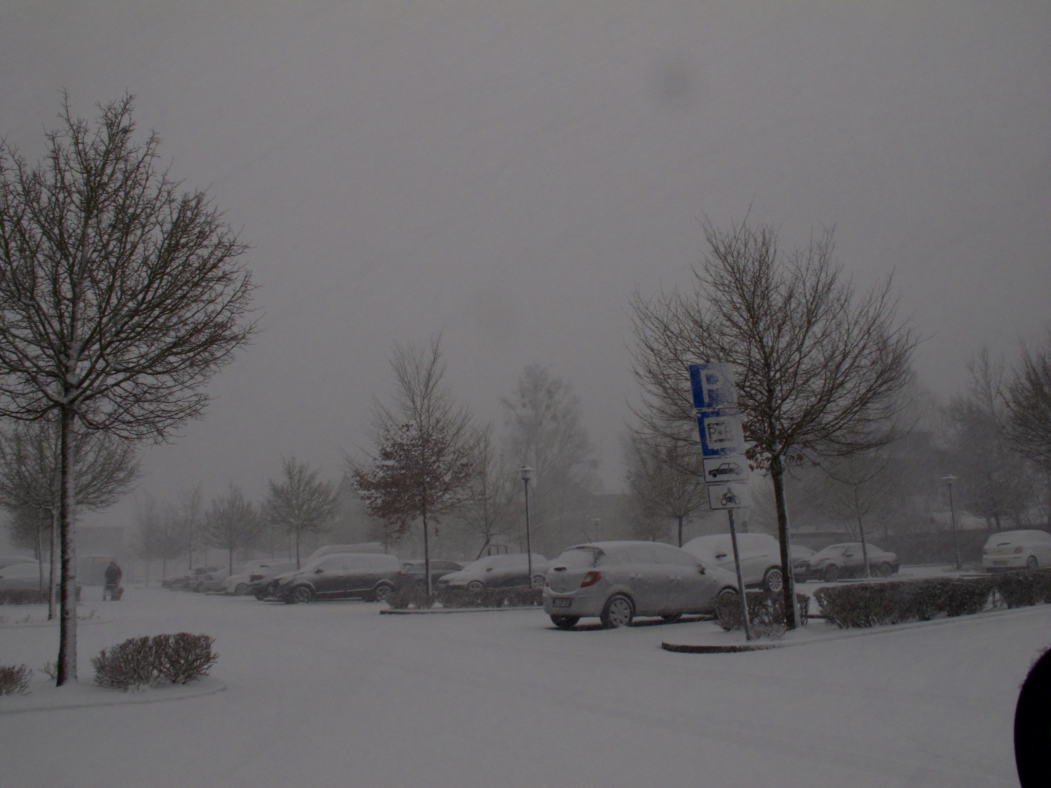
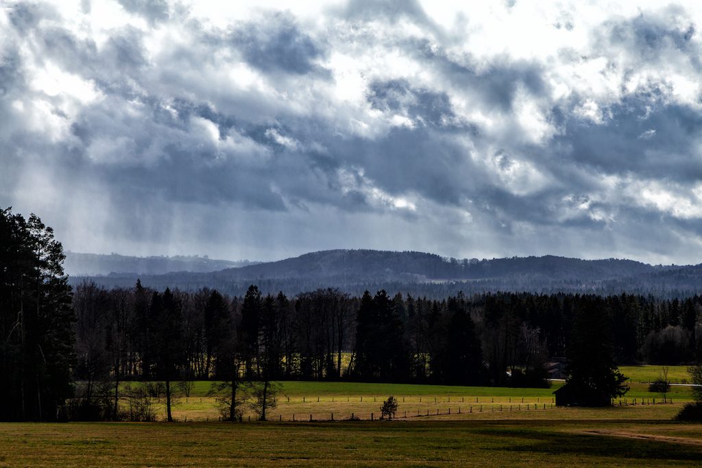
At the end of the weeks with stormy weather, there were showers with snow and little hail. This created some impressing sights shortly before sunset

In the aftermath of windstorm Eberhard temperatures decreased and there were snow and little hail showers illuminated by the sun.

A look into the south with a shower cloud above the Bavarian Upland

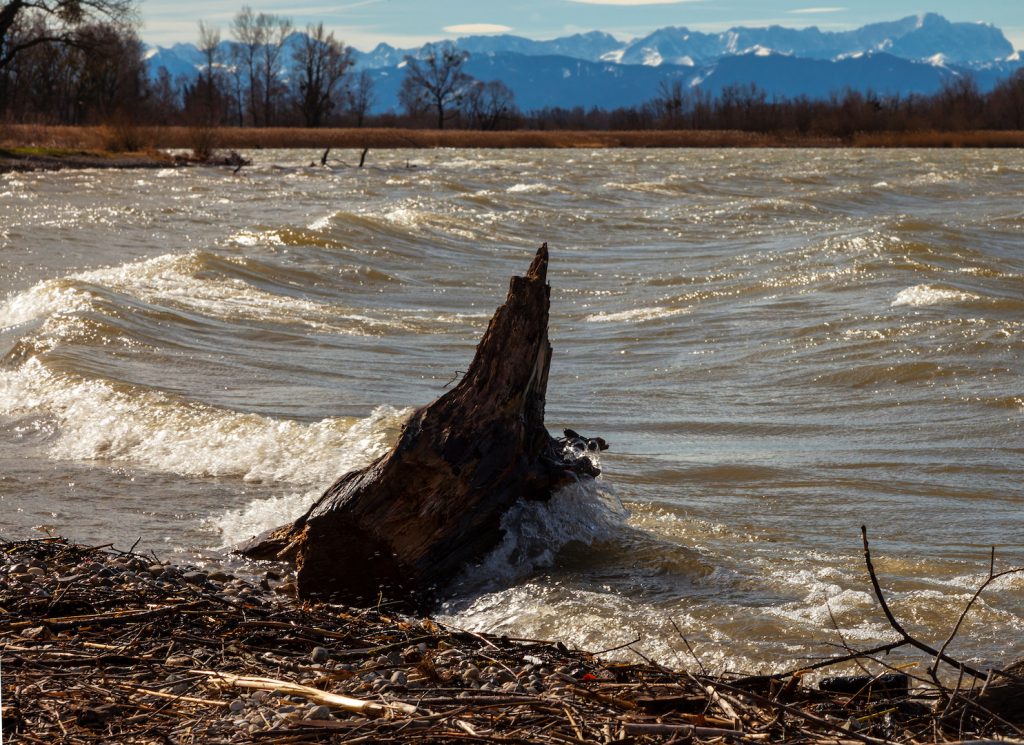
There were huge waves on the lakes in Bavaria due to the storm. A lot of driftwood appeared on the Eastern side of Lake Ammersee. It was an unusual sight. The lake appeared more like a shore at the Baltic Sea.

A lake in Upper Bavaria with waves.

After March 18 the weather calmed down. A high-pressure system led to cold but sunny weather in Southern Germany.

JANUARY 2019: MASSES OF SNOW

January 2019 began with new weather extremes in Central Europe. After the long drought in 2018 a lot of people hoped there would be rain and snow. Everywhere in Middle Europe there was too little rainfall from early 2018 til November 2018. In Berlin the river Spree was flowing backwards. There were concerns about the pheatric levels. Rain or Snow was indeed urgently needed to redeem the situation. Then the snow came but in a way that it created new problems.

After January 5 it was snowing in the alpine countries. However the winter dream turned for some places into a nightmarish situation. It didn’t stopped snowing for days. Villages in Austria and Germany were isolated and couldn’t any longer reached by cars. The problem: Snow and wind turned trees into dangerous obstacles.

Felled trees were lying on rail tracks and blocked many roads. It became also a rising danger for pedestrians. In Upper Bavaria an emergency alert was issued in the well known tourist areas of Berchtesgaden and Garmisch-Partenkirchen. The snow was growing and growing and became too heavy for the roofs of many buildings. Some roofs had already collapsed. The danger of avalanches was continually rising. Casualties happened because some ski-tourists didn’t listen to the warnings.  In the countryside there were countless car accidents due to bad road conditions.

Beginning with the night of January 12-13 the situation started to become more severe. There was again heavy snowfall but also the temperature began to rise. It also started to rain in lower areas. This is a big problem because it makes the snow much heavier. The danger of trees and buildings collapsing was rising and it still is.

January 13 a severe storm is announced. It stems from another low pressure system arriving from the North. There was already a storm-flood in Northern Germany. Usually the time of mid-January is often a very cold time of the year with long lasting high pressure systems.

Weather researchers are saying this could also related to the changed climate conditions in the arctic. It is somehow a mirror image of the situation in summer when high pressure systems didn’t move any longer and created the drought. Now it is a situation where low pressure systems are hitting against the alps because there is generally not much exchange in the atmosphere. There is again a weather pattern where the same weather conditions last longer as expected.

Extreme situations in the winter happened before in 2006 and 1999 when there was a terribly tragedy due to avalanches in the Austrian Alps in Galtür. Since then a lot of protection measures were put into place in the Alps.


Nevertheless winter is always a great photo-motive: Wind and snow are creating sculptures. If you look you can see also often a “blue light” in the snow. This happens due to refractions of light in the snow.

Weather services are still warning about severe conditions the coming week beginning January 14. Perhaps later there will be some sunshine and people can enjoy the beauty of a winter in the mountains.

January 16-18: “Friederike” Strongest Winter Storm In Germany Since Kyrill

After a calm but grey weekend and a calm Monday, the wind freshened up on Tuesday, January 16. On Tuesday morning there was a turbulent sky with fast moving clouds in Southern Germany. There was rain in the afternoon. But on the next day with the public in the wake of Winterstorm Friederike, which was announced to arrive on Thursday, weather in many parts of Germany was getting extreme. Already in the night, there had been accidents due to winter-thunderstorms.

In Bavaria, Wednesday morning started still relatively calm but in Southern Bavaria around the lakes and in the South-West it was already day when it looked like the night would fall again at 8.00am in the morning.

Suddenly it became darker and darker. A snowstorm set in and there was lightning and thunder. Within minutes a lot of snow fell and streets became slippery. There was also hail. After ten in the morning the sky cleared up, even the sun was shining shortly but it was a day with many more showers. It was windy all the day.


There was a bit more snow in the night. In the morning it felt warmer. Then, on Thursday, the wind was picking up speed. Storm-warnings were issued before. Weather models did still slightly differ on Thursday morning but the storm hit mostly the middle of Germany as expected. But also in Southern-Germany, there were really strong winds.

Friederike was soon suspected to be the strongest winter storm since Kyrill which was exactly the same day, on an Eighteen January. Indeed, the storm already caused many accidents and did damage even before it crossed over Germany.

In the early afternoon, there were still different forecasts if the storm would increase in the early evening hours or if the weather would calm down. Many schools were closed for the afternoon, Flights from Munich got canceled, trains were delayed. In the late afternoon, Deutsche Bahn shut down its long-distance travel.

At 4.30pm, Januar 18, the sky is mostly clear, but the wind is still very strong. Most of the snow is molten away and a brook is running down the street.

The aftermath: As the weather calmed down in the night, the news showed the colossal damage which Friederike did. Due to its extreme wind speeds, it made it into the top five of monstrous windstorms in Europe over the last 30 years.

By Peter Engelmann


Aktivieren Sie JavaScript um das Video zu sehen.
https://youtu.be/P5T0oWqGT8M

September 13, 2017, Storm Sebastian

Germany was hit on September 13, 2017 by a deadly windstorm. “Sebastian”. The storm did a lot of damage in Northern Germany and killed three people. Also Southern Germany was affected by the storm. In Upper Bavaria the alps could be seen very clearly. T

his was similar like the “Foehn-Effect” but not necessarily the same like the “Foehn-Effect”. The “Foehn” is a dry wind similar to the “Santa-Ana” wind, the “Foehn-Effect” on the East side of the Scottish Highlands or The “Chinook”. It occurs when moist air is rising on one side of the mountains and turns into warm downslope winds on the other side. Often it is the southern side of the alps where rain clouds are climbing.

Then it can become suddenly very warm in the valleys and the countryside adjacent to the mountains on the northern side. It could be also vice versa and then you have warm weather for example in the Tessin and a lot of rain on the Northern side of the alps.


The “Foehn-Effect” can be dramatic in itself. With temperatures climbing very fast there is a sudden danger of avalanches in the alps in the winter. Also, the “Foehn” is held responsible for health and mental problems. Sometimes when the traffic for example in Munich feels crazy, drivers doing weird things the “Foehn” is said to be the culprit.

In this situation, it was basically that the windstorm came from the Southwest. In Southern-Germany there wasn’t so much rain but there was no dust thus the Alps appeared closer as they are. The next day the weather calmed down but in some areas, there were still train delays due to Sebastian.

The windstorm was predicted but it is still a challenge for weather-services to predict the exact path of a storm. On a much minor scale, it was a bit like with “Irma” which took a slightly different path of destruction. It will be a task for the future to develop even more detailed systems for weather-warnings to prevent tragic incidents as it happened due to this windstorm.

The extreme weather events in 2017 raised again the question if the weather is becoming more extreme and yes, it seems true to a certain extent. It will be especially difficult also in the future to do precise nowcasts of storms like this one. Therefore it is important that people take precautions when severe weather events like “Sebastian” are announced. One important rule is to not go into the woods.

If possible driving should be reduced and people should be on alert when driving on rural roads with a lot of trees on both sides. Usually, windstorms in Europe do not destroy whole buildings so unlike the hurricanes people are safe when staying at home. “Sebastian” was the first windstorm of autumn 2017 and likely more storm systems will follow in Europe.

Storms happen between October and December but there is also often this “Foehn-Effect” in Bavaria or a longer lasting high-pressure system in Middle Europe. When this happens people speak of a “Golden October” due to the colors of the leaves. The “Foehn-Effect” is a chance for photographers in the alpine regions to take spectacular pictures but need sometimes a bit of experience due to the light conditions.

There is often a very bright light during daytime and in the evening the days quickly become shorter. Upper Bavaria, for example, offers many excellent viewpoints like the Hohen Peissenberg where there is an exceptional sight of the Alps.